Journey to Mt Sharp - Part 1: Site 7 to Waypoint 1, Sol324 [Jul4,'13] to Sol391 [Sep12,'13] |

  |
Journey to Mt Sharp - Part 1: Site 7 to Waypoint 1, Sol324 [Jul4,'13] to Sol391 [Sep12,'13] |
 Sep 10 2013, 12:25 AM Sep 10 2013, 12:25 AM
Post
#511
|
||
 Member  Group: Members Posts: 408 Joined: 3-August 05 Member No.: 453 |
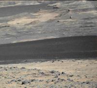
Sol 388 Mastcam-100 pano preview from thumbnails.
Airbag |
|
 |
 
|
|
|
Sep 10 2013, 12:42 AM
Post
#512
|
|
|
Senior Member Group: Members Posts: 2346 Joined: 7-December 12 Member No.: 6780 |
Sol 385/388 post-drive MAHLI images, rotated 150 degrees, white-balanced by sky:

|
|
|
|
|
Sep 10 2013, 12:33 PM
Post
#513
|
||
 Senior Member Group: Members Posts: 1465 Joined: 9-February 04 From: Columbus OH USA Member No.: 13 |
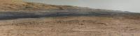
Starting to see some detail in the dune field (ripples)--or maybe just JPG artifacts?
-------------------- |
|
|
|
|
|
| Guest_Actionman_* |
Sep 10 2013, 12:50 PM
Post
#514
|
|
Guests |
QUOTE (jmknapp @ Sep 10 2013, 07:33 AM)  Starting to see some detail in the dune field (ripples)--or maybe just JPG artifacts? The dark dune seems to have a very high crest at this area and the ripples span it's girth with a consistency. |
|
|
|
|
Sep 10 2013, 02:44 PM
Post
#515
|
|
 Senior Member Group: Members Posts: 4246 Joined: 17-January 05 Member No.: 152 |
I think it's real ripples.
Looking at this image: 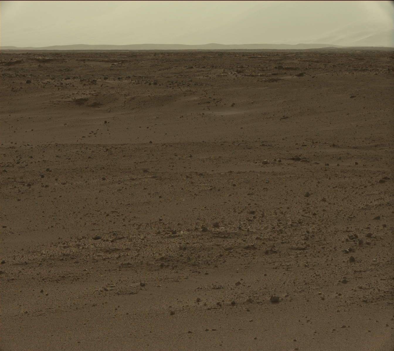 got me thinking about how familiar Mars can look sometimes. The dusty air makes a huge difference - the way the hills fade into the distance looks very earth-like. How strange would Mars have looked had it not been a dusty place, and had a very dark blue sky with distant hills clearly visible? |
|
|
|
|
Sep 10 2013, 04:02 PM
Post
#516
|
|
 Member Group: Members Posts: 222 Joined: 7-August 12 From: Garberville, CA Member No.: 6500 |
Sol 385 & 388 Navcam 360's...
The slightly elevated position of MSL on both these Sols offer excellent views of the entire horizon. Just above the UHF antenna in the Sol 385 panos the rover's tracks are visible dozens of meters back descending and disappearing into the small depression to the north before climbing onto the rise we're on, offering a good idea of the terrain scale in that direction and the distance traveled on the long Sol 385 drive. They're still just barely discernible a bit to the right of the antenna in the Sol 388 panos too. Sol 385 2-D (NLB - full frame):  Sol 385 Anaglyph (bottom cropped):  Sol 388 2-D (NLB -full frame):  Sol 388 Anaglyph (bottom cropped): 
-------------------- "We shall not cease from exploration, and the end of all our exploring will be to arrive where we started and know the place for the first time." -T.S. Eliot
|
|
|
|
|
Sep 10 2013, 06:32 PM
Post
#517
|
|
|
Solar System Cartographer Group: Members Posts: 10146 Joined: 5-April 05 From: Canada Member No.: 227 |
Just posted a map update - no drive but some placenames. We are heading to Darwin, but it's not down in the basin, it's a bit to the northwest of there.
Also, looking at the sol 388 images, we have M100 images from the middle of the drive sequence and at the end of the drive. Those would give long baseline stereo coverage of the basin. Phil http://www.jpl.nasa.gov/news/news.php?release=2013-273 -------------------- ... because the Solar System ain't gonna map itself.
Also to be found posting similar content on https://mastodon.social/@PhilStooke NOTE: everything created by me which I post on UMSF is considered to be in the public domain (NOT CC, public domain) |
|
|
|
|
Sep 10 2013, 11:51 PM
Post
#518
|
|
|
Member Group: Members Posts: 866 Joined: 15-March 05 From: Santa Cruz, CA Member No.: 196 |
resolving clear ripples now a rising tide dozens of meters in depth slowly spills across Sharp's edge sink, forward filling voids then covering outcrops to reclaim again what once was but now will be again, but a sea of sand..
|
|
|
|
|
Sep 11 2013, 12:09 AM
Post
#519
|
|
|
Senior Member Group: Members Posts: 1465 Joined: 9-February 04 From: Columbus OH USA Member No.: 13 |
There was a good SETI Talks in July on Gale dunes:
Dune migration along MSL Curiosity's traverse on Mars -- Simone Silvestro QUOTE The NASA Mars Science Laboratory rover, Curiosity, has safely landed near a 35 km long dark dune field in Gale Crater on Mars. This dune field crosses the landing site from the NE to the SW and lies along Curiosity's traverse to Aeolis Mons. Dr. Silvestro will present evidence of recent aeolian activity in the form of ripple and dune migration and further estimate wind directions within the dune field through analysis of ripple and dune morphologies and the Mars Regional Atmospheric Modeling System (MRAMS). He will show how constraints on the wind regime provide a unique opportunity to use ground measurements from MSL to test the accuracy of winds predicted from orbital data.
-------------------- |
|
|
|
|
Sep 11 2013, 12:37 AM
Post
#520
|
|
|
Member Group: Members Posts: 222 Joined: 7-August 12 From: Garberville, CA Member No.: 6500 |
QUOTE (Phil Stooke @ Sep 10 2013, 10:32 AM) .....Those would give long baseline stereo coverage of the basin...... Phil http://www.jpl.nasa.gov/news/news.php?release=2013-273 Indeed. The time of day difference for shadow matching was my first concern about that - but lo and behold - it looks like there's another set coming in from Sol 389 that matches the time of day of that first Sol 388 set. We've only gotten a few all MC 100 stereo landscapes in the whole mission so really looking forward to that when all the frames are in... In the meantime, even with one pesky MC100 still missing I couldn't resist putting these together. Here's the Sol 388 MC look at the basin and dune fields beyond in the second pano taken late in the afternoon. There's so many interesting things to discover in this one single pano... I don't even know where to start... Sol 388 - MC 100 - 2D - Click thumb for Half Sized version - 12,802 x 1,181 pixels- 3.87MB The Full Resolution version at 25,614 x 2,362 - 13.31MB is HERE. Sol 388 - MC 34/MC100 Anaglyph - Click thumb for Half Sized version - 12,802 x 1,181 pixels- 4.93MB The Full Resolution version at 25,614 x 2,362 - 17.10MB is HERE. And for good measure the Sol 388 MC 34 standalone full resolution pano (with a slightly wider field of view) at 9,588 x 870 pixels - 2.30MB: 
-------------------- "We shall not cease from exploration, and the end of all our exploring will be to arrive where we started and know the place for the first time." -T.S. Eliot
|
|
|
|
|
Sep 11 2013, 01:56 AM
Post
#521
|
||
|
Member Group: Members Posts: 408 Joined: 3-August 05 Member No.: 453 |
...and the sol 389 Mastcam-100 pano preview (from thumbnails) which not surprisingly, looks quite a bit like the sol 388 one (but see above why this was done of course):
Airbag PS Ed, as always, your full size color anaglyphs are just stunning! |
|
|
|
|
|
|
Sep 11 2013, 02:06 AM
Post
#522
|
|
 Senior Member Group: Members Posts: 2425 Joined: 30-January 13 From: Penang, Malaysia. Member No.: 6853 |
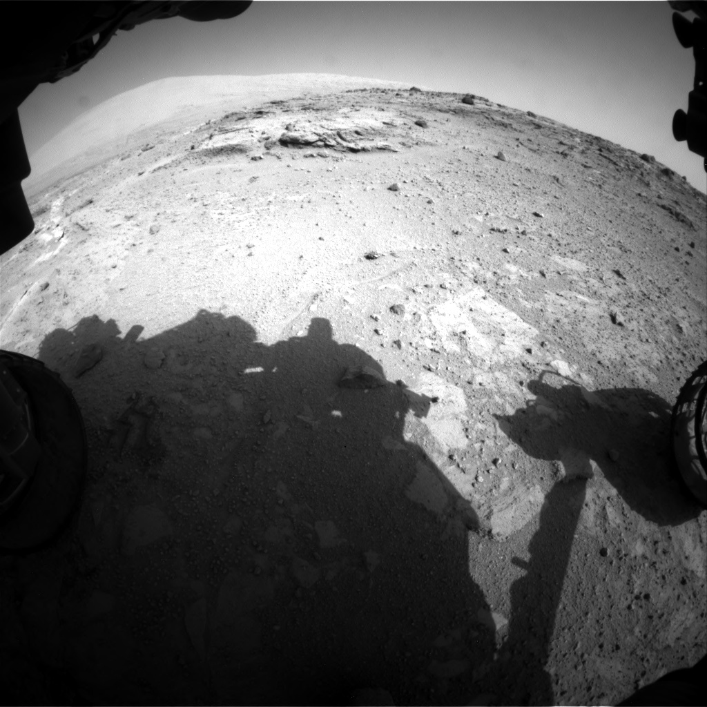
QUOTE (Greenish @ Sep 10 2013, 03:45 AM) Also looks like they may be using the ChemCam RMI to look ahead.pointed per jmknapp's site... [attachment=30926:Sol387_C...31846972.png] Good call Greenish, the pointing data location corresponds directly with Phil's updated traverse map which identifies 'Darwin' as WP1. |
|
|
|
|
Sep 11 2013, 04:28 AM
Post
#523
|
|
|
Senior Member Group: Members Posts: 4246 Joined: 17-January 05 Member No.: 152 |
Not sure if we made it all the way to Darwin, but this sure looks yummy:
|
|
|
|
|
Sep 11 2013, 04:53 AM
Post
#524
|
|
|
Senior Member Group: Members Posts: 2425 Joined: 30-January 13 From: Penang, Malaysia. Member No.: 6853 |
QUOTE (fredk @ Sep 11 2013, 12:28 PM) Not sure if we made it all the way to Darwin, but this sure looks yummy: Drive duration of around 140 minute, but needed to drive approx 110m. Even if we are short of Darwin, a few will be calling out "This place looks cool, let's have a look around here" 
|
|
|
|
|
Sep 11 2013, 10:02 AM
Post
#525
|
||
|
Senior Member Group: Members Posts: 1465 Joined: 9-February 04 From: Columbus OH USA Member No.: 13 |
QUOTE (PaulH51 @ Sep 10 2013, 11:53 PM) Drive duration of around 140 minute, but needed to drive approx 110m. Apparently it missed the SPICE cutoff or something--we'll probably see around sunrise sol 391, sooner if UMSFers can triangulate it. Here's a mosaic from sol 384:
-------------------- |
|
|
|
|
|
|

|
Lo-Fi Version | Time is now: 19th April 2024 - 11:13 AM |
|
RULES AND GUIDELINES Please read the Forum Rules and Guidelines before posting. IMAGE COPYRIGHT |
OPINIONS AND MODERATION Opinions expressed on UnmannedSpaceflight.com are those of the individual posters and do not necessarily reflect the opinions of UnmannedSpaceflight.com or The Planetary Society. The all-volunteer UnmannedSpaceflight.com moderation team is wholly independent of The Planetary Society. The Planetary Society has no influence over decisions made by the UnmannedSpaceflight.com moderators. |
SUPPORT THE FORUM Unmannedspaceflight.com is funded by the Planetary Society. Please consider supporting our work and many other projects by donating to the Society or becoming a member. |
|