Help identifying this map., Did Ludek Pesek use a real location? |

  |
Help identifying this map., Did Ludek Pesek use a real location? |
 Aug 8 2010, 03:20 PM Aug 8 2010, 03:20 PM
Post
#1
|
|
|
Member  Group: Members Posts: 212 Joined: 19-July 05 Member No.: 442 |
In 1967 space artist Ludek Pesek wrote 'Log of a Moon Expedition' a curious work which, when I encountered it in high school had the feel of being written much earlier.
Recently I've been trying to locate a copy of this book and his later Mars Expedition book 'The Earth is Near' and found a few pages scanned, including the map I'm linking to below. The map shows the area in which the story takes place and seems to be based on telescopic images. But is it of a real location on the lunar surface or did he make it up out of the whole cloth? Map of a Moon Expedition |
 |
 
|
|
Aug 8 2010, 04:29 PM
Post
#2
|
||
|
Member Group: Members Posts: 808 Joined: 10-October 06 From: Maynard Mass USA Member No.: 1241 |
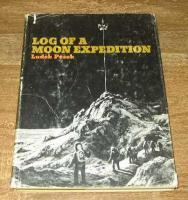
Very interesting map ... (what we really need a working 'image search engine' ...a million dollar app)
To all UMSFers who may not know this: if you are trying to find a hard-to-find space book (for example: 'The International Atlas of Lunar Exploration', by a certain P.Stooke) then goto: abebooks.com Gndonald, there are 37 copies of 'Log of a Moon Expedition' there, from $3US to $30US (search author: pesek, title: log) ... here is the cover:
By the way That Stooke fellow may be your only hope... try this abebooks search: author: stooke title: lunar results: 30 copies, $136 to $287! -------------------- CLA CLL
|
|
|
|
|
|
|
Aug 9 2010, 01:40 AM
Post
#3
|
|
|
Member Group: Members Posts: 212 Joined: 19-July 05 Member No.: 442 |
UNNECESSARY INLINE QUOTE REMOVED - ADMIN
I'll give them a try, there is also a local second hand bookshop that offers search/ordering. As a thank you I'll throw in this scan of the fronts-piece/cover illustration, Fronts Piece (Source) |
|
|
|
|
Aug 9 2010, 11:14 AM
Post
#4
|
|
|
Solar System Cartographer Group: Members Posts: 10151 Joined: 5-April 05 From: Canada Member No.: 227 |
Interesting map. I hadn't seen it before. It looks like one of the Lunar Orbiter sites in Mare Tranquillitatis east of Censorinus (certainly not telescopic data). I'll do some comparisons later this morning.
Phil -------------------- ... because the Solar System ain't gonna map itself.
Also to be found posting similar content on https://mastodon.social/@PhilStooke Maps for download (free PD: https://upload.wikimedia.org/wikipedia/comm...Cartography.pdf NOTE: everything created by me which I post on UMSF is considered to be in the public domain (NOT CC, public domain) |
|
|
|
|
Aug 9 2010, 02:33 PM
Post
#5
|
|
|
Solar System Cartographer Group: Members Posts: 10151 Joined: 5-April 05 From: Canada Member No.: 227 |
Ok, it's fictitious, but Pesek was very well acquainted with the moon and contemporary imaging of it, and I think he's constructed his landscape out of some features imaged in Apollo sites. The broken crater rim near the middle looks very much like Maskelyne F in this map:
http://planetarynames.wr.usgs.gov/images/Lunar/lac_61_lo.pdf - but flipped left-right. Other features don't match that area, but this region around Apollo Site 1 (one of the five candidates for the first landing) looks a lot like Pesek's image except for the rilles, which he might have based on those near Triesnecker. Phil -------------------- ... because the Solar System ain't gonna map itself.
Also to be found posting similar content on https://mastodon.social/@PhilStooke Maps for download (free PD: https://upload.wikimedia.org/wikipedia/comm...Cartography.pdf NOTE: everything created by me which I post on UMSF is considered to be in the public domain (NOT CC, public domain) |
|
|
|
|
Aug 9 2010, 03:37 PM
Post
#6
|
|
|
Member Group: Members Posts: 212 Joined: 19-July 05 Member No.: 442 |
--- Full quote removed.
Thanks, I pulled up my copy of the LAC61 map and I can see what you mean about the region between Maskelyne F/Wallach and the highlands near Maskelyne C/P. Interesting that Pesek chose to do that on such a well mapped body (even in the early 60s), I'd guess he could not find anywhere that fit the requirements of the story he was writing. |
|
|
|
|
Aug 9 2010, 03:57 PM
Post
#7
|
|
|
Solar System Cartographer Group: Members Posts: 10151 Joined: 5-April 05 From: Canada Member No.: 227 |
He probably wanted a place with a greater concentration of interesting features than the moon actually offered - like the rilles along with the buried craters and highland boundary.
Phil -------------------- ... because the Solar System ain't gonna map itself.
Also to be found posting similar content on https://mastodon.social/@PhilStooke Maps for download (free PD: https://upload.wikimedia.org/wikipedia/comm...Cartography.pdf NOTE: everything created by me which I post on UMSF is considered to be in the public domain (NOT CC, public domain) |
|
|
|
|
Aug 9 2010, 06:16 PM
Post
#8
|
|
 Member Group: Members Posts: 655 Joined: 22-January 06 Member No.: 655 |
QUOTE (Phil Stooke @ Aug 9 2010, 03:33 PM)  Ok, it's fictitious, but Pesek was very well acquainted with the moon and contemporary imaging of it, and I think he's constructed his landscape out of some features imaged in Apollo sites. The broken crater rim near the middle looks very much like Maskelyne F in this map: http://planetarynames.wr.usgs.gov/images/Lunar/lac_61_lo.pdf - but flipped left-right. Other features don't match that area, but this region around Apollo Site 1 (one of the five candidates for the first landing) looks a lot like Pesek's image except for the rilles, which he might have based on those near Triesnecker. Phil I think you've just invented a new science Phil - Lunar-cartographical forensics. Nice. |
|
|
|
|
Aug 10 2010, 01:40 PM
Post
#9
|
|
|
Solar System Cartographer Group: Members Posts: 10151 Joined: 5-April 05 From: Canada Member No.: 227 |
CSI Moon?
Phil -------------------- ... because the Solar System ain't gonna map itself.
Also to be found posting similar content on https://mastodon.social/@PhilStooke Maps for download (free PD: https://upload.wikimedia.org/wikipedia/comm...Cartography.pdf NOTE: everything created by me which I post on UMSF is considered to be in the public domain (NOT CC, public domain) |
|
|
|
|
May 16 2013, 04:31 PM
Post
#10
|
|
|
Member Group: Members Posts: 212 Joined: 19-July 05 Member No.: 442 |
It has been a very long time since this thread was added to, but I though this post on David S.F. Portree's blog Beyond Apollo about the "Log of a Moon Expedition" might be of interest. He identifies the location of the fictional landing site as Sinus Medii...
http://www.wired.com/wiredscience/2013/05/...xpedition-1964/ |
|
|
|
|

|
Lo-Fi Version | Time is now: 25th April 2024 - 09:52 AM |
|
RULES AND GUIDELINES Please read the Forum Rules and Guidelines before posting. IMAGE COPYRIGHT |
OPINIONS AND MODERATION Opinions expressed on UnmannedSpaceflight.com are those of the individual posters and do not necessarily reflect the opinions of UnmannedSpaceflight.com or The Planetary Society. The all-volunteer UnmannedSpaceflight.com moderation team is wholly independent of The Planetary Society. The Planetary Society has no influence over decisions made by the UnmannedSpaceflight.com moderators. |
SUPPORT THE FORUM Unmannedspaceflight.com is funded by the Planetary Society. Please consider supporting our work and many other projects by donating to the Society or becoming a member. |
|