Jezero Delta Campaign, Sols 414-1000, 21 Apr 2022- 23 Dec 2023 |

  |
Jezero Delta Campaign, Sols 414-1000, 21 Apr 2022- 23 Dec 2023 |
 Nov 5 2023, 09:06 PM Nov 5 2023, 09:06 PM
Post
#1066
|
|
 Member  Group: Members Posts: 809 Joined: 3-June 04 From: Brittany, France Member No.: 79 |
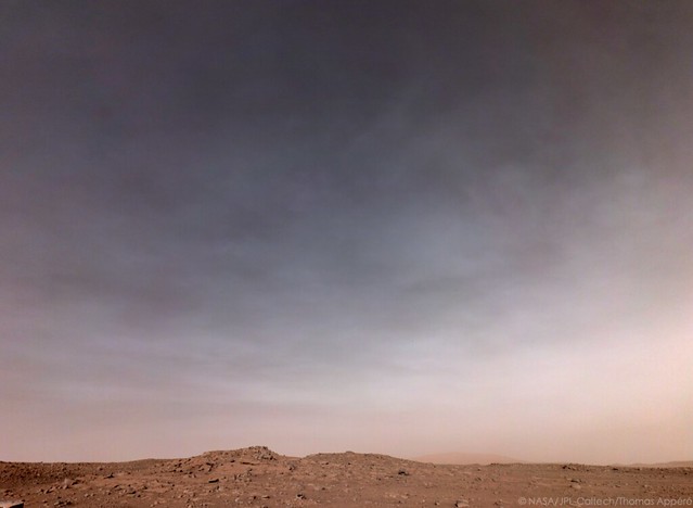
Nice clouds imaged on sol 959 by NavCam Left.

-------------------- |
 |
 
|
|
Nov 5 2023, 09:36 PM
Post
#1067
|
||||
 Member Group: Members Posts: 665 Joined: 9-May 21 From: Germany Member No.: 9017 |
Sol 958 SuperCam Remote Micro-Imager mosaic with Mastcam-Z context and sol 957 Navcam context
|
|||
|
|
|
|||
|
Nov 6 2023, 08:23 AM
Post
#1068
|
|
|
Member Group: Members Posts: 809 Joined: 3-June 04 From: Brittany, France Member No.: 79 |
Cloudy sky on sol 961. NavCam Right, 16:13 LMST.
-------------------- |
|
|
|
|
Nov 6 2023, 10:52 PM
Post
#1069
|
|
|
Senior Member Group: Members Posts: 1043 Joined: 17-February 09 Member No.: 4605 |
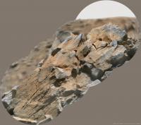
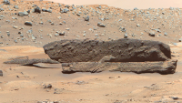
QUOTE (tau @ Nov 5 2023, 01:48 PM)  /.......This rock is probably not a conglomerate, but a grainy rock (sandstone?) with a bumpy surface. [attachment=54096:ZL0_0939...L0_0950_.jpg] I think you are spot on Tau. The bumpy aspect is a function of erosion. It is standing proud of similar rocks and was probably part of that bed and potentially tilted. |
|
|
|
|
Nov 7 2023, 03:44 PM
Post
#1070
|
|||||
|
Member Group: Members Posts: 665 Joined: 9-May 21 From: Germany Member No.: 9017 |
I was wondering if the layered rock might extend beneath the bumpy rock, which can't be decided from the images in the previous posts.
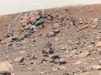
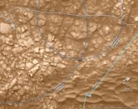
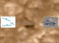
The bumpy rock had even been imaged already on sol 934 with the left and right eyes of the Mastcam-Z simultaneously. These paired raw images (1, 2), along with paired images of Sol 950 (3, 4, 5, 6), enabled triangulation (map 1). There is a dark rock (and/or shadow) at the intersection of the distance circles around the respective rover positions. Helicopter flight paths run nearby. And indeed, the dark rock is visible in some helicopter color camera photos from sol 915. Calculating the relative positions (as seen from above) of the visible front faces of the three rocks with the help of the sol 950 raw images results in the left inset in map 2. Light blue polygons are a measure of the uncertainty of the triangulation. Here is A - the bumpy rock, B - the layered rock, C - the rock with a hovering pointed tip and its shadow. Both insets and the orbital photo are of the same scale. The photo made by the helicopter clearly shows that A and B are not connected and that the apparent contact between A and B in this image is an optical illusion.
|
||||
|
|
|
||||
|
Nov 8 2023, 08:50 AM
Post
#1071
|
|
|
Senior Member Group: Members Posts: 2998 Joined: 30-October 04 Member No.: 105 |
QUOTE (serpens @ Nov 6 2023, 05:52 PM) I think you are spot on Tau. The bumpy aspect is a function of erosion. It is standing proud of similar rocks and was probably part of that bed and potentially tilted. Oh my. Geo-paredolia strikes! --Bill -------------------- |
|
|
|
|
Nov 8 2023, 01:05 PM
Post
#1072
|
|
|
Senior Member Group: Members Posts: 1043 Joined: 17-February 09 Member No.: 4605 |
Really? OK.
|
|
|
|
|
Nov 11 2023, 01:32 PM
Post
#1073
|
||
|
Member Group: Members Posts: 665 Joined: 9-May 21 From: Germany Member No.: 9017 |
Here is a wiggle stereogram for sol 950.
|
|
|
|
|
|
|
Nov 15 2023, 08:19 PM
Post
#1074
|
|
 Member Group: Members Posts: 823 Joined: 9-September 17 From: UK Member No.: 8241 |
-------------------- |
|
|
|
|
Nov 16 2023, 10:26 AM
Post
#1075
|
|
|
Member Group: Members Posts: 823 Joined: 9-September 17 From: UK Member No.: 8241 |
-------------------- |
|
|
|
|
Nov 16 2023, 11:17 AM
Post
#1076
|
|
|
Member Group: Members Posts: 823 Joined: 9-September 17 From: UK Member No.: 8241 |
-------------------- |
|
|
|
|
Nov 16 2023, 09:50 PM
Post
#1077
|
|
|
Member Group: Members Posts: 823 Joined: 9-September 17 From: UK Member No.: 8241 |
-------------------- |
|
|
|
|
Nov 17 2023, 09:33 PM
Post
#1078
|
||
|
Solar System Cartographer Group: Members Posts: 10153 Joined: 5-April 05 From: Canada Member No.: 227 |
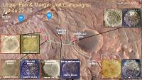
https://www.lpi.usra.edu/pac/presentations/...023%20v1.4.pptx
This link is to the recent PAC meeting presentation on the Mars program. It includes a nice slide on the delta samples:
Phil -------------------- ... because the Solar System ain't gonna map itself.
Also to be found posting similar content on https://mastodon.social/@PhilStooke Maps for download (free PD: https://upload.wikimedia.org/wikipedia/comm...Cartography.pdf NOTE: everything created by me which I post on UMSF is considered to be in the public domain (NOT CC, public domain) |
|
|
|
|
|
|
Nov 18 2023, 05:48 PM
Post
#1079
|
|||
 Senior Member Group: Members Posts: 1629 Joined: 5-March 05 From: Boulder, CO Member No.: 184 |
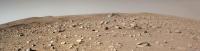
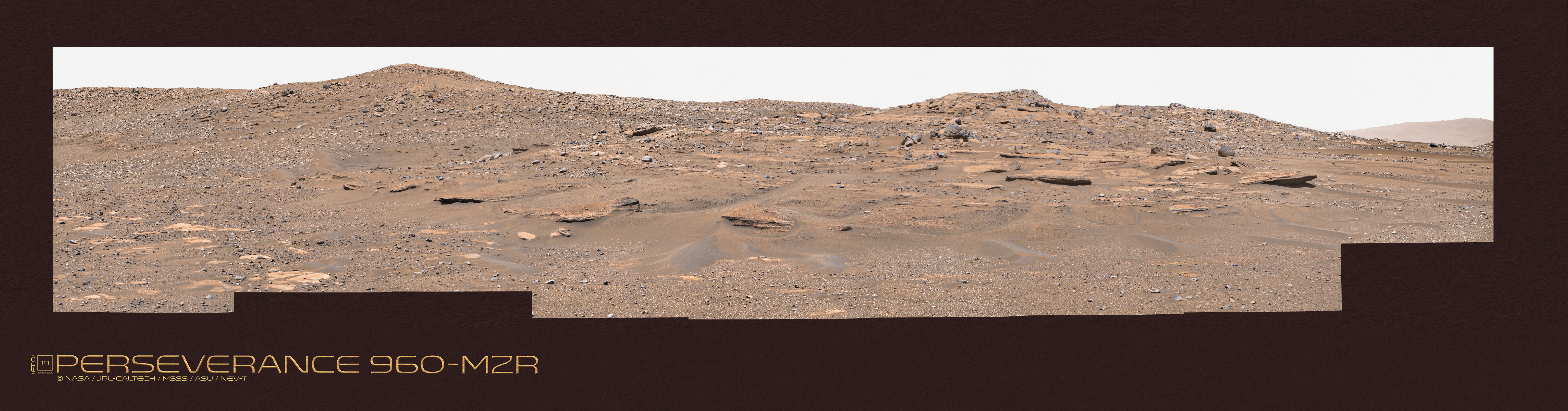
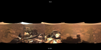
Sol 958 is seen in this 360 degree mosaic along with a large version link. The drive was to the NNW and the view is centered on north. Thanks to Paul for image and camera navigation info and Kevin Gill for the raw image utilities that all help prep the images for my processing steps. This one has more seams than usual as the images come from three different times of the day with changing land and sky illumination.
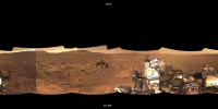
Here is Sol 959 heading to the ENE along with a large version link.
-------------------- Steve [ my home page and planetary maps page ]
|
||
|
|
|
||
|
Nov 19 2023, 02:57 AM
Post
#1080
|
||
|
Senior Member Group: Members Posts: 1629 Joined: 5-March 05 From: Boulder, CO Member No.: 184 |
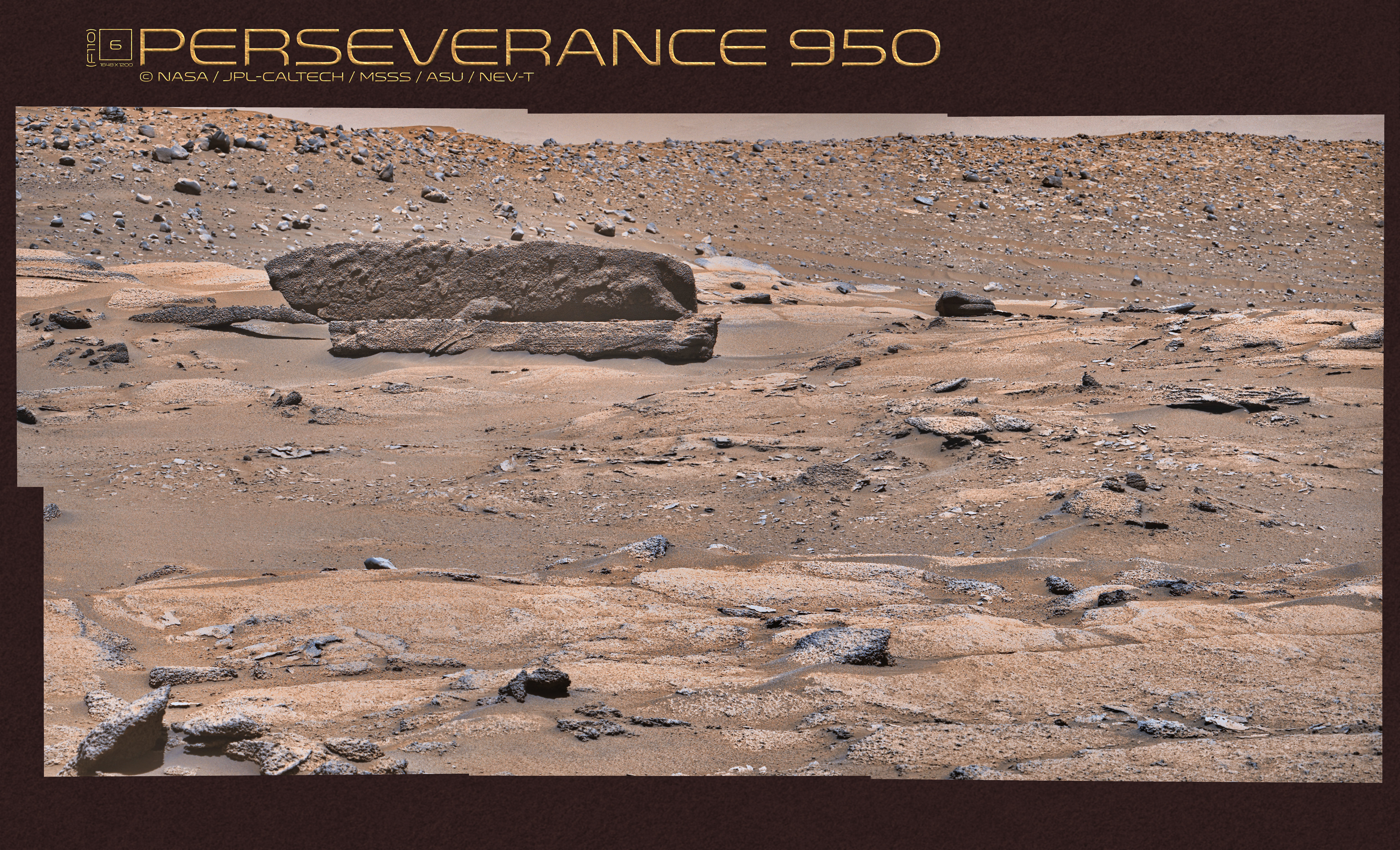
And here is Sol 960 heading to the east along with a large version link. Thanks to Paul for image and camera navigation info and Kevin Gill for the raw image utilities that all help prep the images for my processing.
Extended drive animation from Sol 387 to the present. -------------------- Steve [ my home page and planetary maps page ]
|
|
|
|
|
|
|

|
Lo-Fi Version | Time is now: 28th April 2024 - 06:49 AM |
|
RULES AND GUIDELINES Please read the Forum Rules and Guidelines before posting. IMAGE COPYRIGHT |
OPINIONS AND MODERATION Opinions expressed on UnmannedSpaceflight.com are those of the individual posters and do not necessarily reflect the opinions of UnmannedSpaceflight.com or The Planetary Society. The all-volunteer UnmannedSpaceflight.com moderation team is wholly independent of The Planetary Society. The Planetary Society has no influence over decisions made by the UnmannedSpaceflight.com moderators. |
SUPPORT THE FORUM Unmannedspaceflight.com is funded by the Planetary Society. Please consider supporting our work and many other projects by donating to the Society or becoming a member. |
|