Beyond Lewis and Clark Gap, Sol 4482- (September 2, 2016-) |

  |
Beyond Lewis and Clark Gap, Sol 4482- (September 2, 2016-) |
 Oct 7 2016, 09:52 PM Oct 7 2016, 09:52 PM
Post
#31
|
|
 Senior Member     Group: Members Posts: 4260 Joined: 17-January 05 Member No.: 152 |
The features near MSL bear some resemblence to recurring slope lineae (RSL), dark streaks that appear and reappear and that might be related to current water.
If the gully near Oppy was carved by water, it was probably in the very distant past - I haven't heard anyone suggest water was still present. The Oppy gully isn't an RSL. |
|
|
|
 Oct 7 2016, 11:00 PM Oct 7 2016, 11:00 PM
Post
#32
|
|
|
Member    Group: Members Posts: 866 Joined: 15-March 05 From: Santa Cruz, CA Member No.: 196 |
It's almost as if the gulley near Oppy had to have been exhumed, it just looks too surficial to be that ancient, perhaps what we see is just a lingering remnant of its once lower reaches, though I have no idea if we know how deep these slopes have been eroded over the eons.
|
|
|
|
 Oct 7 2016, 11:04 PM Oct 7 2016, 11:04 PM
Post
#33
|
|
|
Solar System Cartographer     Group: Members Posts: 10256 Joined: 5-April 05 From: Canada Member No.: 227 |
Check this out... MEPAG presentation from yesterday's meeting, with Opportunity's future route mapped out.
Phil http://mepag.jpl.nasa.gov/meeting/2016-10/...MarsScience.pdf -------------------- ... because the Solar System ain't gonna map itself.
Also to be found posting similar content on https://mastodon.social/@PhilStooke Maps for download (free PDF: https://upload.wikimedia.org/wikipedia/comm...Cartography.pdf NOTE: everything created by me which I post on UMSF is considered to be in the public domain (NOT CC, public domain) |
|
|
|
 Oct 9 2016, 11:29 PM Oct 9 2016, 11:29 PM
Post
#34
|
|
 Member    Group: Members Posts: 691 Joined: 21-December 07 From: Clatskanie, Oregon Member No.: 3988 |
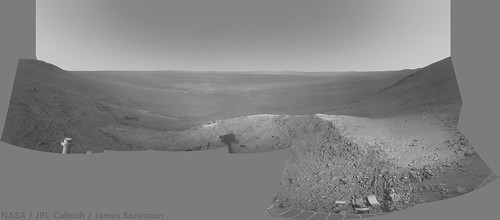
Opportunity's Navcam view from Spirit Mound.
 https://www.flickr.com/photos/43581439@N08/...211963/sizes/k/ |
|
|
|
 Oct 10 2016, 05:46 PM Oct 10 2016, 05:46 PM
Post
#35
|
|
 Member    Group: Members Posts: 423 Joined: 13-November 14 From: Norway Member No.: 7310 |
Check this out... MEPAG presentation from yesterday's meeting, with Opportunity's future route mapped out. Phil http://mepag.jpl.nasa.gov/meeting/2016-10/...MarsScience.pdf Excellent, just what the official release was missing. I like that they are planning to visit a small well-preserved crater; makes me all nostalgic. -------------------- |
|
|
|
 Oct 11 2016, 01:47 PM Oct 11 2016, 01:47 PM
Post
#36
|
|
|
Member    Group: Members Posts: 402 Joined: 5-January 07 From: Manchester England Member No.: 1563 |
It's almost as if the gulley near Oppy had to have been exhumed, it just looks too surficial to be that ancient, perhaps what we see is just a lingering remnant of its once lower reaches, though I have no idea if we know how deep these slopes have been eroded over the eons. TBH my bet would be that it's more recent, and due to dust or debris flow with little or no water involved - perhaps a little lubrication to help things move if it dates from a high obliquity period, but my gut feeling is that the idea of liquid water being involved is more wh\t people are determined toi find than what is actually there. Would be delighted to be wrong though! -------------------- |
|
|
|
 Oct 13 2016, 11:42 PM Oct 13 2016, 11:42 PM
Post
#37
|
|
|
Member    Group: Members Posts: 866 Joined: 15-March 05 From: Santa Cruz, CA Member No.: 196 |
|
|
|
|
 Oct 14 2016, 01:09 AM Oct 14 2016, 01:09 AM
Post
#38
|
|
 Member    Group: Members Posts: 691 Joined: 21-December 07 From: Clatskanie, Oregon Member No.: 3988 |
From the tracking site.
pancam_EDM_test_L6R2 http://qt.exploratorium.edu/mars/opportuni...A4P2671L6M1.JPG Looks like the MER team is getting ready to attempt to image Schiaparelli's descent. Good luck on the Imaging attempt, and good luck to the Schiaparelli team! |
|
|
|
 Oct 14 2016, 07:03 AM Oct 14 2016, 07:03 AM
Post
#39
|
|
|
Senior Member     Group: Members Posts: 2113 Joined: 13-February 10 From: Ontario Member No.: 5221 |
Since Oppy is on the inner west rim of the crater though, the best view would be if the trajectory overshot the centre of the landing ellipse and ended up far to the east; if the targeting is perfect than ironically the slope will block the view (see http://www.leonarddavid.com/europe-readies...ber-touchdown/) . And obviously the MER team has its own mission which doesn't involve doubling back to the other side of the valley for the sake of one 1 pixel. Don't expect anything like the cover of the Martian Chronicles..
|
|
|
|
 Oct 18 2016, 11:27 AM Oct 18 2016, 11:27 AM
Post
#40
|
|
|
Member    Group: Members Posts: 206 Joined: 15-August 07 From: Shrewsbury, Shropshire Member No.: 3233 |
Am I right in thinking that the landing ellipse for Insight at Meridiani Planum is roughly the same as that for Schiaparelli? Oppy may therefore be able to take a photo of Insight landing in 2 Year's time.
|
|
|
|
 Oct 18 2016, 11:51 AM Oct 18 2016, 11:51 AM
Post
#41
|
|
|
Solar System Cartographer     Group: Members Posts: 10256 Joined: 5-April 05 From: Canada Member No.: 227 |
No, not at all. Insight is heading for an area north of Gale crater, half a world away from Meridiani Planum, and too far north for Curiosity to see it.
Phil -------------------- ... because the Solar System ain't gonna map itself.
Also to be found posting similar content on https://mastodon.social/@PhilStooke Maps for download (free PDF: https://upload.wikimedia.org/wikipedia/comm...Cartography.pdf NOTE: everything created by me which I post on UMSF is considered to be in the public domain (NOT CC, public domain) |
|
|
|
 Oct 19 2016, 09:59 PM Oct 19 2016, 09:59 PM
Post
#42
|
|
 Senior Member     Group: Members Posts: 4260 Joined: 17-January 05 Member No.: 152 |
|
|
|
|
 Oct 27 2016, 09:01 AM Oct 27 2016, 09:01 AM
Post
#43
|
|
 Member    Group: Members Posts: 691 Joined: 21-December 07 From: Clatskanie, Oregon Member No.: 3988 |
|
|
|
|
 Oct 28 2016, 07:17 AM Oct 28 2016, 07:17 AM
Post
#44
|
|
 Member    Group: Members Posts: 691 Joined: 21-December 07 From: Clatskanie, Oregon Member No.: 3988 |
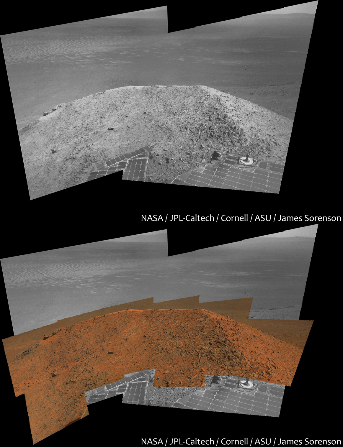
I have been assembling the Spirit Mound mosaic that it has been taking. Here is a preview GIF of it.

|
|
|
|
 Oct 30 2016, 02:29 AM Oct 30 2016, 02:29 AM
Post
#45
|
|
|
Solar System Cartographer     Group: Members Posts: 10256 Joined: 5-April 05 From: Canada Member No.: 227 |
-------------------- ... because the Solar System ain't gonna map itself.
Also to be found posting similar content on https://mastodon.social/@PhilStooke Maps for download (free PDF: https://upload.wikimedia.org/wikipedia/comm...Cartography.pdf NOTE: everything created by me which I post on UMSF is considered to be in the public domain (NOT CC, public domain) |
|
|
|
  |

|
Lo-Fi Version | Time is now: 31st October 2024 - 11:58 PM |
|
RULES AND GUIDELINES Please read the Forum Rules and Guidelines before posting. IMAGE COPYRIGHT |
OPINIONS AND MODERATION Opinions expressed on UnmannedSpaceflight.com are those of the individual posters and do not necessarily reflect the opinions of UnmannedSpaceflight.com or The Planetary Society. The all-volunteer UnmannedSpaceflight.com moderation team is wholly independent of The Planetary Society. The Planetary Society has no influence over decisions made by the UnmannedSpaceflight.com moderators. |
SUPPORT THE FORUM Unmannedspaceflight.com is funded by the Planetary Society. Please consider supporting our work and many other projects by donating to the Society or becoming a member. |

|