InSight Surface Operations, 26 Nov 2018- 21 Dec 2022 |

  |
InSight Surface Operations, 26 Nov 2018- 21 Dec 2022 |
 Jul 9 2020, 05:07 PM Jul 9 2020, 05:07 PM
Post
#946
|
|
|
Senior Member  Group: Members Posts: 2511 Joined: 13-September 05 Member No.: 497 |
QUOTE (Phil Stooke @ Jul 8 2020, 04:05 PM)  I hope that the arm can now be freed up to complete the panorama imaging. I could really use a full panorama, foreground as well as horizon. https://www.planetary.org/multimedia/space-...trait-as-a.html seems pretty complete, though it's hard to tell what gaps might have been filled and how. I couldn't find an "official version" of the 360 pan anywhere, or even a well-documented amateur version -- maybe there's one upthread here? I could bug Justin Maki about this but I've already bugged him enough for M2020 stuff. -------------------- Disclaimer: This post is based on public information only. Any opinions are my own.
|
 |
 
|
|
Jul 9 2020, 05:31 PM
Post
#947
|
|
|
Solar System Cartographer Group: Members Posts: 10151 Joined: 5-April 05 From: Canada Member No.: 227 |
That 360 view looks really nice, but it's not real. It is a partial panorama with gaps filled by cloning. One bit of evidence is the 'Rolling Stones Rock' which appears twice with its rolling track, one version flipped.
Phil -------------------- ... because the Solar System ain't gonna map itself.
Also to be found posting similar content on https://mastodon.social/@PhilStooke Maps for download (free PD: https://upload.wikimedia.org/wikipedia/comm...Cartography.pdf NOTE: everything created by me which I post on UMSF is considered to be in the public domain (NOT CC, public domain) |
|
|
|
|
Jul 9 2020, 06:43 PM
Post
#948
|
|
|
Senior Member Group: Members Posts: 2511 Joined: 13-September 05 Member No.: 497 |
QUOTE (Phil Stooke @ Jul 9 2020, 09:31 AM) That 360 view looks really nice, but it's not real. It is a partial panorama with gaps filled by cloning. I should have suspected as much, but I still don't know just how many gaps remain if you look at the whole image dataset. -------------------- Disclaimer: This post is based on public information only. Any opinions are my own.
|
|
|
|
|
Jul 10 2020, 03:06 AM
Post
#949
|
|
|
Solar System Cartographer Group: Members Posts: 10151 Joined: 5-April 05 From: Canada Member No.: 227 |
I have been working with the full image set. We have a full horizon panorama and all the workspace. I think there may be a few gaps around the edges of the workspace. It's possible we have the full area covered, but the neither the InSight team nor the wizards here have released a full cylindrical panorama including all of the workspace, which is what I am looking for to support other mapping. Eventually they intend to produce full panoramas with two or three different illumination directions.
Phil -------------------- ... because the Solar System ain't gonna map itself.
Also to be found posting similar content on https://mastodon.social/@PhilStooke Maps for download (free PD: https://upload.wikimedia.org/wikipedia/comm...Cartography.pdf NOTE: everything created by me which I post on UMSF is considered to be in the public domain (NOT CC, public domain) |
|
|
|
|
Jul 10 2020, 11:36 AM
Post
#950
|
|
|
Member Group: Members Posts: 103 Joined: 3-February 20 From: Paris (France) Member No.: 8747 |
Bonjour,
Without wanting to be systematically critical, it also seems that the efficiency of wind protection (WTS) is relatively poor. I quote from the link provided yesterday by Fredk regarding SEIS operations : "InSight's seismometer, called the Seismic Experiment for Interior Structure (SEIS), detected its first marsquake nearly three months after starting its measurements in January 2019. By the fall of 2019, it was detecting a potential quake or two per day. While SEIS has detected more than 480 seismic signals overall, the rate has dropped to less than one per week." "This rate change is tied to seasonal variations of atmospheric turbulence, which creates noise that covers up the tiny quake signals. Despite the protective Wind and Thermal Shield, SEIS is sensitive enough that shaking from the wind hitting the shield can make quakes harder to isolate." The difficulties to overcome are innumerable for the accomplishment of a planetary mission, I am perfectly aware of it. And the unexpected takes its share. Lets see how the WTS was sold to us before the launch of Insight: https://www.seis-insight.eu/en/public-2/seis-instrument/wts |
|
|
|
|
Jul 11 2020, 07:08 PM
Post
#951
|
|
 Junior Member Group: Members Posts: 28 Joined: 17-April 08 From: Okemos, MI, USA Member No.: 4097 |
QUOTE (Quetzalcoatl @ Jul 10 2020, 06:36 AM) the efficiency of wind protection (WTS) is relatively poor. "This rate change is tied to seasonal variations of atmospheric turbulence, which creates noise that covers up the tiny quake signals. Despite the protective Wind and Thermal Shield, SEIS is sensitive enough that shaking from the wind hitting the shield can make quakes harder to isolate." I think your inferences are unwarranted. It was always known that wind noise was the limiting factor for signal detection, and the increase of wind on a seasonal basis would therefore obviously decrease the number of detections. That doesn't tell us anything about whether the WTS is working at the expected efficiency. If you take a look at figure SI1.1 in The Seismicity of Mars (Supplemental) and compare it to the figures in Noise Model of SEIS, they seem pretty close to me. |
|
|
|
|
Jul 11 2020, 08:18 PM
Post
#952
|
|
|
Senior Member Group: Members Posts: 2511 Joined: 13-September 05 Member No.: 497 |
QUOTE (Phil Stooke @ Jul 9 2020, 07:06 PM) Eventually they intend to produce full panoramas with two or three different illumination directions. All of the images through sol 480 are released through PDS at https://pds-imaging.jpl.nasa.gov/data/nsyt/insight_cameras/ in multiple forms (including ones where spacecraft structure is helpfully masked out) but even though their SIS describes multiple flavors of mosaics, 3D grids, etc, I don't think any of those have been released yet; at least I couldn't find them. -------------------- Disclaimer: This post is based on public information only. Any opinions are my own.
|
|
|
|
|
Jul 11 2020, 11:03 PM
Post
#953
|
|
|
Solar System Cartographer Group: Members Posts: 10151 Joined: 5-April 05 From: Canada Member No.: 227 |
Thanks, Mike. I'm in there after every release but not finding what i want yet. There were some mosaics in earlier releases but not now, it seems. Don't know why.
In other news, the arm has been raised on sol 577: https://mars.nasa.gov/insight-raw-images/su...0101_0095M_.JPG Phil -------------------- ... because the Solar System ain't gonna map itself.
Also to be found posting similar content on https://mastodon.social/@PhilStooke Maps for download (free PD: https://upload.wikimedia.org/wikipedia/comm...Cartography.pdf NOTE: everything created by me which I post on UMSF is considered to be in the public domain (NOT CC, public domain) |
|
|
|
|
Jul 12 2020, 03:24 AM
Post
#954
|
|
|
Senior Member Group: Members Posts: 2082 Joined: 13-February 10 From: Ontario Member No.: 5221 |
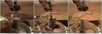
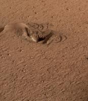
QUOTE (Phil Stooke @ Jul 11 2020, 07:03 PM) In other news, the arm has been raised on sol 577: https://mars.nasa.gov/insight-raw-images/su...0101_0095M_.JPG Phil Huh... the pit seems almost completely filled with soil already (and it really looks very powdery!). There might not be that much filling in for the scoop to do. |
|
|
|
|
Jul 13 2020, 11:01 AM
Post
#955
|
||
 Senior Member Group: Members Posts: 2428 Joined: 30-January 13 From: Penang, Malaysia. Member No.: 6853 |
Increasing Dust on the Lander's Solar Array: Sol 10, 227 and today (sol 578)
EDIT: Selected Solar Array output from the Mission Managers Reports posted in the InSight Analysts Notebook (PDS) Sol 1: >3000 Whr Sol 103: ~2800 Whr/sol Sol 225-232: ~1950Whr/sol (when the middle image was obtained) Sol 301-308: ~1900 Whr/sol Sol 376-402 ~2100 Whr/sol Sol 478-484: ~2100 Whr/sol No further data in the PDS I think we need a friendly  
|
|
|
|
|
|
|
Jul 13 2020, 03:40 PM
Post
#956
|
|||
|
Founder Group: Chairman Posts: 14432 Joined: 8-February 04 Member No.: 1 |
I had a go at generating another structure from motion of the workspace after the Sol 577 Workspace Survey https://sketchfab.com/3d-models/insight-sol...ae1d41096e31e5c
Attached thumbnail(s)
|
||
|
|
|
||
|
Jul 15 2020, 03:37 AM
Post
#957
|
|
 Member Group: Members Posts: 610 Joined: 23-February 07 From: Occasionally in Columbia, MD Member No.: 1764 |
QUOTE (Quetzalcoatl @ Jul 10 2020, 07:36 AM) Without wanting to be systematically critical, it also seems that the efficiency of wind protection (WTS) is relatively poor. I think it is important to phrase remarks like this carefully. I believe the WTS is doing its job effectively (viz, eliminating wind forces and temperature changes on the instrument) It is a separate question (1) whether atmosphere-generated disturbances communicated by other pathways are dominating the noise background, and a separate question still (2) whether that noise is confounding the ability to detect Mars seismicity, and a separate question still (3) whether aspirations to determine aspects of Mars' interior are feasible on a lander like InSight. I wrote a paper (titled mostly about Venus, to avoid being too confrontational during the 2011/2012 Discovery competition, when I was involved in the Titan Mare Explorer) that discusses the prominent role of wind and lander noise. Apollo 11 saw lander noise, even in the absence of an atmosphere, and even with the seismometer many meters from the lander (effect was less, but not zero, on subsequent landers whose crews were able to emplace the seismometers further away) Even if you buried the seismometer a meter or two down, if you are within some meters of a big 'wind noise antenna', there will be a contribution. (Seismic observatories are sited away from trees and buildings for this reason, and ideally tens of meters down in bedrock. The most useful literature I came across on this problem a decade ago is in nonideal locations where seismic instrumentation is used for treaty verification and perimeter security....) On InSight a dominant noise is wind loads on the lander, communicated through the feet and the regolith to the instrument. That's physics, that's not a failure of the WTS. There is a practical limit on how far away it can be placed, due to finite arm length. A recent paper (https://agupubs.onlinelibrary.wiley.com/doi/abs/10.1029/2019JE006353) shows that basically putting the instrument on the ground a meter or so away knocks the noise down by an order of magnitude, and putting the wind shield on knocks it down by another OOM. So WTS works. The big issue (2) is basically that Mars has turned out to be seismically quiet (which to some extent we knew from Viking anyway....but that's another story) If there were more activity, the wind noise, not too different from expectations I think, would not be a problem, we would have detected the events. On (3) it's probably still too early to say. One single large event would tell us an awful lot. Maybe it will happen tomorrow. . |
|
|
|
|
Jul 15 2020, 10:02 AM
Post
#958
|
|
|
Member Group: Members Posts: 103 Joined: 3-February 20 From: Paris (France) Member No.: 8747 |
Thank you very much, sir,
My inexperience is the only excuse for this clumsy wording (or even inaccurate according to your arguments) This detailed answer can certainly clarify a little my ideas on some of the interferences complicating the analysis of SEIS data. |
|
|
|
|
Jul 15 2020, 10:13 AM
Post
#959
|
|
|
Member Group: Members Posts: 103 Joined: 3-February 20 From: Paris (France) Member No.: 8747 |
QUOTE (rlorenz @ Jul 15 2020, 04:37 AM) ...One single large event would tell us an awful lot. Maybe it will happen tomorrow. If i may, I will set my alarm to ring early in the morning to not miss anything of this event, hoping that the vibrations of the bell do not disturb the SEIS sensors.  |
|
|
|
|
Jul 15 2020, 07:57 PM
Post
#960
|
|
 Senior Member Group: Members Posts: 2530 Joined: 20-April 05 Member No.: 321 |
I'm no geologist, but I'm somewhat handy around statistics, and it seems to me that if wind is often a troubling source of noise, but at other times it is not, the loss of science is not proportional to the amount of time that wind prevents the detection of a quake.
Small quakes are likely relatively continuous in distribution, and if we record those for a fraction of the mission time, we still learn a lot. And if there is a massive quake, it would likely exceed the wind noise problem. And if there isn't, we learn from that, too. The goal here isn't to have a flawless, uninterrupted record of martian seismicity. That would be ideal, but it isn't a requirement. |
|
|
|
|

|
Lo-Fi Version | Time is now: 26th April 2024 - 12:54 AM |
|
RULES AND GUIDELINES Please read the Forum Rules and Guidelines before posting. IMAGE COPYRIGHT |
OPINIONS AND MODERATION Opinions expressed on UnmannedSpaceflight.com are those of the individual posters and do not necessarily reflect the opinions of UnmannedSpaceflight.com or The Planetary Society. The all-volunteer UnmannedSpaceflight.com moderation team is wholly independent of The Planetary Society. The Planetary Society has no influence over decisions made by the UnmannedSpaceflight.com moderators. |
SUPPORT THE FORUM Unmannedspaceflight.com is funded by the Planetary Society. Please consider supporting our work and many other projects by donating to the Society or becoming a member. |
|