Printable Version of Topic
Click here to view this topic in its original format
Unmanned Spaceflight.com _ Opportunity _ Solander Point
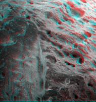
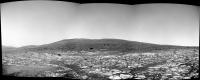
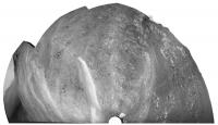
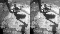
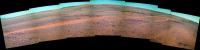
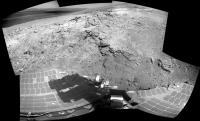
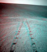
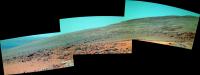
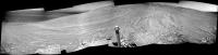
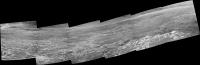
Posted by: mhoward Aug 4 2013, 08:39 PM
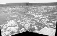
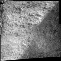
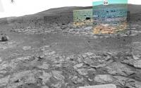
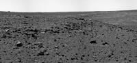
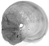
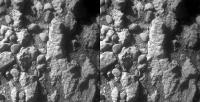
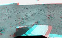
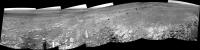
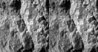
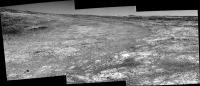
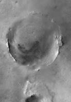
Opportunity is very close to Solander Point, so let's start the new thread. Here's a view just to get things rolling. There will no doubt be more and better images soon.
|
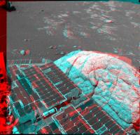
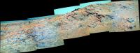
Posted by: Astro0 Aug 4 2013, 10:48 PM
I am moved to MEME this 

|
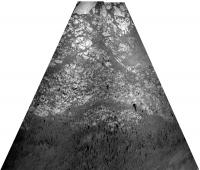
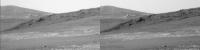
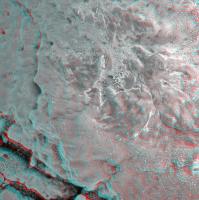
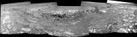
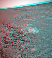
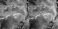
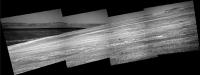
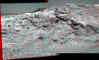
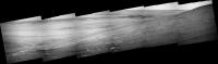
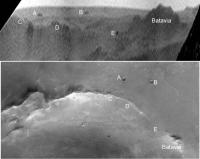
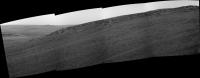
Posted by: Phil Stooke Aug 4 2013, 11:05 PM
Turning that approach view on its head:
|
Phil
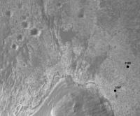
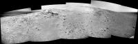
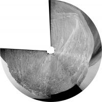
Posted by: Phil Stooke Aug 5 2013, 12:07 AM
And this is the location I get from that view.
Phil
|
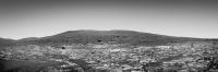
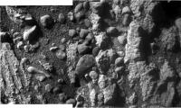
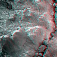
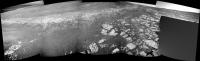
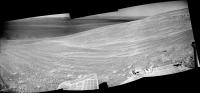
Posted by: SFJCody Aug 5 2013, 09:49 PM
http://qt.exploratorium.edu/mars/opportunity/pancam/2013-08-05/1P428526666EFFC6E2P2415L7M2.JPG
http://qt.exploratorium.edu/mars/opportunity/pancam/2013-08-05/1P428872684EFFC700P2418R2M1.JPG
http://qt.exploratorium.edu/mars/opportunity/pancam/2013-08-05/1P428700237EFFC6TLP2417L2M3.JPG
I have a sudden itch to put on my sturdy hiking boots!
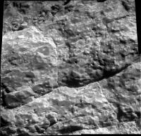
It's amazing how abrupt the contact between the blocky material of the hillside and the sulphate-sandstone plains is. Hardly any hillside rocks have been scattered out onto the plains. How many billions of years has this scene been sitting undisturbed, waiting for us...? <drifts off into planetary reverie>
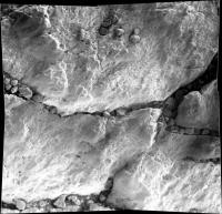
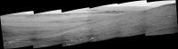
Posted by: Phil Stooke Aug 6 2013, 12:28 AM
http://qt.exploratorium.edu/mars/opportunity/pancam/2013-08-05/1P428526666EFFC6E2P2415L7M2.JPG
So that's where I left that box of old floppy disks...
Phil
Posted by: Tesheiner Aug 6 2013, 12:26 PM
The monthly report by Salley Rayl is available here: http://www.planetary.org/explore/space-topics/space-missions/mer-updates/2013/07-mer-update-opportunity-arrives-at-solander-suburb.html
I just started reading it but would like to highlight this paragraph:
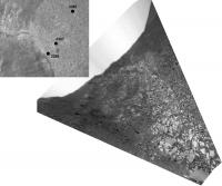
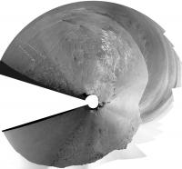
Posted by: Phil Stooke Aug 6 2013, 02:04 PM
3389 position and perspective view of the two frame navcam pan.
Phil
|
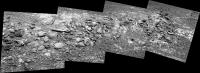
Posted by: walfy Aug 8 2013, 12:15 AM
A quick stitch from the micro camera, Sol 3390:
|
Posted by: Tesheiner Aug 8 2013, 03:04 PM
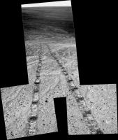
Some pictures available from sol 3391, telling that Opportunity backtracked a few meters from the previous site.
http://qt.exploratorium.edu/mars/opportunity/navcam/2013-08-08/1N429231997EFFC7A0P1952L0M1.JPG
And several features were imaged before driving, but they are still on the downlink queue:
03391::p2547::32::4::4::0::0::2::10::pancam_Mula_Mula_L257R2
03391::p2548::32::4::4::0::0::2::10::pancam_Tick_Bush_L257R2
03391::p2549::32::13::13::0::0::2::28::pancam_Red_Poker_L234567Rall
Posted by: jamescanvin Aug 9 2013, 07:31 AM
Red Poker is the target she has just been looking at (she backed up a bit before taking the image to get a better view).
Tick Bush is where she drove to, ~4.5m away
Posted by: SFJCody Aug 14 2013, 05:47 AM
A new update! :-)
http://www.nmnaturalhistory.org/rover-field-reports-from-mars.html
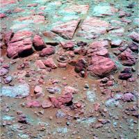
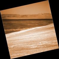
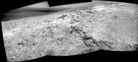
Posted by: Astro0 Aug 14 2013, 07:03 AM
An earlier view of Solander Point with some sky added for effect
|
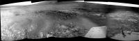
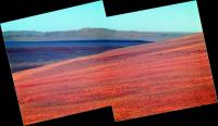
Posted by: fredk Aug 15 2013, 09:19 PM
Long-baseline stereo view of the east side of Solander and across to Tribulation, from sols 3381 and 3385:

|
|
We're starting to get a good view of a prominent ridge on the north face of Tribulation.
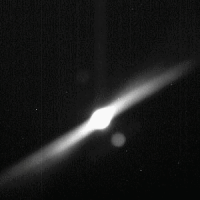
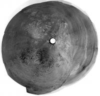
Posted by: walfy Aug 15 2013, 11:55 PM
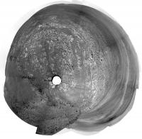
This is Phobos partially eclipsing the sun, yes? The eclipse comes out much clearer in reverse where some light is getting refracted in Oppy's lens. From sol 3396:
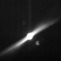
|
It looks to be around the right size according to this recent comparison image from NASA:

|
If something else is going on, I'll eat my hat!
Posted by: fredk Aug 16 2013, 12:21 AM
Yep, Phobos transit. Like we've seen before with transits, the jpl jpegs are stretched badly so we'll have to wait for PDS to get a better view. I'm not sure why the stretching gives such a different result for transit images than for the regular tau images...
Posted by: Deimos Aug 16 2013, 12:37 AM
Most Sun images are taken with an automatic "Sun" subframe, that is nice and small. The Sun is a big part, so it stretches OK. The transit images are optimized for speed, which perversely forces a larger frame. The Sun is a small fraction, and the contrast stretch blows it away.
Posted by: Phil Stooke Aug 16 2013, 03:10 PM
Looks like we've moved right up to the contact now:
http://www.midnightplanets.com/web/MERB/image/03398/1N429848747EFFC7C0P1925R0M1.html
Phil
Posted by: mhoward Aug 16 2013, 04:24 PM
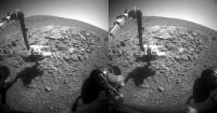
The boulder that she seems http://www.midnightplanets.com/web/MERB/image/03398/1N429848618EFFC7C0P1925L0M1.html on Sol 3398 is "Quandong Mulla Mulla" (really curious if anyone can track down the origin of that one). The big boulder on the far left of this view is "Cheese Tree".
|
Posted by: charborob Aug 16 2013, 05:50 PM
http://en.wikipedia.org/wiki/Mulla_mulla and http://en.wikipedia.org/wiki/Santalum_acuminatum are Australian plants.
Posted by: mhoward Aug 16 2013, 06:04 PM
Ah, okay, thanks. Via @mikeseibert on Twitter, "Mulla Mulla" is the name of the boulder. "Quandong" must be a second target seen in the same Pancam image (my guess would be the outcrop next to Mulla Mulla).
Posted by: mhoward Aug 18 2013, 07:14 PM
I spent a fair amount of time working on this long-baseline anaglyph from sols 3381-3385 before I realized I don't have any 3D glasses with me. So... somebody let me know if it works. Normally I wouldn't post an anaglyph without actually testing it, but I'm taking a chance. (I realize the images were taken outside the range of sols for this topic, but the subject is obviously Solander Point.)

|
Posted by: charborob Aug 18 2013, 09:09 PM
Looks OK to me.
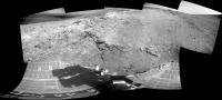
Posted by: Astro0 Aug 19 2013, 02:11 AM
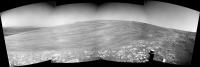
Sol 3400 Climbing Solander Point.

|
That big rock was pretty close


Posted by: vikingmars Aug 19 2013, 10:02 AM
 Climbing Solander Point. That big rock was pretty close
 WOW ! What a view : one of the best shots of the entire mission ! Thanks a lot to Oppy's Nav' Team (and to Astro0, of course)
Posted by: charborob Aug 19 2013, 12:23 PM
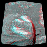
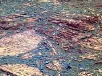
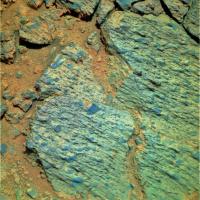
Sol 3401. Anaglyph of basaltic (?) rock containing vesicles.
|
Posted by: walfy Aug 19 2013, 07:14 PM
A nice map showing the planned route up the hill for this fall:
http://planetary.s3.amazonaws.com/assets/images/4-mars/mer/20130818_3394_Srat_sci.jpg
I got it from this http://www.planetary.org/blogs/guest-blogs/2013/crumpler-sol3397.html.
Posted by: charborob Aug 19 2013, 08:33 PM
With the December 12 position about 17m higher than the current position, that should give us a great view of the surroundings.
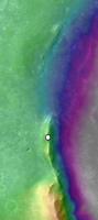
Posted by: vikingmars Aug 19 2013, 10:13 PM
Wintering at this spot means no great global views of Endeavour and of the surrounding plains until the end of 2014/beginning of 2015...
I thought they were to climb a little higher (white dot on image herewith) to get some spectacular views while spending a long time wintering at the same spot. An opinion focused on Mars outreach of course and to gain more public support for Mars exploration when times are tough to get more funds. Well... That's science !
|
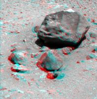
Posted by: walfy Aug 20 2013, 05:43 AM
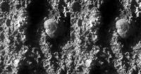
This rock from sol 3398 renders nicely in 3D:
|
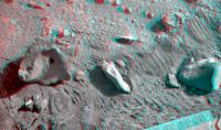
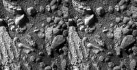
Posted by: walfy Aug 20 2013, 06:16 AM
A micro from Sol 3392:
|
Posted by: jamescanvin Aug 20 2013, 02:20 PM
I thought they were to climb a little higher (white dot on image herewith) to get some spectacular views while spending a long time wintering at the same spot.
I don't think that the < 12th Dec (Station 5) is necessarily the spot for the whole winter. With such a large expanse of northern facing slopes I was under the impression that Oppy would inch her way up Solander Point rather than staying in one place. They want to be at that location before 12th December but could easily be up near your dot by the end of winter.
Posted by: CosmicRocker Aug 21 2013, 04:39 AM
Yeah, that's what I thought. The http://www.planetary.org/explore/space-topics/space-missions/mer-updates/2013/02-mer-update-opportunity-wraps-up-science-on-matijevic-hill.html concept was mentioned in this TPS update, and may have been mentioned elsewhere.
Posted by: geoffrey.landis Aug 21 2013, 06:40 PM
|
|
where did that comparison image come from? The size comparison to the Earth's moon looks quite a bit different from the version on the JPL site (http://www.jpl.nasa.gov/images/msl/20130815/pia17351-640.jpg):

Posted by: elakdawalla Aug 21 2013, 06:51 PM
The one that walfy posted was taken down and replaced later with the version you just posted. http://www.unmannedspaceflight.com/index.php?s=&showtopic=7691&view=findpost&p=202440
Posted by: walfy Aug 21 2013, 09:39 PM
A 3D micro from the latest batch, Sol 3403, that was much easier than usual to put together:
|
Posted by: vikingmars Aug 22 2013, 08:04 AM
Thanks jamescanvin and CosmicRocker for your explanations. I feel really better... for outreach purposes of course !
Posted by: walfy Aug 23 2013, 08:28 AM
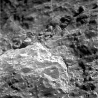
Many nice images of late, many rendering wonderfully in 3D. Such desolate, ancient objects! And we can almost touch them. That big rock up close from Sol 3405:
|
Posted by: walfy Aug 23 2013, 08:32 AM
Just one more for tonight, also from recent Sol 3405:
|
Posted by: atomoid Aug 24 2013, 10:19 AM
sol 3397 an old tyme movie
|
Posted by: walfy Aug 25 2013, 07:11 PM
Nice shot along the "banks," the planned route before heading up the hill:
|
Posted by: charborob Aug 25 2013, 11:43 PM
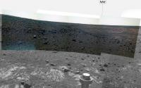
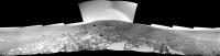
Sol 3407 navcam panorama:
|
|
Posted by: mhoward Aug 25 2013, 11:46 PM
Return of the partial-color drive direction mosaic on sol 3407. Yay!
|
Posted by: jvandriel Aug 26 2013, 07:34 PM
The panoramic L0 Navcam view on Sol 3407.
Jan van Driel
|
Posted by: jvandriel Aug 27 2013, 09:52 AM
Special request.
The panoramic view taken on Sol 3389 taken with the L0 Navcam.
Jan van Driel
|
Posted by: jvandriel Aug 27 2013, 09:55 AM
Sol 3389 the Navcam panoramic view.
Jan van Driel
|
|
Posted by: jvandriel Aug 27 2013, 09:59 AM
and the last one.
Sol 3389. Looking back.
Jan van Driel
|
|
Posted by: Tesheiner Aug 28 2013, 06:08 PM
Here's part of a "post-drive" navcam mosaic shot on sol 3410.

|
Posted by: jvandriel Aug 29 2013, 06:45 PM
The Navcam L0 panoramic view on Sol 3410.
Jan van Driel
|
|
Posted by: mhoward Aug 30 2013, 06:34 PM
"Coal Island", Sol 3412. After taking these Pancam images she turned around and advanced slightly toward the target.
|
Posted by: serpens Aug 30 2013, 10:50 PM
So is "Coal Island" the outcrop of what, from a distance, looks as if it could be more vesicular basalt, or the transition from planar to cross stratified laminae in the left image?
Posted by: jvandriel Aug 31 2013, 12:33 PM
Sol 3412 the L0 navcam view.
Jan van Driel
|
Posted by: Phil Stooke Aug 31 2013, 09:15 PM
This is the sol 3410 panorama posted by jvandriel (Thanks!) in a circular version. It gives a nice view of the tracks and surrounding features.
Phil
|
Posted by: Phil Stooke Aug 31 2013, 10:00 PM
Another circular view from jvandriel's nice panoramas - this is sol 3407.
Phil
|
Posted by: charborob Sep 2 2013, 04:25 PM
Two sol 3415 MI images stitched together:
|
Posted by: charborob Sep 3 2013, 11:24 AM
Sol 3416 pancam mosaic (Coal Island):
|
Posted by: atomoid Sep 3 2013, 11:26 PM
they seem to be doing some stereo imaging by pitching the camera vertically.. a new technique? i hadn't noticed this before. I rotated the images ccw with shadows down here as that goes easier on the eyes at least for these Sol 3415 crosseyes.
|
|
i see 'leg-o-lamb' on the left ?!
Posted by: Phil Stooke Sep 4 2013, 03:18 PM
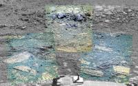
False color (very false) of the scarp from sol 3417. Interesting little 'red' pebbles here and there. Not really red of course.
Phil
|
Posted by: atomoid Sep 5 2013, 12:49 AM
A few more interesting cross-eyes (ccw90 rotated)
Sol3378-->
|

|
|
Posted by: fredk Sep 5 2013, 03:08 AM
I'm sure many of us were surprized at how close we got to Mulla Mulla. It turns out it really was a close call. From the latest http://www.planetary.org/explore/space-topics/space-missions/mer-updates/2013/08-mer-update-opportunity-begins-science-at-base-of-solander.html
As it turned out, Opportunity didn't even so much suffer a scrape... But it might have been mission catastrophic... and it happened because of human error. "This is an operational error and it's a big deal," said Callas. As a result, the incident generated what is known as an Incident Surprise Anomaly (ISA) report. "We want to thoroughly understand why our process didn't catch it, because it should have.
The issue stemmed from a mis-positioning of the 'keep out' zone around the rock. "In hindsight, if you look at it, you go - 'Oh yeah that 'keep out' zone wasn't positioned correctly.' But no one caught that," Callas said.
Yikes!
Posted by: dilo Sep 5 2013, 06:27 AM
I guess Oppy wasn't in autonomous navigation mode, but I wonder there wasn't any sort of proximity alarm and automatic safe stop for such situations, eventually triggered by hazardcams!
Posted by: Tesheiner Sep 5 2013, 12:43 PM
The F/R-Hazcams "per se" can't do that. You need a sort of hazard avoidance SW built on top to do that function. And IIRC autonav includes this feature but it is quite slow.
Posted by: ngunn Sep 5 2013, 01:16 PM
I'm struggling to understand how colliding with a rock at a speed of a few centimetres per second could have been "mission catastrophic". (Just as well my car is more robust.)
Posted by: djellison Sep 5 2013, 01:26 PM
It would probably damage solar panels quite badly. Moreover, you're then hung up on a rock with the arrays - you need to get 'off' that, which will cause more damage.
Posted by: Phil Stooke Sep 5 2013, 02:02 PM
I would have thought that constant monitoring of tilt and engineering data from wheels etc. would stop the drive before anything got hung up too much. But obviously much better to avoid it than to test my assumptions.
Phil
Posted by: mhoward Sep 5 2013, 02:57 PM
In stereo, it didn't look to me like Mulla Mulla was tall enough to hit the arrays. Unless she tilted more - which could easily have been in the cards I guess.
Wopmay looked scarier
|
|
Posted by: Tesheiner Sep 5 2013, 04:18 PM
Not tall enough but its size was only known with a given margin when it was seen from the position before that drive was executed. It might not have contacted the wings but damaged the wiring under them.
Regarding tilt and other data monitoring, I think that would not be enough to stop the rover in this kind of scenario.
Posted by: serpens Sep 6 2013, 10:49 PM
Referring back to post 51, the PS update confirms that "Coal Island" is the contact between the planar and tilted laminae. But the planar bench ("Grasberg unit") was designated altered material eroded from old Endeavour rim "Shoemaker" material. Is this implying that the tilted laminae represents pre impact sedimentary layering rather than Grasberg unit material tilted due to a local subsidence?
Posted by: Phil Stooke Sep 6 2013, 11:08 PM
The Grasberg unit is the lowest layer of the Burns Formation, the stack of sulfate-rich sandstones seen all over Meridiani. They sit on top of the layer of debris eroded off the Endeavour rim hills. The scarp here, the little step up above the bench, is presumably that eroded debris. The exact relationship is not easy to figure out just looking at the images here, but it seemed to be clearer at the north end of Cape York.
More interesting to me is the origin of the basalt boulders like Tick Bush. Are they ejecta thrown in from a distant impact? I don't see any sign of basalt flows in the vicinity.
Phil
Posted by: serpens Sep 7 2013, 11:06 PM
Not sure that you are correct there Phil. On CY the Burns Formation sulphate sandstone onlaps the bench (Deadwood - Grasberg unit) which is eroded material from Cape York (Shoemaker), and the same seems true here. The basaltic boulders seem to be eroding out of the upturned rim remnant. Given that Endeavour was formed by an impact into hundreds of meter thick Miyamoto ejecta they could well pre-date the impact. Coal Island is a contact between two units with, in false colour, seemingly different lithology and what I find fascinating is the possibility that the tilted laminae could be a pre-impact deposit.
|
Posted by: walfy Sep 7 2013, 11:37 PM
Nice view of the "shore" in 3D, sol 3419:
|
Posted by: Phil Stooke Sep 8 2013, 04:11 AM
Re: the Grasberg unit:
https://gsa.confex.com/gsa/2013AM/webprogram/Paper233091.html
"The bright outcrop margin (the Grasberg unit) is the most prominent of several successive onlaps of thinly-laminated sulfate sediments onto the crater rim inselbergs."
And also:
http://www.lpi.usra.edu/meetings/lpsc2013/pdf/2292.pdf
"A stop at the site named Grasberg confirmed through MI and APXS analysis that this band is a material distinct from either the materials of Cape York or the Burns Formation.
Grasberg is an unusual composition with elevated Cl, and a grain-size finer than the MI resolution, in contrast to the coarse sandstone typical of Meridiani. This is a relatively thin
(several tens of cm thick) unit that unconformably overlies the slopes of an eroded Cape York."
Phil
Posted by: serpens Sep 8 2013, 07:16 AM
I think the following paper goes a little deeper into explanation of the bench Phil: http://www.lpi.usra.edu/meetings/lpsc2013/pdf/2294.pdf
To quote, A rock unit ringing the base of Cape York was investigated at Deadwood and again at Grasberg, at Cape Yorks northern tip. This unit is bright-toned with platy, millimeter-scale layering. Its elemental composition is intermediate between the rocks of the Shoemaker formation and the Burns Formation, with elevated Ca and S concentrations, interpreted as a clastic sedimentary rock formed by erosion of the Shoemaker Formation and later modified to create the S enrichment. Squires also tributed the bench to shoemaker detritus in his Nature article Ancient Impact and Aqueous Processes at Endeavour Crater, Mars although he differentiated between inner and outer bench material (outer being Burns formation onlap which is quite pronounced to the west of CY). Identifying the bench as eroded rim breccia material seems an important call in defining Endeavour, confirming that the Burns unit was deposited a long time after the impact, when the rim had eroded away.
Posted by: MahFL Sep 9 2013, 10:37 AM
Remember Oppy does not travel very fast but she has tons of torque, so she could crunch herself pretty bad.
Posted by: atomoid Sep 9 2013, 09:16 PM
One wonders whether Oppy's accelerometers are used in general drive usage for instance to adjust drive behavior over small rocks, which should nullify hazards such as this, since any sensed impasse should signal to adjust suspension, wheel spin, etc. in adaptation to the terrain feature encountered... or maybe they are only used to measure degree of tilt? i'm sure im oversimplifying it and someone here is probably familiar with those specs..
Posted by: RoverDriver Sep 9 2013, 10:25 PM
On a typical drive accels and gyros are used to monitor rover attitude and the suspension system is also monitored but in this case they would not have detected a collision with such a big rock. And before you ask, no I was not on shift that day ;-)
Paolo
Posted by: atomoid Sep 9 2013, 10:38 PM
interesting.. Thanks! I guess it really is hazardous negotiating boulder fields, Gusev probably proved to be quite the obstacle course in that regard, though I dont recall hearing any worries about that aspect, though that may just be selective memory and no similar scary incidents occurred as far as I know.
broken plate http://www.midnightplanets.com/web/MERB/sol/03420.html

|
Posted by: dvandorn Sep 10 2013, 01:00 AM
I'll tell you one thing -- I doubt that you could have driven the MERs or MSL at, say, the Viking 2 landing site. Way too many blocks to work around at that location, at least for anything larger than a smallish toaster.
It just goes to show that, for rovers of MER and even MSL size, there is a lot of the Martian surface that is not easily trafficable.
-the other Doug
Posted by: RoverDriver Sep 10 2013, 02:47 PM
Is this a challenge? ;-)
-the other Doug
That is true, but MER/MSL are quite capable rovers in terms of wheeled vehicles. The max traversable slope is slightly higher than that of a HMMWV, for example, end the size of a traversable obstacle is much better than a typical Earth vehicle. We have driven our testbeds on Earth in *very* difficult terrain but for obvious reasons we don't do that on Mars unless we have to.
Paolo
Posted by: jvandriel Sep 10 2013, 02:51 PM
The panoramic view on Sol 3423 taken with the L0 Navcam.
Jan van Driel
|
Posted by: dvandorn Sep 10 2013, 05:32 PM
In no way...
Although, if there was a chance that saying "yes" would magically cause a MER or an MSL to suddenly appear next to the V2 lander, just to take on the challenge, my answer would of course be different... 
Paolo
Oh, understood, and I can imagine a rover the size of MSL might even be able to make, oh, 5 or 10 meters a drive at a site as boulder-strewn as the V2 site, climbing over one half-meter-tall rock after another. Perhaps less than that for a MER-sized rover. I wasn't saying you couldn't drive one of these marvelous wheeled vehicles over difficult terrain, just that it would make for lousy trafficability -- your forward progress would be slow and painstaking.
Come to think of it, rocky terrain hasn't been the rover trap some might have imagined, has it? The only time the MERs have fallen into traps, it's been in drifts or pools of fine, unconsolidated powdered rock, not up against walls of hard, unscalable rock.
-the other Doug
Posted by: RoverDriver Sep 10 2013, 11:26 PM
Come to think of it, rocky terrain hasn't been the rover trap some might have imagined, has it? The only time the MERs have fallen into traps, it's been in drifts or pools of fine, unconsolidated powdered rock, not up against walls of hard, unscalable rock.
-the other Doug
I think you are not taking into account statistics. It is much easier to see a rock than to see unconsolidated sand and therefore the likelyhood of getting a rover trapped in sand is higher.
Paolo
Posted by: dvandorn Sep 11 2013, 02:09 AM
Oh, no doubt. I can well imagine that this is what makes sand traps more dangerous than rock fields -- the latter can be much more easily seen and avoided.
Truly, I'm not in any way questioning the abilities of the rovers or their excellent drivers. Just noting that we've seen places -- like the V2 landing site -- where trafficability would be lousy for just about any wheeled vehicle. We've actually been somewhat lucky (or at least better at estimating ground truth from orbital imagery) in that the three rover landing sites -- Gusev, Meridiani and Gale -- show considerably less dense boulder populations than we saw at either Viking site or at the Pathfinder site. Indeed, Meridiani has a remarkably low boulder density, making for generally great trafficability, the odd soft dust ripple notwithstanding...
-the other Doug
Posted by: nprev Sep 11 2013, 02:49 AM
I think it's wise to remember here that the Viking landing sites were selected in part based on Earth-based radar interpretations of surface smoothness in the 1970s, which frankly were kinda off the mark.
The VOs didn't have nearly the cam resolution that even MGS had, and all that came before them were the Mariners. We're kinda spoiled nowadays...not that I'm complaining.
Pains me to say it, but we were REALLY lucky that both of the VLs made it down safely. (To be fair, though, the history of science itself is replete with luck; serendipity is definitely a part of of the process of discovery.) As a result, we sent more spacecraft & learned enough about the planet so that we are now able to set down rovers in both terrain-accessible & geologically interesting locales.
Moving on now. Always. 
Posted by: RoverDriver Sep 11 2013, 03:08 PM
Truly, I'm not in any way questioning the abilities of the rovers or their excellent drivers....
-the other Doug
Doug I did not take your comments as questioning our driving abilities. I was just explaining some possibly underestimated reasons for our occasional troubles. I'm glad we never had to deal with a rock anomaly. That would be much harder to deal with (pun intended).
Paolo
Posted by: Phil Stooke Sep 11 2013, 03:25 PM
To clarify nprev's comment, only Viking 1 had earth-based radar data to estimate roughness. Viking 2 was too far north. Reflectivity was measured at the sub-Earth point as the planet rotated, giving east-west lines of roughness data at various latitudes depending on the positions of the planets, but the Viking 2 site was too far north for that.
Phil
Posted by: vikingmars Sep 11 2013, 09:19 PM
Well... And to complement Phil's good statement, the radar gave good echoes for the actual VL1 site (then named "Alpha") that predicted with good accuracy small to medium-sized rocks (i.e. no larger than 30 cm). Regarding the landing itself, it has nothing to do with luck. Hundred of major tests (plus thousands of minor tests) were designed by the engineers at JPL and at Lockheed-Martin PLUS an important margin for the deceleration with the parachute PLUS an important margin on deceleration possibilities with the retrorockets for the last phase of the descent PLUS a landing radar "à la Lunar Module" to trigger the final slowdown and for a last-second avoiding of big boulders. In fact, they were quite confident for mission success and even should the orbiter failed entering orbit, the engineers designed a "salvage" mission in which they were only rotating the orbiter to aim at the planet with a proper angle and then released the lander. In such a desperate case, Jim Martin and Tom Young, were still giving more than 50% probability for mission success... "...and that's better than no mission at all !" they said.
Posted by: mcaplinger Sep 11 2013, 09:54 PM
Viking had no ability to avoid big boulders or any other landing hazard; its terminal descent radar only measured velocity vectors. See http://www.cs.odu.edu/~mln/ltrs-pdfs/NASA-76-cr159388.pdf
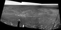
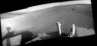
Posted by: Astro0 Sep 11 2013, 10:23 PM
Meanwhile (back on topic) at Solander Point, there's some fabulous rocks being photographed by Opportunity.
|
Posted by: atomoid Sep 11 2013, 11:35 PM
sol 3422 outcrop features popping up all over the place
|
|
|
Posted by: jvandriel Sep 12 2013, 11:31 AM
The Mi Cam Panorama on Sol 3422.
Jan van Driel
|
Posted by: jvandriel Sep 13 2013, 09:50 AM
The Navcam L0 panoramic view on Sol 3425.
Jan van Driel
|
Posted by: jvandriel Sep 14 2013, 12:08 PM
The L0 Navcam images from Sol 3425 and Sol 3426 stichted together
into this panoramic view.
Jan van Driel
|
|
Posted by: Tesheiner Sep 15 2013, 08:51 AM
I think we are just starting to see again the plains on the right part of the mosaic, aren't we?
Posted by: ngunn Sep 15 2013, 09:44 AM
I assumed that was Cape York on the horizon above the rightmost solar panel - is that correct?
Posted by: Phil Stooke Sep 15 2013, 11:56 AM
Yes, you're right.
Phil
Posted by: fredk Sep 15 2013, 02:57 PM
I think we're getting close to seeing the plains, but my impression is we're still a bit below plains level and are just seeing the rim. As we climb up Solander the view over the plains should open up quite abruptly. I can't wait...
Posted by: Phil Stooke Sep 16 2013, 01:25 PM
This is jvandriel's new panorama in circular form. Since then we have driven slightly up onto the slope.
Phil
|
Posted by: jvandriel Sep 16 2013, 02:26 PM
Here is the Sol 3428 Pancam L2 view.
Jan van Driel
|
Posted by: atomoid Sep 16 2013, 11:05 PM
MI detail from sol3427
|
Posted by: walfy Sep 16 2013, 11:52 PM
Nice! Here's one for the glasses:
|
Posted by: Tesheiner Sep 17 2013, 05:09 PM
Sol 3430. Here's the view from the current site, about 12m WNW of the previous one.
|
|
Just wondering but I think we haven't seen yet any gypsum vein around here at Solander Point, right?
Posted by: jvandriel Sep 17 2013, 07:55 PM
Here is the complete Mi Cam view on Sol 3427.
Jan van Driel
|
Posted by: fredk Sep 18 2013, 04:34 PM
http://qt.exploratorium.edu/mars/opportunity/navcam/2013-09-18/1N432777375EFFC8CTP1762R0M1.JPG?sol3431
Posted by: mhoward Sep 19 2013, 12:27 AM
"Field Notes from Mars" has been updated on September 18. For anyone who's paying attention, I assume you know you'll want to go read this right away. http://www.nmnaturalhistory.org/rover-field-reports-from-mars.html
Posted by: ngunn Sep 19 2013, 07:08 AM
Fantastic! - love that 1m contour map. (I think it shows we still have a fair bit of a climb before the plains vista opens up.)
Posted by: ElkGroveDan Sep 19 2013, 01:53 PM
Thanks for pointing that out Mike. Love this line:
Opportunity is allowing us for the first time to do not only fundamental geographic exploration, but it is enabling on the ground geologic study of past climatic history on Mars. You only get to do that once per planet. We are here. And we are doing it now, this weekend.
Posted by: Phil Stooke Sep 19 2013, 08:44 PM
The picture Fredk linked to just a few posts back showed some disconnected white spots which, as he suggested, might have been fragments of a gypsum vein. This picture shows another, maybe a bit more obviously linear:
http://www.midnightplanets.com/web/MERB/image/03431/1N432777958EFFC8CTP1762L0M1.html
(right between the tracks in the foreground) - so I think we are really seeing the veins here again.
Phil
Posted by: charborob Sep 20 2013, 04:15 AM
Sol 3431 navcam pan:
|
|
Posted by: jvandriel Sep 20 2013, 08:58 AM
Here is the complete Navcam L0 view on Sol 3431.
Jan van Driel
|
|
Posted by: jvandriel Sep 20 2013, 09:31 AM
and also the one taken on Sol 3430.
Jan van Driel
|
|
Posted by: Tesheiner Sep 20 2013, 09:43 AM
http://www.midnightplanets.com/web/MERB/image/03431/1N432777958EFFC8CTP1762L0M1.html
(right between the tracks in the foreground) - so I think we are really seeing the veins here again.
Phil
Agree.
And the fact that no vein were identified 'til now could be because the rover didn't actually moved over the rim terrain until some sols ago.
Posted by: Greenish Sep 20 2013, 02:38 PM
Haven't seen one of these posted in a while (not sure why, other good sources? other priorities?), so here's an L257 mosaic from Sol 3428. Not sure about the horizon angle though - slope could be more or less than shown.

|
Posted by: Phil Stooke Sep 21 2013, 01:20 AM
This is jvandriel's 3431 pan in circular form. Ready to go to work right on the edge of the rock layer.
Phil

|
Posted by: jvandriel Sep 23 2013, 03:19 PM
The Road ahead on Sol 3435.
Jan van Driel

|
Posted by: mhoward Sep 24 2013, 10:46 PM
Looks like the climb of Solander Point has begun, maybe? At least a little bit. Sol 3437 estimated drive:

|
Posted by: mhoward Sep 25 2013, 06:56 PM
Okay, I guess the climb hasn't really begun; it's just the way Solander Point is tilted. Still, fun.
Posted by: charborob Sep 25 2013, 07:57 PM
Sol 3437 navcam pan:

|
Posted by: Tesheiner Sep 26 2013, 10:17 AM
And another drive is expected thisol 3439.
Posted by: jvandriel Sep 26 2013, 11:24 AM
A Stereo view taken on Sol 3437.
Jan van Driel

|
Posted by: Phil Stooke Sep 26 2013, 02:27 PM
Charborob's half pan in circular form - looking uphill. For a map view turn it upside down.
Phil
|
Posted by: jvandriel Sep 27 2013, 07:14 PM
The not complete navcam view on Sol 3439.
The rest will follow later.
Jan van Driel
|
Posted by: charborob Sep 28 2013, 02:50 AM
Some more images have come down. Here is a wider navcam pan (sol 3439):
|
|
Posted by: jvandriel Oct 2 2013, 06:26 PM
The Navcam L0 view on Sol 3441 looking forward.
Jan van Driel
|
Posted by: jvandriel Oct 2 2013, 06:32 PM
and looking back on sol 3441.
Jan van Driel
|
Posted by: atomoid Oct 3 2013, 09:57 PM
just enjoying the graphically striking imagery on these sol3444 hazcams..
|
Posted by: ngunn Oct 5 2013, 03:30 PM
Spectacular view today - http://qt.exploratorium.edu/mars/opportunity/pancam/2013-10-05/1P434201509EFFC8MDP2441L2M1.JPG
Posted by: charborob Oct 5 2013, 04:07 PM
Sol 3446 pancam view:

|
Posted by: dilo Oct 5 2013, 06:04 PM
Raw processing:
|
Posted by: jvandriel Oct 5 2013, 08:09 PM
L257 Panoramic view on Sol 3447.
Jan van Driel
|
Posted by: charborob Oct 6 2013, 03:01 PM
Wider sol 3447 pancam view:
|
Posted by: ollopa Oct 6 2013, 04:43 PM
Has the big crater been named yet? ElkGroveDan suggested "Broadside Crater" eons ago, in response to Stu's very prescient post and pictures (now worth revisiting).
http://www.unmannedspaceflight.com/index.php?showtopic=6438&view=findpost&p=161723
Posted by: ngunn Oct 6 2013, 10:13 PM
I'm looking at the crater (not much smaller) on the next frame to the right and I notice it has a very bright rim. What buried material might account for that? Maybe its sampling an interesting layer beneath Endeavour.
Posted by: jvandriel Oct 7 2013, 02:37 PM
The panoramic view taken on Sol 3446-3449 L2.
Jan van Driel

|
Posted by: kenny Oct 7 2013, 03:38 PM
http://www.unmannedspaceflight.com/index.php?showtopic=6438&view=findpost&p=161723
Might just be that the one you mention is more recent and hence the ejecta is brighter, and not covered by the darker drift material we see elsewhere all over Mars?
There is another smaller crater with similarly bright rim closer to the biggest crater.
Posted by: mhoward Oct 8 2013, 05:02 PM
http://www.planetary.org/explore/space-topics/space-missions/mer-updates/2013/09-mer-update-opportunity-roves-to-solander-west-into-winter-campground.html
A couple quotes:
...
Posted by: craigmcg Oct 8 2013, 10:08 PM
These photos are some of the most dramatic we've seen! Nice.
Posted by: charborob Oct 9 2013, 12:19 PM
Sol 3451 navcam partial pan:
|
|
Posted by: James Sorenson Oct 9 2013, 01:06 PM
Part of the Solander Point Ridge Pan.
http://www.flickr.com/photos/43581439@N08/10169352475/
Posted by: Phil Stooke Oct 9 2013, 02:07 PM
Very nice! I couldn't resist playing with the far wall of Endeavour a bit to reveal more of its structure. There's even a crater or other feature out on the plains beyond the rim at the right edge.
Phil

|
Posted by: jvandriel Oct 9 2013, 05:01 PM
My version of the Sol 3451 navcam panoramic view.
Jan van Driel
|
|
Posted by: jvandriel Oct 9 2013, 07:22 PM
a little late but here is the complete navcam panoramic view
taken on Sol 3439 and 3441.
Looking back
|
|
Looking forward
|
|
Jan van Driel
Posted by: Phil Stooke Oct 9 2013, 07:36 PM
It's never too late for a full pan! Thanks for those. Now... what can I do with them?
Phil
Posted by: Phil Stooke Oct 9 2013, 08:24 PM
This is jvandriel's pan in circular form. Later on sol 3441 Opportunity moved south a few meters for some work on the rocks.
Phil

|
Posted by: Tesheiner Oct 9 2013, 09:19 PM
And there was another move on sol 3451. Almost 20m SW per the tracking DB.
Posted by: jvandriel Oct 11 2013, 10:54 AM
Here is the complete navcam view taken on Sol 3451.
Jan van Driel
|
|
Posted by: Phil Stooke Oct 11 2013, 11:46 PM
and here's a circular version of that pan to show the general layout of the area.
Phil

|
Posted by: mhoward Oct 12 2013, 01:22 PM
A six-frame Pancam L1R12 drive direction mosaic on sol 3453. This must be color anaglyph heaven.

|
Posted by: brellis Oct 12 2013, 05:44 PM
I still wish it would be named for Gary Larson's Far Side.
Posted by: mhoward Oct 13 2013, 09:40 PM
Color clast survey L257, Sol 3455. Bits of things that look slightly like veins but are not bright... interesting?

|
Posted by: nprev Oct 14 2013, 12:26 AM
I would hope so. Also lotsa pretty sparkly little rocks. Hope they take some closer looks at all this stuff.
Posted by: jvandriel Oct 14 2013, 06:55 PM
The colour L257 view on Sol 3455.
Jan van Driel

|
Posted by: Phil Stooke Oct 15 2013, 12:38 AM
"Hope they take some closer looks at all this stuff. "
Don't worry, we'll be on this slope for a long time!
Phil
Posted by: eoincampbell Oct 15 2013, 02:35 AM
This aint any old slope, right ? Ground truths await...besides the rest we'll see... 
Posted by: charborob Oct 15 2013, 12:43 PM
Sol 3457 partial navcam pan:

|
Looks like Oppy climbed a bit.
Posted by: Tesheiner Oct 15 2013, 01:15 PM
24m ESE, according to the "telemetry".
Posted by: Phil Stooke Oct 15 2013, 01:52 PM
This is a circular version of charborob's partial pan. When I posted that route map for Solander I should have had the 3451 position a bit further south. Now we are up near the outcrops on the ridge crest.
Phil

|
Posted by: charborob Oct 16 2013, 12:14 PM
Sol 3458 partial navcam pan:

|
Climbing a bit more.
Posted by: jvandriel Oct 17 2013, 01:26 PM
The complete L257 colour pancam view on Sol 3453-3455.
Jan van Driel
|
Posted by: jvandriel Oct 18 2013, 09:12 AM
The view with the R0 navcam on Sol 3458.
Jan van Driel

|
Posted by: fredk Oct 18 2013, 02:41 PM
You can read a rough estimate of our northerly tilt off of the east-facing navcams. I estimate around 17 degrees, although it might be a bit lower (or higher) if this image is not looking directly east:

|
Posted by: brellis Oct 18 2013, 07:24 PM
Thinking way too far ahead, and with my usual optimism: Have there been any general notions of where Opportunity will head next spring? Continuing on the Cape Tribulation path? Or will she head north? Do we get ~into~ the crater next year??
Posted by: Phil Stooke Oct 18 2013, 07:36 PM
'Into the crater' is probably not nearly as interesting as the rim. Endeavour is full of sediments like those we spent 8 years crossing to get here. The rim is the new stuff, the ancient stuff, and there's plenty of scope here to find different kinds of rock jumbled up in the hills. If long distance travel is considered, going south towards Iazu crater and its ejecta might still be more interesting than going into Endeavour. I would expect to spend at least a Mars year just on these hills and Cape Tribulation.
Phil
Posted by: brellis Oct 19 2013, 04:28 AM
Thanks Phil - and many multitudes of thanks for sharing your imagery here. You really know how to 'tie the room together'!
Posted by: James Sorenson Oct 19 2013, 08:30 AM
Some of the recent Sol's Navcam's.
Sol-3451
http://www.flickr.com/photos/43581439@N08/10358083606/
Sol-3457
http://www.flickr.com/photos/43581439@N08/10358276103/
Sol-3458
http://www.flickr.com/photos/43581439@N08/10358085236/
Posted by: dilo Oct 19 2013, 02:36 PM
Stunning quality, James!
In the first mosaic, Solander appears as a small dune due to wide angle...
Posted by: James Sorenson Oct 19 2013, 08:03 PM
Or a Bunny Hill.
Posted by: jvandriel Oct 22 2013, 01:51 PM
The L0 navcam view on Sol 3463.
Jan van Driel

|
Posted by: charborob Oct 22 2013, 03:33 PM
Sol 3464 pancam pan of the summit of the hill:

|
Posted by: James Sorenson Oct 22 2013, 03:40 PM
And my take.
http://www.flickr.com/photos/43581439@N08/10423560704/
Posted by: mhoward Oct 24 2013, 10:17 PM
Opportunity did a neat drive on Sol 3466 and now is at "Waratah" outcrop, according to the database. (Images go to Flickr)
http://www.flickr.com/photos/marscat/10465042615/ http://www.flickr.com/photos/marscat/10465066754/
Posted by: Astro0 Oct 25 2013, 03:05 AM
Love it. With all these Aussie names being used for the Endeavour journey, I really hope that they use 'Upper Cumbucter West'.
Other Australians will know the name, but for everyone else, it's a place that doesn't exist.
The name is often used to describe somewhere that is very remote or perhaps a location that is a little strange or as a vague description of where some other place is when you actually don't know where it is. As an example: "Oh yeah mate, that's just down the road from Upper Cumbucter West".
Yes, we're a weird lot 

Posted by: James Sorenson Oct 25 2013, 09:48 AM
The 3466 Navcam.
http://www.flickr.com/photos/43581439@N08/10472668526/I'm working on the 3465 Nav Pan now, will post when finished.
Edit:
http://www.flickr.com/photos/43581439@N08/10473053446/
Posted by: jvandriel Oct 25 2013, 05:04 PM
Here is my view of the Sol 3464 L2 pancam panorama.
Jan van Driel
|
|
Posted by: jvandriel Oct 27 2013, 09:01 AM
The L0 Navcam panoramic view on Sol 3468.
Jan van Driel

|
Posted by: jvandriel Oct 27 2013, 08:53 PM
and the L2 pancam view on Sol 3469.
Jan van Driel

|
Posted by: jvandriel Oct 29 2013, 02:47 PM
Here is the complete navcam L 2 panoramic view taken on Sol 3468 and Sol 3469.
Jan van Driel
|
|
Posted by: Phil Stooke Oct 29 2013, 06:20 PM
Sol 3471 - up at the next level - and a great view all around.
Phil
http://www.midnightplanets.com/web/MERB/image/03471/1P436329045EFFC9BIP2356L2M1.html
http://www.midnightplanets.com/web/MERB/image/03471/1N436328572EFFC9BIP1824R0M1.html
Posted by: jvandriel Oct 29 2013, 09:27 PM
Sol 3471
the Navcam view

|
the Pancam view

|
Jan van Driel
Posted by: Phil Stooke Oct 29 2013, 11:58 PM
This is Jan's 3468-3469 pan in circular form.
Phil

|
Posted by: fredk Oct 30 2013, 01:28 AM
Yeah, I like the view from here too. Here's one especially nice frame. Anaglyph:

|
Posted by: fredk Oct 30 2013, 01:32 AM
And cross-eyed:

|
Posted by: James Sorenson Oct 30 2013, 03:24 AM
My take on the 3471 Navcam Pan.
http://www.flickr.com/photos/43581439@N08/10567666274/
Posted by: Phil Stooke Oct 30 2013, 03:42 AM
At some point as we climb, Cape Tribulation will start to show above the foreground ridge of Solander Point - that will be quite a sight.
Phil
Posted by: remcook Oct 30 2013, 10:41 AM
It's already quite a dramatic view! Love the pans James!
Posted by: ngunn Oct 30 2013, 11:39 AM
I wouldn't expect that to happen while we remain on 15 degree northward slopes. Also I note that the elevation of our target 'Winter Outcrops' is around -1485m. That's still about 15m lower than Cape York and 25m lower than the plains outside Endeavour. (EDITED to correct levels)
Posted by: Phil Stooke Oct 30 2013, 02:23 PM
Very true! I was looking further into the future.
Phil
Posted by: MarkG Oct 30 2013, 05:06 PM
I presume that Oppy is now purposely parked daily with a north-facing slant?
Posted by: charborob Oct 30 2013, 06:30 PM
Sol 3472, partial navcam pan:

|
Some more climbing!
Posted by: jvandriel Oct 31 2013, 09:27 PM
The Navcam L0 view on Sol 3473.
Jan van Driel

|
Posted by: charborob Nov 1 2013, 02:35 AM
Sol 3472 navcam pan:

|
Posted by: jvandriel Nov 4 2013, 10:39 AM
The Pancam L7 view on Sol 3476.
Jan van Driel

|
Posted by: Phil Stooke Nov 4 2013, 04:55 PM
Nice pan! On the left side near the top, it looks like we are approaching a patch of finely-layered material rather different from the blocky impact breccias in the outcrops behind us.
Phil
Posted by: Floyd Nov 4 2013, 04:56 PM
Is there a small crater in the sand in the left panel--or just an optical trick?
Posted by: mhoward Nov 4 2013, 06:35 PM
http://www.planetary.org/explore/space-topics/space-missions/mer-updates/2013/10-mer-update-opportunity-gets-back-to-the-past-at-winter-site.html

Here's a quick anaglyph view. Floyd, I think it's difficult to say whether that's a small dust-filled impact mark on the left or what.

|
Posted by: Phil Stooke Nov 6 2013, 12:08 AM
Sol 3478: up and over a break in slope by the look of it.
Phil
http://www.midnightplanets.com/web/MERB/image/03478/1R436950321EFFC9GWP1301R0M1.html
Posted by: mhoward Nov 6 2013, 12:24 AM
It looks like a backup and drive-around to me. I guess they didn't want to tangle with the drift? (I'm a little surprised.) However, check out the Pancam L257R2 on Sol 3477, labelled 'bright material'. I'd say it matches the description in the http://www.planetary.org/explore/space-topics/space-missions/mer-updates/2013/10-mer-update-opportunity-gets-back-to-the-past-at-winter-site.html of where she's headed.

|

|
Posted by: Phil Stooke Nov 6 2013, 12:30 AM
Perhaps more for good tilt than fear of drifts!
Phil
Posted by: MarkG Nov 6 2013, 05:00 AM
It seems to me that there often seems to be a small area of dunes atop hills or crater edges, like at Victoria and the Columbia Hills and now here on the Endeavor rim. The rige of slope must somehow create a local lee vortex that accumualtes a small dune line there...
Posted by: jvandriel Nov 6 2013, 10:56 AM
The Pan cam L7 view on Sol 3478.
Jan van Driel

|
Posted by: jvandriel Nov 6 2013, 11:16 AM
and the Nav cam L0 panoramic view on Sol 3478.
Jan van Driel

|
Posted by: fredk Nov 8 2013, 03:24 AM
It looks like the dogleg maneuver http://marsrovers.jpl.nasa.gov/mission/status_opportunityAll.html#sol3473 I'm guessing that if the ground had been flat, it wouldn't have been a problem to drive through, but on a slope like this they wanted to avoid it.
Posted by: eoincampbell Nov 8 2013, 04:10 AM
Yes, and that 'favorable' energy mini-boost...
Posted by: jvandriel Nov 8 2013, 09:17 AM
The panoramic views on Sol 3480.
Jan van Driel
Navcam

|
Pancam

|
Posted by: Ant103 Nov 8 2013, 08:29 PM
I'm in a good mood, so I decided to make a Postcard from Sol 3473
http://www.db-prods.net/blog/2013/11/08/opportunity-a-lassaut-de-solander-point-carte-postale-du-sol-3473/
Posted by: Zeke4ther Nov 8 2013, 11:04 PM
Ooohhh!!! That is quite nice!
Thank-you Damia.
Posted by: fredk Nov 9 2013, 03:01 AM
Based on http://qt.exploratorium.edu/mars/opportunity/navcam/2013-11-08/1N437211989EFFC9MGP1615R0M1.JPG?sol3481 I'd say we're now at least as high as the highest point on Cape York. Notice how CY no longer sticks up above the horizon (though that's techically probably not the true horizon, since the top of CY is below the level of the outside plains, so I don't think we're at the plains height yet). CY is the "stain" just below the horizon on the left side of the frame.
Posted by: jvandriel Nov 9 2013, 12:36 PM
Sol 3478-3479 L0
|
|
Sol 3480-3481 L0
|
|
Jan van Driel
Posted by: jvandriel Nov 9 2013, 12:46 PM
Sol 3480 Pancam L7
added 1 image at the leftside.
Jan van Driel

|
Posted by: ngunn Nov 9 2013, 02:22 PM
Am I right in thinking the dark pyramid right on top there corresponds to the 'Winter outcrops' marked on the traverse map? Or are those still beyond our current skyline?
(as ever big thanks to all the mosaic makers here)
Posted by: mhoward Nov 9 2013, 03:51 PM
I only know what I read in the http://www.planetary.org/explore/space-topics/space-missions/mer-updates/2013/10-mer-update-opportunity-gets-back-to-the-past-at-winter-site.html and see in the database (http://www.unmannedspaceflight.com/index.php?s=&showtopic=7708&view=findpost&p=204327), but based on that, I think her destination is beyond the nearest rise. If that's the case, getting there could be interesting.

|
Posted by: Phil Stooke Nov 10 2013, 01:03 AM
This is our current location, from jvandriel's new pan, sols 3480-81.
Phil

|
Posted by: Phil Stooke Nov 10 2013, 01:17 AM
... and the previous location, sols 3478-3479. A good view of the tracks along the ridge.
Phil

|
Posted by: jvandriel Nov 10 2013, 09:28 AM
The Navcam L0 view on Sol 3482.
Jan van Driel

|
Posted by: neo56 Nov 10 2013, 10:24 AM
This is really mountain hiking ! I'm really looking forward what is the view on the other side of the hill (even if we know that with HiRISE). Thank you Oppy and JPL for this amazing hiking on Mars
Posted by: jvandriel Nov 11 2013, 03:45 PM
Sol 3482 L0.
Added 5 images.
Jan van Driel

|
Posted by: jvandriel Nov 11 2013, 04:12 PM
and the Pancam L7 view on Sol 3482.
Jan van Driel

|
Posted by: ngunn Nov 11 2013, 08:37 PM
The outcrops here look to have the right sort of dip to be intact everted rim strata from the Endeavour impact. (Such were in short supply at Cape York, perhaps because it suffered more slumping, immediately post-impact or subsequently, than the Solander/Tribulation rim segment.) Of course I'm actively looking for everted strata, so maybe I'm seeing them where there aren't any. What do others think? http://qt.exploratorium.edu/mars/opportunity/pancam/2013-11-10/1P437304679EFFC9OXP2364R1M1.JPG
Posted by: Phil Stooke Nov 12 2013, 05:53 PM
This is jvandriel's half pan of sol 3482 in circular form.
Phil

|
Posted by: Phil Stooke Nov 12 2013, 05:58 PM
... and this is the location on part of Larry Crumpler's map. We are almost exactly 19 km south of the landing site.
Phil

|
Posted by: serpens Nov 12 2013, 10:11 PM
The rim is extremely eroded and part of the remnant could well be upturned or overturned elements of the original impact rim. But Endeavour was formed in the deep Miyamoto ejecta blanket so it would be difficult to differentiate between brecciated breccia from the Endeavour impact and original Miyamoto breccia in an upturned rim. Stratification is normally accepted to be sedimentary so if pre-Endeavour strata was identified this would provide some really interesting indications of the history of the area post Miyamoto and prior to Endeavour.
Posted by: ngunn Nov 12 2013, 10:36 PM
Yes it would be interesting. The most likely source of strata formed post-Miyamoto and pre-Endeavour would be ash and debris deposits fom nearby impacts that occurred between betwen the two in time. Some layers might preserve a record of redistribution of the fallen material by wind or water. Just finding layered material with the right orientation is very interesting, but of course it could have got there in a number of other ways.
Phil: thanks for the location.
Posted by: jvandriel Nov 13 2013, 09:07 AM
The Navcam L0 panoramic view on Sol 3485
Jan van Driel
|
|
Posted by: Phil Stooke Nov 13 2013, 02:26 PM
Nice pan! Here's a circular version of it showing us beside another outcrop of what looks like impact breccia. The tracks in the distance are from sol 3471 and the white spot at the upper end of them is Waratah, the outcrop containing the in situ target Baobab.
Phil

|
Posted by: James Sorenson Nov 14 2013, 07:14 AM
My version of the 3485 Navcam Pan.
http://www.flickr.com/photos/43581439@N08/10850161154/
http://www.flickr.com/photos/43581439@N08/10850340153/
Posted by: jvandriel Nov 14 2013, 09:04 AM
and the complete panoramic L0 view on Sol 3485.
Jan van Driel
|
|
Posted by: jvandriel Nov 15 2013, 08:35 AM
The L2-5-7 Pancam view on Sol 3487.
Jan van Driel
|
Posted by: charborob Nov 15 2013, 12:43 PM
Anaglyph of Moreton Island outcrop:
|
Posted by: James Sorenson Nov 19 2013, 01:22 PM
I just had to put this together from Sol-3488.
http://www.flickr.com/photos/43581439@N08/10943930576/
Posted by: Phil Stooke Nov 19 2013, 07:17 PM
Very nice - Hey, Opportunity, look to the left a bit! - so we can see Cape York. But in this view we do see something else. A large shallow depression called Antares which lies north and slightly east of Cape York. It was barely visible if at all from Cape York itself, but from up here it's more visible, a subtle depression hinted at by shading just below the horizon, spanning more than the full width of this image.
Phil
Posted by: jvandriel Nov 19 2013, 08:19 PM
The Navcam L0 view on Sol 3490.
Jan van Driel
|
Posted by: fredk Nov 19 2013, 09:53 PM
My thought exactly when I saw that series! But the R2 frame does start to show a bit of CY:
http://qt.exploratorium.edu/mars/opportunity/pancam/2013-11-18/1P437833130EFFC9U0P2366R2M1.JPG?sol3488
Posted by: James Sorenson Nov 19 2013, 11:30 PM
According to the tracking site, there was an 8 point pan looking back at the tracks on the same sol. This is just one of two sequences looking back at the tracks, so stay tuned .
Posted by: neo56 Nov 20 2013, 08:22 PM
Epic picture James !
Posted by: jvandriel Nov 21 2013, 09:16 AM
The Nav cam L0 views from Sol 3492 and Sol 3493 stitched together.
Jan van Driel
|
Posted by: jvandriel Nov 21 2013, 09:30 AM
and the view on Sol 3493.
Jan van Driel
|
Posted by: fredk Nov 22 2013, 03:17 AM
Updated map in http://www.nmnaturalhistory.org/rover-field-reports-from-mars.html with a better-defined location for the winter clay-signature outcrops.
Posted by: jvandriel Nov 22 2013, 11:50 AM
Sol 3492-3493.
added a few images.
Jan van Driel
|
Posted by: jvandriel Nov 22 2013, 12:17 PM
The L2 view of the wheeltracks on Sol 3488.
Jan van Driel
|
Posted by: walfy Nov 22 2013, 07:19 PM
This image made for a nice 3D from sol 3485:
|
Posted by: atomoid Nov 22 2013, 11:17 PM
http://www.unmannedspaceflight.com/index.php?s=&showtopic=7708&view=findpost&p=204673! now I can make out those 'multiple rises' http://www.unmannedspaceflight.com/index.php?s=&showtopic=7708&view=findpost&p=204660 referred to. I almost missed the re-emergence of the tracks much further down the slope below to the right..
Posted by: dvandorn Nov 23 2013, 04:55 AM
added a few images.
Jan van Driel
|
|
I know that the Endeavour impactor is supposed to have impacted into a nice thick layer of ejecta from Miyamoto, but the layered rocks along this ridge look really nicely sequenced to me -- really looks like the exposed edge of a nice intact unit. The layers line up right down the ridge line.
I suppose this could be our old friend, the sulfate sandstone, but I thought the sandstone unit was emplaced after the Endeavour impact...
-the other Doug
Posted by: ngunn Nov 23 2013, 08:49 AM
That's what I posited in post 218: pre-Endeavour beds maybe tilted outward by that impact, presumably not Meridiani sandstone.
Posted by: serpens Nov 23 2013, 10:18 PM
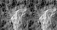
Perhaps age dims the vision but this looks like weathered impactite to me.
|
Posted by: walfy Nov 24 2013, 12:41 AM
The current outcrop:

|
Posted by: jvandriel Nov 24 2013, 02:50 PM
The pancam L2 view from Sol 3494 and Sol 3495.
Jan van Driel

|
Posted by: MarkG Nov 26 2013, 05:40 AM
So the layering-like texture we are seeing is actually wind erosion, not layering? Like micro-yardangs?
Posted by: jvandriel Nov 26 2013, 01:41 PM
The Pancam L2 view on Sol 3494-3495-3496.
Jan van Driel

|
Posted by: ngunn Nov 26 2013, 10:08 PM
Not necessarily. Layered impact deposits can be formed very quickly from a single impact. Larger chunks mixed up with dustfall is how this looks to me. There would have been many neighbourhood impacts after Miyamoto and before Endeavour. (I note that there seem to be no 'berries here, new or old - no idea what that implies . . . )
Posted by: serpens Nov 26 2013, 10:14 PM
Seems that way to me Mark. This looks like a lithic breccia along the lines of Tisdale rather than a suevite. It may be my imagination but are there some wind tails where clasts protected the matrix from what would have been a NW wind? I don't think it is possible to differentiate between breccia deposited before the Endeavour impact in an uplift rim or as large chunks of ballistic ejecta from the impact and new breccia formation arising from the impact.
Posted by: jvandriel Nov 27 2013, 09:13 PM
The Navcam L0 view on Sol 3499.
Jan van Driel

|
Posted by: PaulM Nov 28 2013, 01:05 PM
When I saw large angular rocks in a fine grained layered matrix my immediate thought was that they were glacial dropstones.
Posted by: jvandriel Nov 30 2013, 12:16 PM
The complete Navcam L0 view on Sol 3499.
Jan van Driel
|
|
Posted by: jvandriel Dec 2 2013, 12:25 PM
The L7 Pancam view on Sol 3503.
Jan van Driel

|
Posted by: jamescanvin Dec 3 2013, 09:34 AM
The above is the latest 'Drive Direction' mosaic, with any luck Oppy will be driving that way in the next few hours (unless tosols drive is just a bump).
Posted by: mhoward Dec 3 2013, 08:43 PM
And there it is; nice drive on Sol 3505. This is getting exciting! (At rover speed, of course.)
|
Posted by: serpens Dec 3 2013, 09:35 PM
So is this the outcrop that orbital analysis identified as potentially having clays?
Posted by: Phil Stooke Dec 3 2013, 09:50 PM
It's a bit to the west of those outcrops.
Phil
Posted by: mhoward Dec 3 2013, 11:09 PM
I believe the outcrops in question are visible upper left in the above view. But here's a better view where they're more clearly visible in Pancam false color, on the left.
She'll get over there eventually, I imagine. It's probably just a question of how many things they find to investigate along the way.
|
Posted by: fredk Dec 3 2013, 11:20 PM
Looks right - the putative clay outcrops would be the light-toned, flatish-looking outcrops in the mid-background of the colour part of that mosaic.
Maybe we'll scout out the area relatively quickly before settling in on some of that outcrop for more detailed studies.
Posted by: fredk Dec 4 2013, 05:53 AM
Seems the clay signatures are more widespread than it seemed, even extending to where we've already been - from the http://www.planetary.org/explore/space-topics/space-missions/mer-updates/2013/11-mer-update-opportunity-ascends-murray-ridge-into-clay-mineral-grounds.html
And what we identified as the clay region above is now referred to as the "winter wonderland". From our current location, over the next couple of weeks the plan is to
Posted by: jvandriel Dec 4 2013, 09:45 AM
The Navcam L0 view on Sol 3505.
Jan van Driel

|
Posted by: jvandriel Dec 4 2013, 10:00 AM
Here is the false colour L257 panorama taken on Sol 3504.
Jan van Driel
|
Posted by: mhoward Dec 4 2013, 10:56 PM
There was another drive on Sol 3506, about 28.7 S-SE. So she's already approaching "Winter Wonderland", and returned a wide L7R1 drive direction mosaic.
That was a lot faster that I was expecting!
http://www.midnightplanets.com/web/MERB/image/03506/1P439438512EFFCAAHP2375R1M1.html
Posted by: Astro0 Dec 5 2013, 05:31 AM
Pancam - Sol3506
|
Posted by: jvandriel Dec 5 2013, 12:53 PM
Sol 3506
Navcam
|
Pancam
|
Jan van Driel
Posted by: Phil Stooke Dec 5 2013, 03:28 PM
For anyone who's interested, here is a THEMIS visible mosaic of Endeavour crater:
|
and this is the horizon taken from Astro0's pancam mosaic, vertically stretched to separate features a bit and compared with the THEMIS mosaic (rotated). Two craters on the plains beyond Endeavour's far rim are now visible.
|
Phil
Posted by: mhoward Dec 5 2013, 07:17 PM
Another drive on Sol 3507! Approximately 19.4m at 158º from north (that S-SE). I think she's more or less at the western end of the bright outcrop area. Things should be even more interesting from here on! 
|
Posted by: jvandriel Dec 5 2013, 08:55 PM
The R0 Navcam view on Sol 3507
Jan van Driel
|
Posted by: jvandriel Dec 5 2013, 09:34 PM
Sol 3506-3507 L0.
Added 3 images to the right.
Jan van Driel
|
Posted by: jvandriel Dec 6 2013, 08:56 PM
The Pancam L 7 view on Sol 3508.
Jan van Driel
|
Posted by: mhoward Dec 6 2013, 09:39 PM
Here's an anaglyph version of the sol 3508 drive direction mosaic if anyone would like.

|
Posted by: fredk Dec 7 2013, 03:17 AM
I like!
http://marsrovers.jpl.nasa.gov/mission/status_opportunityAll.html#sol3499
Posted by: Phil Stooke Dec 7 2013, 06:52 PM
This is the 3506 position in a circular image based on jvandriel's original panorama.
Phil
|
Posted by: Phil Stooke Dec 7 2013, 08:50 PM
And we have a name! Cook Haven. I hope it lives up to its namesake.
http://www.midnightplanets.com/web/MERB/image/03509/1P439698804EFFCACMP2378L7M1.html
Phil
Posted by: kenny Dec 8 2013, 03:42 PM
Is anyone else curious to see what Cape York looks like from up here, as I am?
Posted by: mhoward Dec 8 2013, 04:34 PM
It looks like http://www.midnightplanets.com/web/MERB/image/03507/1N439535301EFFCACMP1797L0M1.html (upper left) - but yes, let's hope we see some great Pancam coverage at some point during the winter. Let's just hope she isn't developing a case of trench wheel.
Posted by: Phil Stooke Dec 8 2013, 04:43 PM
Mike beat me to it by a second or two, but this is my version, merging both frames from that sequence and brightening (and enlarging). Pancam should look pretty good when we get it.
Phil

|
EDIT: added a sol 3499 version showing Nobby's Head as well)

|
Posted by: dilo Dec 8 2013, 05:15 PM
Looking to apparent horizon, these images confirm that both structures (Cape York and Nobby's Head) are within Endeavour depression and, as suggested from elevation charts, Opportunity will not go significantly above Meridian plain level by climbing the Murray ridge, making impossible to see farther features like Victoria or Endurance craters... 
Posted by: Phil Stooke Dec 8 2013, 05:36 PM
Ah, but wait until next year when we're on top of Cape Tribulation!
Phil
Posted by: kenny Dec 9 2013, 08:58 AM
Many thanks, guys. Even with the low-res, this shows very clearly how those features are on the down slope into Endeavour, and how flat they are.
Posted by: jvandriel Dec 9 2013, 12:25 PM
The Nav cam L0 images from Sol 3507 (-1 image) and Sol 3509
stitched together.
Jan van Driel
|
|
Posted by: Phil Stooke Dec 10 2013, 02:13 PM
Very nice - and with a bit of geometric wizardry it becomes this circular panorama. The various outcrops can be identified quite easily on the HiRISE image now.
Phil
|
Posted by: atomoid Dec 14 2013, 02:36 AM
Phil
brings me back to 2009 http://www.unmannedspaceflight.com/index.php?s=&showtopic=5503&view=findpost&p=145461 I don't think we could see anything at all from Victoria, as far as I recall it took until about http://www.midnightplanets.com/web/MERB/image/01920/1N298633609MRDA3EZP0705L0M1.html when things started popping up on the horizon, though I may be off by a rise or two on that.
Posted by: fredk Dec 14 2013, 06:41 AM
We couldn't see Tribulation from Victoria, but we could see the tallest peaks on the east and north rim of Endeavour. Check out these pancam views:
http://marsrovers.jpl.nasa.gov/gallery/all/1/p/950/1P212524402EFF76CNP2386R1M1.JPG
http://marsrovers.jpl.nasa.gov/gallery/all/1/p/950/1P212524613EFF76CNP2386R1M1.JPG
Posted by: jvandriel Dec 14 2013, 07:34 PM
Sol 3509-Sol 3510.
The Pancam L7 images stitched together.
Jan van Driel
|
Posted by: ngunn Dec 16 2013, 08:17 PM
Nice to have that reminder. I was wondering if you could also remind us of how much was/was't visible from the rise around Concepcion? From here on Solander the horizon does look paler and possibly somewhat more distant directly behind Sutherland Point and southern Cape York. If I recall right the plains do rise steadily in that direction.
[Welcome back Tesheiner!
]
Posted by: atomoid Dec 16 2013, 10:31 PM
if using Tesheiner's google earth kmz as an elevation guide we should have seen it around http://www.midnightplanets.com/web/MERB/sol/02024.html as well since that even looks higher than the http://www.midnightplanets.com/web/MERB/sol/02143.html. though I ran out of time and cant look further..
Posted by: fredk Dec 17 2013, 01:00 AM
The "http://www.unmannedspaceflight.com/index.php?showtopic=6438" thread is a good place to look for first sightings. I don't think we could see Solander from Concepcion. There's a good inverse-polar showing what we could see http://www.unmannedspaceflight.com/index.php?s=&showtopic=6438&view=findpost&p=154652
The first mention I know of of Solander was in http://www.unmannedspaceflight.com/index.php?s=&showtopic=6438&view=findpost&p=161715 But it was barely visible a bit earlier, on sol 2269:
http://marsrovers.jpl.nasa.gov/gallery/all/1/p/2269/1P329615225ESFAI16P2445L6M1.JPG
Anyway, this suggests that once we get up onto the first main hill of Solander to our south, we may be able to see clear across something like 10 km of plains to the west...
Posted by: HughFromAlice Dec 26 2013, 11:19 PM
Happy Christmas and New Year everyone 
Over Christmas I made a movie which I think you guys might like: -
Opportunity Rover: 6 Month Journey On Meridiani Planum Mars June-Dec13 [Movie From Haz Cam Pics]
http://youtu.be/I0xUEyMIvBI
Of course, following things here made it so much easier to make the movie. Thanks guys - love your high standards. And map makers like ET, I hope you like my little moving tracking map idea!
Must get back into making a few posts  . Hugh
Posted by: monty python Dec 27 2013, 07:43 AM
WOW. just WOW!
thank you!!!!!!!!
Posted by: TheAnt Dec 27 2013, 04:55 PM
Thank you, nice slideshow. (The soundtrack I could have done without though.)
It is funny how the trek of this little rover have affected me, since when I watched the youtube file - I considered it to be familiar surroundings.
Just as much as the images I did browse trough yesterday taken in one environment that at least superficially is quite similar - but that I have physically visited.
Posted by: craigmcg Dec 27 2013, 04:58 PM
A great Christmas present for us all! Thanks.
Posted by: Tesheiner Jan 22 2014, 09:06 PM
Given that our rover is currently on its winter campaign we thought it appropriate to have a dedicate thread to that and move several posts there.
http://www.unmannedspaceflight.com/index.php?showtopic=7790 is the currently active thread so posts should be done there, unless it is related with something before sol 3512 in which case this is still the proper place.
Powered by Invision Power Board (http://www.invisionboard.com)
© Invision Power Services (http://www.invisionpower.com)