Dawn's Survey Orbit at Ceres |

  |
Dawn's Survey Orbit at Ceres |
| Guest_Steve5304_* |
 Jul 27 2015, 06:22 PM Jul 27 2015, 06:22 PM
Post
#241
|
|
Guests |
QUOTE (Herobrine @ Jul 27 2015, 05:33 PM)  While we're waiting for HAMO, I thought I'd make a preview of what we can expect to see at HAMO and LAMO. At the top are 3 frames from the survey orbit (originally 1024x1024). The middle row shows the spots from the frame above at their HAMO-equivalent scale. The bottom row shows the same spots at their LAMO-equivalent scale. [attachment=37260:orbits_25_percent.png] All images are shown at 25% actual image size. I feel like this may have already been done before, and I didn't check through the forum, so my apologies if this is redundant. So, I would think HAMO orbit should able to solve the mystery or atleast answer some questions which will make new ones 
|
 |
 
|
|
Jul 28 2015, 12:05 AM
Post
#242
|
|
 Member  Group: Members Posts: 291 Joined: 29-December 05 From: Ottawa, ON Member No.: 624 |
QUOTE (Steve5304 @ Jul 26 2015, 01:46 PM) Any news on hamo. When do we expect the first survey? It's on their website. They switched engines and are on their way. http://dawn.jpl.nasa.gov/news/news-detail.html?id=4659 |
|
|
|
|
Jul 28 2015, 02:50 PM
Post
#243
|
||
|
Junior Member Group: Members Posts: 65 Joined: 19-November 14 From: Milan, Italy Member No.: 7340 |
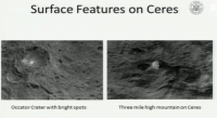
New topographic and themal maps of Ceres!
http://www.nasa.gov/jpl/dawn/new-names-and-insights-at-ceres Also, I'm watching live the USHR10 hearing and Russell showed this nice image of the bright spots in Occator and the mountain.
|
|
|
|
|
|
|
Jul 28 2015, 04:35 PM
Post
#244
|
|
 Member Group: Members Posts: 423 Joined: 13-November 14 From: Norway Member No.: 7310 |
So Occator (and hence its spots) sits at the edge of a highland area, while the mountain sits in a lowland area. Hmm.
---- (unrelatedly: many months ago during approach, it was noted that it looked like the north some places was less cratered than the south. while that might not be the case, there is actually a north-south dichotomy some places in terms of altitude, such that the observations might have been of something real after all) -------------------- |
|
|
|
|
Jul 29 2015, 03:01 PM
Post
#245
|
||
|
Senior Member Group: Members Posts: 2998 Joined: 30-October 04 Member No.: 105 |
For those who need it, here is an add-on scale bar for the topography on the new Dawn Ceres map pia19607 (and it is useable with the cylindrical projection pia19606). The topography is represented +/- 7.5 km about a zero datum.
As suspected, this little world has some strange topography. --Bill
Attached thumbnail(s)
-------------------- |
|
|
|
|
|
|
Jul 29 2015, 04:40 PM
Post
#246
|
|
 Member Group: Members Posts: 656 Joined: 20-April 05 From: League City, Texas Member No.: 285 |
Looking at the topo map, there's something interesting going on with the Rongo depression (as had been evident in the opnav topo maps) -- I really want to think of it as a subduction zone. It is just to the west of the mountain (Hualani); perhaps a coincidence, perhaps not -- pretty common for mountains to form adjacent to subduction zones. There is also an unnamed depression 60 degrees east of Hualani which has some similarities to the Rongo depression. All of this going on in a 90 degree swath along the equator, with the remainder of the equatorial region looking much older and generally higher. Someday an interesting story ought to come out of this.
Direct link http://www.nasa.gov/sites/default/files/th...ain_labeled.png |
|
|
|
|
Jul 30 2015, 09:45 AM
Post
#247
|
||
 Newbie Group: Members Posts: 11 Joined: 13-May 15 Member No.: 7464 |
The topographic map doesn't justice imho to the rugged high terrain from SO image 34
http://photojournal.jpl.nasa.gov/catalog/PIA19603 This is between Yalode and Zadeni. Plenty of interesting peaks (shadows) and small craters
|
|
|
|
|
|
|
Jul 30 2015, 11:55 AM
Post
#248
|
|
|
Senior Member Group: Members Posts: 2998 Joined: 30-October 04 Member No.: 105 |
The ruggedness is exaggerated due to the low lighting angle.
What are the yellow arrows showing? --Bill -------------------- |
|
|
|
|
Jul 30 2015, 01:04 PM
Post
#249
|
|
|
Junior Member Group: Members Posts: 21 Joined: 30-June 15 From: Brooklyn NY Member No.: 7543 |
Does anyone have, or know a link to, a gif version of the rotating Ceres topographical globe animation? I have searched the internet without success.
|
|
|
|
|
Jul 30 2015, 04:44 PM
Post
#250
|
|
 Member Group: Members Posts: 555 Joined: 27-September 10 Member No.: 5458 |
Charles, are you wanting to pull from individual frames or do you want an actual gif? Also, in what resolution?
-------------------- |
|
|
|
|
Jul 31 2015, 01:46 AM
Post
#251
|
|
|
Junior Member Group: Members Posts: 21 Joined: 30-June 15 From: Brooklyn NY Member No.: 7543 |
QUOTE (ZLD @ Jul 30 2015, 12:44 PM) Charles, are you wanting to pull from individual frames or do you want an actual gif? Also, in what resolution? A maximum resolution gif. Not the individual frames (I can pull those myself). |
|
|
|
|
Jul 31 2015, 03:33 PM
Post
#252
|
|
 Senior Member Group: Members Posts: 3419 Joined: 9-February 04 From: Minneapolis, MN, USA Member No.: 15 |
Still no images posted that were taken after June 25th. Are we expecting newly-acquired images in the next week or two?
-the other Doug -------------------- The trouble ain't that there is too many fools, but that the lightning ain't distributed right. -Mark Twain
|
|
|
|
|
Jul 31 2015, 05:49 PM
Post
#253
|
|
 Member Group: Members Posts: 244 Joined: 2-March 15 Member No.: 7408 |
QUOTE (dvandorn @ Jul 31 2015, 10:33 AM) Still no images posted that were taken after June 25th. Are we expecting newly-acquired images in the next week or two? I don't think Dawn has acquired any imagery since June 27. A few days later it started (or tried to, at least) its descent to HAMO, which is still in progress. I feel like you might have already known that, though. If you're asking about imagery acquired June 26th and 27th, I have no idea. Then again, I could also be completely wrong. |
|
|
|
|
Jul 31 2015, 06:08 PM
Post
#254
|
|
|
Merciless Robot Group: Admin Posts: 8784 Joined: 8-December 05 From: Los Angeles Member No.: 602 |
According to the press release, it should be done thrusting in mid-August. Don't think that there will be any new imagery till at least then.
-------------------- A few will take this knowledge and use this power of a dream realized as a force for change, an impetus for further discovery to make less ancient dreams real.
|
|
|
|
|
Aug 1 2015, 12:26 AM
Post
#255
|
|
|
Senior Member Group: Members Posts: 3419 Joined: 9-February 04 From: Minneapolis, MN, USA Member No.: 15 |
I actually wasn't aware that there were no plans whatsoever to do any imaging during the transition to HAMO. Thanks for the reassurance, guys.
-the other Doug -------------------- The trouble ain't that there is too many fools, but that the lightning ain't distributed right. -Mark Twain
|
|
|
|
|

|
Lo-Fi Version | Time is now: 18th June 2024 - 04:13 AM |
|
RULES AND GUIDELINES Please read the Forum Rules and Guidelines before posting. IMAGE COPYRIGHT |
OPINIONS AND MODERATION Opinions expressed on UnmannedSpaceflight.com are those of the individual posters and do not necessarily reflect the opinions of UnmannedSpaceflight.com or The Planetary Society. The all-volunteer UnmannedSpaceflight.com moderation team is wholly independent of The Planetary Society. The Planetary Society has no influence over decisions made by the UnmannedSpaceflight.com moderators. |
SUPPORT THE FORUM Unmannedspaceflight.com is funded by the Planetary Society. Please consider supporting our work and many other projects by donating to the Society or becoming a member. |
|