Printable Version of Topic
Click here to view this topic in its original format
Unmanned Spaceflight.com _ Opportunity _ Matijevic Hill detailed survey
Posted by: ronald Dec 7 2012, 07:19 PM
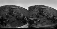
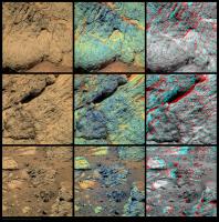
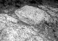
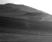
Some movement on sol 3153 to Copper Cliff:

|
Also visible in the http://www.unmannedspaceflight.com/index.php?act=attach&type=post&id=29036
Finished watching the two videos posted above - very interesting stuff - Thanks stewjack for posting the links!
Posted by: serpens Dec 7 2012, 09:50 PM
Ronald, really nice presentation thank you. The choice of 3-d methods is very much appreciated.
Posted by: ronald Dec 10 2012, 03:34 PM
Thanks 
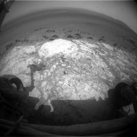
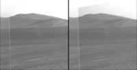
A quick one for sol 3155:
|
|
Posted by: Tesheiner Dec 10 2012, 05:19 PM
Use this thread for all images, discussions, etc. post sol 3153.
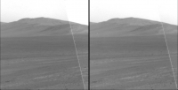
Posted by: Stu Dec 10 2012, 06:22 PM
Really looking forward to Oppy getting stuck into the rocks here...
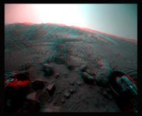
|
Posted by: Bill Harris Dec 11 2012, 01:06 AM
RE: the "NewBerries" discovered at this zone of the column:
Asteroids hitting Earth typically vaporize a mass of target rock comparable to the projectiles mass. As this vapour expands in a large plume or fireball, it cools and condenses into molten droplets called spherules.
http://www.nature.com/nature/journal/v485/n7396/full/nature10982.html

From my review of the literature and observations of the stratigraphy at the site, I am inclined to regard the "spherules of unknown affinity" simply as impact spherules.
--Bill
Posted by: dburt Dec 11 2012, 06:13 PM
"Simply as impact spherules" may not be as simple as it sounds. Impacts can form spherule-like objects by multiple processes, including, e.g., condensation of silicate vapor to a glass, which you cited, condensation of sticky steam to mineral grains forming accretionary lapilli (e.g., the larger spherules stratigraphically associated with the Chicxulub Crater assumed to have killed the dinosaurs), hollow vesicles in impact glass later filled with minerals, or spherulites associated with devitrification (rapid partial crystallization) of impact glass (which spherulites characteristically have a radiating internal structure also noted at high magnification in some of the "newberries"). Multiple types of impact spherules might be expected to be preserved on Mars, much more commonly than on Earth, whose early impact record has been completely erased or is incomplete (biased by differential settling through sea water and heavily altered by aqueous processes).
-dburt
Posted by: ronald Dec 11 2012, 08:25 PM
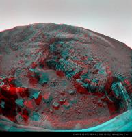
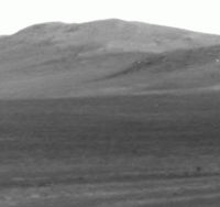
Fancy Vermilion - Sol 3156:
|
|
http://dl.dropbox.com/u/5875127/mer/1P408356279EFFBW%23%23P2437LXM1_L.JPG
Posted by: serpens Dec 12 2012, 12:19 AM
The interesting aspect on the provenance of these new-berries is their position towards the bottom of the original crater rim. This seems a most unlikely position for deposition of lapilli or condensation spherules originating with the Endeavour impactor and provides an indication that this is part of the pre-impact surface / sub surface.
Posted by: Stu Dec 12 2012, 06:17 PM
Opportunity MI mosaic...
|
Posted by: ronald Dec 12 2012, 07:48 PM
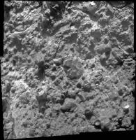
Some more Copper Cliff from sol 3156:
|
Could be a part of the Matijevic Hill Memory Game

http://dl.dropbox.com/u/5875127/mer/copper_cliff_3x3_X.jpg
Posted by: SteveM Dec 12 2012, 10:47 PM

Steve M
Posted by: Eutectic Dec 13 2012, 02:10 AM
Fracturing followed by fluids depositing the white mineral in the fractures. Brecciation is common with impact. We saw similar fine veins near the south end of Cape York. Here's a link to a picture of a terrestrial breccia; different scale, fracturing mechanism, and fracture fill, but the filled fracture idea is the same:
http://www.nr.gov.nl.ca/nr/mines/outreach/education/features/breccia1lg.jpg
Posted by: eoincampbell Dec 13 2012, 02:28 AM
Does Vermilion look like a contact point between rock types that Steve Squyres alluded too in his recent AGU talk?
Posted by: serpens Dec 14 2012, 07:00 AM
Me too, although interpretation will be a nightmare. For instance the Copper Cliff MI pan shows glass, spherules, angular and rounded clasts, tiny veins and possibly a clast within a clast. While this is a polymictic impact product we cannot assume that the glass and spherules are cogenetic. Cape York is probably giving us an insight into the multiple impact products of the Hadean but our understanding will be through a glass darkly.
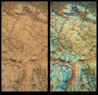
Posted by: jhagen Dec 14 2012, 07:39 AM
|
|
In this version of MI 3158 I rotated the mosaic 180 degrees just for familiar shadow angle.
|
Posted by: xflare Dec 14 2012, 01:29 PM
Looks like there is a bit of everything mixed up in that rock 
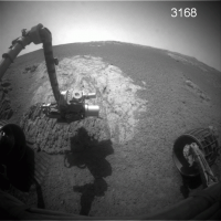
Posted by: Floyd Dec 20 2012, 12:20 PM
The forgotten rover is still keeping busy. From JPL
Shoulder Work At 'Copper Cliff'
Opportunity Status for sol 3159-3165
Release Date: 12/19/12
Opportunity is working at "Matijevic Hill" (named in honor of Jake Matijevic) at the inboard edge of "Cape York" on the rim of Endeavour Crater. There, the rover has been conducting in-situ (contact) science measurements at a location called "Copper Cliff."
On Sol 3160 (Dec. 13, 2012), Opportunity began taking images with its Microscopic Imager (MI) for a mosaic of a surface target. Partway through the activity, the rover's robotic arm experienced a stall in the shoulder azimuth joint. This has been seen a few times before when the arm is commanded to move at a slow rate, but not the slowest rate. Magnetic detents normally hold the motor armature when unpowered, and under certain slow-rate conditions they are able to restrain the armature from spinning. At higher rates, the armature has enough momentum to keep spinning, while at the slowest rates a higher stall threshold is used. Activities on Sol 3162 (Dec. 15, 2012) confirmed the joint is OK, and an offset placement of the Alpha Particle X-ray Spectrometer (APXS) was completed.
On Sol 3165 (Dec. 18, 2012), Opportunity bumped about 18 feet (5.5 meters) to the west to reach a new set of surface targets in this Copper Cliff area. The rover will likely continue in-situ investigations in the area through the coming holiday.
As of Sol 3165, the solar array energy production was 533 watt-hours with an increased atmospheric opacity (Tau) of 0.955 and a solar array dust factor of 0.607.
Total odometry is 22.02 miles (35438.37 meters)
http://www.jpl.nasa.gov/images/mer/2012-12-19/pia16560-full.jpg
Posted by: ronald Dec 20 2012, 10:34 PM
Naaaaa
Vermilion again - sol 3165:
|
Posted by: James Sorenson Dec 22 2012, 09:06 AM
I wasn't going to add this here, because I made this for my Facebook Banner, but I'll post it anyway's.

|
Posted by: fredk Jan 1 2013, 06:02 PM
Some changes visible between sols 3168 and 3177, probably due to dust blown by wind:
|
They're not due to lighting differences, since the local times of the two frames differ by only a few minutes. Gusts are always welcome...
Posted by: TheAnt Jan 2 2013, 08:48 PM
Good find, and yes Gusts of wind are very much welcome for Opportunity.
Posted by: fredk Jan 4 2013, 03:31 PM
Sure enough, we did have a cleaning event, on sol 3175, according to the http://marsrovers.jpl.nasa.gov/mission/status_opportunityAll.html#sol3174
Posted by: fredk Jan 5 2013, 07:13 PM
And we are back at Whitewater Lake:
http://qt.exploratorium.edu/mars/opportunity/navcam/2013-01-05/1N410670731EFFBW%23%23P0675R0M1.JPG?sol3182
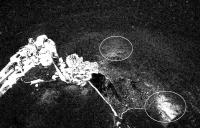
You can see the grind mark (circled):
|
Posted by: mhoward Jan 5 2013, 07:37 PM
Hey, you're right! I was wondering where those tracks came from.
http://www.flickr.com/photos/marscat/8349920347/
http://www.flickr.com/photos/marscat/8349920347/, on Flickr
Posted by: kungpostyle Jan 9 2013, 02:13 AM
The Planetary Society report:
http://www.planetary.org/explore/space-topics/space-missions/mer-updates/2012/12-mer-update-opportunity-zeroes-in-on-clay-minerals-and-looking-back-on-2012.html
Posted by: nprev Jan 9 2013, 02:36 AM
A.J.S. Rayl just plain does it right.
And a big shout-out to our own Stu & Tesheiner for their featured contributions to this excellent article!
Posted by: mhoward Jan 9 2013, 03:23 AM
That's a particularly blockbuster report. Really striking for the collaboration between MER and MRO to reach any conclusions. Makes me wonder: if Opportunity were parked over, say, Whitewater Lake, would that be detectable to CRISM?
Posted by: Tesheiner Jan 9 2013, 08:28 PM
Opportunity did a small bump to the right on sol 3185, and Whitewater Lake is now dead center ahead of the IDD workvolume.
http://marsrovers.jpl.nasa.gov/gallery/all/1/f/3185/1F410932776EFFBW__P1214L0M1.JPG
Posted by: acastillo Jan 10 2013, 05:33 PM
With what is going on with Curiousity, I sometimes forget the amazing landscape that Opportunity is roving in.
Go Opportunity!! 
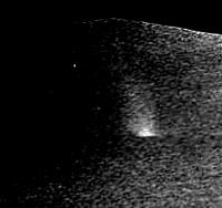
Posted by: mhoward Jan 14 2013, 08:50 PM
Was poking around and just now noticed this: dust devil on sol 3182. (Center frame; vertical line is south).
|
|
Posted by: Stu Jan 14 2013, 09:12 PM
Well spotted.
Posted by: fredk Jan 14 2013, 09:28 PM
Yeah, nice catch! That's only DD#2 for Oppy, IIRC.
Here's a stacked average of the L and R frames:
|
If anyone's skeptical, it appears in exactly the same spot in the L and R frames, but is completely absent from the neighbouring frames, taken less than a minute earlier:
http://marsrovers.jpl.nasa.gov/gallery/all/1/n/3182/1N410670869EFFBW__P0675R0M1.JPG
Posted by: atomoid Jan 14 2013, 09:50 PM
hmmm, yeah and If I Searched Correctly, there was only DD#1 in http://www.unmannedspaceflight.com/index.php?s=&showtopic=6623&view=findpost&p=162500 and http://www.unmannedspaceflight.com/index.php?act=attach&type=post&id=22163 from way back in 2010 SOL 2301 ...
also in the http://www.db-prods.net/marsroversimages/Opportunity/2010/Sol2301-pancam.jpg
Posted by: mhoward Jan 14 2013, 10:08 PM
Good point, Fred - right in the overlap area. Here's two frames if anyone wants to make a flicker animation - seems to be beyond my technical ability at the moment. (Disclaimer: contains my own inexact de-vignetting and brightness adjustment.)
|
|
Posted by: Phil Stooke Jan 14 2013, 10:35 PM
Great observation!
Phil
Posted by: fredk Jan 14 2013, 11:36 PM
|
And here's the difference, with DD minus without DD:
|
Heavy jpeg artifacts at this zoom and stretch, but in all cases I've averaged the L and R frames to boost S/N by sqrt(2).
Posted by: atomoid Jan 15 2013, 12:26 AM
so are entering into dust devil season?
if the last sighting was SOL 2301 and now its SOL 3182 it looks like were at least a season ahead of the last cycle sighting, any seasonal pattern to this? http://www.planetary.org/explore/space-topics/mars/mars-calendar.html..
Last DD was seen about the middle between Mars summer solstice and autumnal equinox..
This one has Mars' winter solstice is coming up this Feb 23 2013.
if these two are just outliers i guess we have'nt been paying attention..
Posted by: dvandorn Jan 15 2013, 01:17 AM
I'm not surprised we're seeing a DD here. The relative lack of them at Meridiani is, I think, due to the lack of pronounced hills and slopes in the area. DDs seem to spawn off of hills and out of very large craters. We have the kinds of slopes required to generate them at our current location, but haven't seen much in the way of hills up until now.
-the other Doug
Posted by: walfy Jan 17 2013, 08:51 AM
That dust devil was a treat!
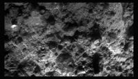
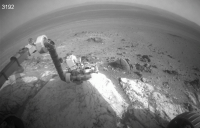
Haven't done one of these for awhile, did my best taking out the headaches. Micro from Sol 3192:

|
Posted by: fredk Jan 17 2013, 04:11 PM
Beautiful! I love those micro-buttes.
Posted by: Phil Stooke Jan 17 2013, 05:45 PM
Yes, they're beauts.
Phil
MOD NOTE: In an unprecedented admin/mod team action, Phil will presently be executed for this...
Posted by: dvandorn Jan 17 2013, 09:30 PM
Groannnnnnnnnnnnnn.....
-the other Doug
Posted by: eoincampbell Jan 18 2013, 03:03 AM
How Dajare You...
Posted by: fredk Jan 18 2013, 05:20 AM
More wind action at Endeavour - what looks like a gust well inside the crater on sol 3194, arrowed:
|
More changes are visible in the foreground, and very easy to see when you take the difference between the two frames:
|
The two frames are only a few minutes apart in local time, so the lighting is almost identical. The gust is not visible in the frames taken just after the 3194 frames:
http://qt.exploratorium.edu/mars/opportunity/forward_hazcam/2013-01-17/1F411742993EDNBW%23%23P1121R0M1.JPG?sol3194
Posted by: fredk Jan 18 2013, 11:39 PM
This has got to be a record - pics from sol 882 down today, that's 6 1/2 years ago!
http://qt.exploratorium.edu/mars/opportunity/pancam/2013-01-18/1P206481762EFF74AZP2780L2M2.JPG?sol----
That was by Beagle Crater, which a few of the oldtimers may recall was just before Victoria...
Edit - that frame was already in the PDS (but not the jpl jpeg site), so it must just be some pipeline thing. Still funny to see...
Posted by: mhoward Jan 18 2013, 11:57 PM
Yeah, a blast from the past. Those images were trickling in so slowly today, it certainly seemed as if they were coming through the normal pipeline.
Posted by: Tesheiner Jan 19 2013, 09:13 AM
Robot dreams maybe?
Posted by: djellison Jan 19 2013, 07:08 PM
It's a Version 2 of the image, so maybe a backed up downlink or ground processing thing.
Posted by: walfy Jan 23 2013, 08:05 AM
A micro from Sol 3194:

|
Posted by: Tesheiner Jan 29 2013, 01:53 PM
Everyone, wakeup! Nobody noticed that two days ago Opportunity left the site she was investigating for the last couple of weeks?
Here's a navcam mosaic taken on sol 3203; we're already on sol 3205.

|
Posted by: mhoward Jan 29 2013, 02:15 PM
Some of us noticed Oppy's now back at "Broken Hammer," previously visited sols 3098-3101.
Here's a view of drive north on sol 3203 (blue line) based on the metadata (vertical line is north):
http://www.flickr.com/photos/marscat/8424107775/ http://www.flickr.com/photos/marscat/8425198580/
Posted by: fredk Jan 29 2013, 03:31 PM
And a further bump north on 3205:
http://qt.exploratorium.edu/mars/opportunity/forward_hazcam/2013-01-29/1F412708761EFFBX05P1211R0M1.JPG?sol3205
Posted by: mhoward Jan 29 2013, 04:36 PM
She basically just turned right and backed up a little bit on 3205. (Compare http://www.midnightplanets.com/web/MERB/03203/1F412539096EFFBX00P1214R0M1.html and http://www.midnightplanets.com/web/MERB/03205/1F412708761EFFBX05P1211R0M1.html)
Posted by: fredk Jan 30 2013, 07:05 PM
Further short drive on 3206:
http://qt.exploratorium.edu/mars/opportunity/forward_hazcam/2013-01-30/1F412797989EFFBX36P1214R0M1.JPG?sol3206
Posted by: mhoward Jan 30 2013, 09:13 PM
Interesting - the sol 3206 drive was westward back to "Flack Lake".
http://www.flickr.com/photos/marscat/8431112896/ http://www.flickr.com/photos/marscat/8430028711/
Posted by: walfy Jan 31 2013, 08:23 AM
A micro from Sol 3200 that actually lines up to one side of the micro from http://www.unmannedspaceflight.com/index.php?s=&showtopic=7553&view=findpost&p=196968. Might try to stitch them later.

|
There's some doubling up of features at the mid-seam, still learning some tricks to line things up better.
(Edit: The above image will line up with the one from http://www.unmannedspaceflight.com/index.php?s=&showtopic=7553&view=findpost&p=196968 if it's rotated 180°. Sometimes I don't know which way is "up"! By the way, Photoshop refuses to auto-stitch these two latest micros with the ones from 3192. Would have to do it manually.
 )
)
Posted by: Bill Harris Feb 1 2013, 01:34 AM
LPSC-44:
44th Lunar and Planetary Science Conference (2013) sess252.pdf
Tuesday, March 19, 2013 [T252]
MARS EXPLORATION ROVER: RESULTS FROM ENDEAVOUR CRATER
http://www.lpi.usra.edu/meetings/lpsc2013/pdf/sess252.pdf
--Bill
Posted by: fredk Feb 1 2013, 04:02 PM
In Fig 2 of http://www.lpi.usra.edu/meetings/lpsc2013/pdf/1286.pdf we finally can see the high-resolution CRISM view of the smectite signature on Matijevic Hill. It would be interesting to see that overlaid on a good quality map, but the background in that image is very low resolution so it would be hard to do.
Posted by: serpens Feb 1 2013, 10:19 PM
Dear me. That smectite location is nothing like the numerous, previous CRISM overlays published in papers and articles. Previously I couldn't understand reference to Opportunity being 'in the sweet spot' - for instance:
http://www.planetary.org/explore/space-topics/space-missions/mer-updates/2012/12-mer-update-opportunity-zeroes-in-on-clay-minerals-and-looking-back-on-2012.html
Does this mean that the previous indications of extensive smectite indications to the south are exaggerated and that the smectites are more localised?
Posted by: ngunn Feb 1 2013, 10:45 PM
I think that is just an overlay of the Whitewater Lake exposure as seen by the rover on a background Crism image. I don't think this is a Crism image that in itself delineates the smectite exposure in an obvious way. (The overlay has much higher resolution than the background, and much higher resolution than Crism.)
Posted by: Bill Harris Feb 2 2013, 03:06 AM
Could be most anywhere in this area-- the CRISM res is so low.
I want to see "Secular City" next door...
--Bill
Posted by: dburt Feb 2 2013, 07:58 PM
MARS EXPLORATION ROVER: RESULTS FROM ENDEAVOUR CRATER
http://www.lpi.usra.edu/meetings/lpsc2013/pdf/sess252.pdf
--Bill
Thanks much for that link. Some of the abstracts make it appear that the devitrification spherulite idea for "newberries," first debated here on UMSF, is gaining traction. In that regard, I found this abstract, from a different session, interesting also:
http://www.lpi.usra.edu/meetings/lpsc2013/pdf/2064.pdf
It begins with "Blueberries, newberries, and accretionary lapilli..." and describes gray-hematite coated basaltic accretionary lapilli, about 7 mm in diameter, resulting from explosive volcanism in Antarctica, including in basal surge beds that are said to mimic fluvial or eolian beds. For purposes of comparison, keep in mind that martian basalts are probably considerably more iron rich and less silicic than the ones from Antarctica.
-dburt
Posted by: Bill Harris Feb 3 2013, 12:12 AM
And thanks for the "Newberries" PDF. That Mt Darwin photo looks almost... Martian. And in keeping with Martian environments, remember that Antarctica wasn't always as it is today.
This will prove to be a great LPSC, with the detailed work at Cape York and the initial work at Gale. And I wouldn't be surprised if we start seeing "hey, I just noticed this at Gusev" from old Spirit data.
The Gifts that Keep on Giving, no?
--Bill
Posted by: fredk Feb 3 2013, 01:24 AM
I wondered about that myself. But the text says
About the resolution, the abstract says the regular resolution is 18 m/px. This seems to correspond to the resolution of most of Fig 2. But the text also describes the oversampled, higher resolution CRISM observations, with 5 m/px resolution. That seems to match pretty well the size of the pixels in the red, smectite patch in Fig 2. So my interpretation is that the red area is the set of pixels with smectite signature from the 5 m/px observations, overlaid on the regular resolution CY CRISM image. We may have to wait for a full paper to come out to know for sure.
Posted by: Phil Stooke Feb 3 2013, 03:29 AM
Not sure about this... to me it looks like the very dark blue background is supposed to be the clay - the largest area being at the south end where older observations placed it and the original reason for going to the south end first. A smaller patch of dark blue under that red patch is the CRISM detection in that area and the red is an overlay of the Whitewater unit as mapped by the rover, showing the spatial match.
But we'll have to wait and see. I will be looking out for this at LPSC.
Phil
Posted by: fredk Feb 3 2013, 06:01 AM
I think you may be right, Phil. Fig 3 is an average over all the pixels in the red area. It would seem surprizing that there'd be enough S/N in each individual pixel to define the red area that precisely based on the CRISM data.
Posted by: Bill Harris Feb 3 2013, 03:28 PM
I want to see "Secular City" next door...
--Bill
--Bill
Posted by: Tesheiner Feb 5 2013, 05:32 PM
There was a quite long drive executed today, sol 3212, placing Opportunity almost at the same site as on sol 3104.
Here's today's navcam mosaic.

|
And http://www.unmannedspaceflight.com/index.php?s=&showtopic=7554&view=findpost&p=193460 is the one shot on sol 3104.
Posted by: atomoid Feb 6 2013, 03:07 AM
http://qt.exploratorium.edu/mars/opportunity/pancam/2013-01-18/1P206481762EFF74AZP2780L2M2.JPG?sol----
That was by Beagle Crater, which a few of the oldtimers may recall was just before Victoria...
catching up on old news here.. remarkably uncanny image!
by chance a recent movie rental stuck in my head makes me i see http://i.ebayimg.com/t/Prometheus-Alien-Full-size-space-jockey-bio-helmet-prop-/00/s/MTE1OFgxNTUx/$T2eC16ZHJGkE9no8iK0vBQJd7MPih!~~60_57.JPG
evoking http://marsrovers.nasa.gov/gallery/all/2/p/513/2P171912249EFFAAL4P2425R1M1.JPG from the lower left of that old Spirit image! (sorry, but had to.. resistance was futile)
Posted by: Bill Harris Feb 6 2013, 06:13 AM
MERs. The gift that keeps on giving.
--Bill
Posted by: walfy Feb 6 2013, 08:12 AM
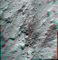
Quite the protruding newberries, really fantastic structures, from sol 3207:

|
Posted by: walfy Feb 6 2013, 08:23 AM
Another one with more consistent lighting also from Sol 3207. This micro overlaps the previous one I just posted:

|
Posted by: CosmicRocker Feb 7 2013, 02:46 AM

Posted by: serpens Feb 7 2013, 03:51 AM
Or newbys?
Posted by: fredk Feb 7 2013, 05:22 AM
Some discussion of future plans in http://www.planetary.org/explore/space-topics/space-missions/mer-updates/2013/02-mer-update-opportunity-completes-nine-years-on-mars.html
In addition, the trek across Botany Bay promises more scientific treasures on the way to Solander Point. "There are large exposures gypsum we think, based on CRISM data, not as veins but as bedrock," said Arvidson... "So we may be driving across Botany Bay to find the lowest part of the Burns Formation exposed."
Posted by: walfy Feb 7 2013, 07:55 AM
I quick GIF of sol 3208 and 3209 micros. Each one is a stitch of 4 images, so not the best of lining everything up between sols, did the best I could under time constraints and in need of more Photoshop lessons!

|
Posted by: walfy Feb 7 2013, 08:05 AM
Oppy picking newberries, closeup view:

|
Posted by: atomoid Feb 8 2013, 01:43 AM
some newbie (SOL 3207) fun with Gimp (tried to minimize shadow) and StereoPhotoMaker:

|
Posted by: walfy Feb 8 2013, 05:08 AM
Nice patterns in the sand, nice view, makes for a good composition!

|
Posted by: fredk Feb 8 2013, 05:41 AM
It is a nice view! Surprizingly the tracks on the left, from sol 3104, don't look very different from the new ones on the right, from 3212. At least from this angle and using navcam.
Posted by: walfy Feb 12 2013, 08:22 AM
Another nice micro of late, Sol 3214.
|
Had to reduce the size to meet upload limitation, need to find some place online to post full res size, minimal compression.
Posted by: fredk Feb 12 2013, 08:08 PM
Looks like a new DD for Oppy, peeking out from behind the central mound:
http://qt.exploratorium.edu/mars/opportunity/navcam/2013-02-12/1N413952887EFFBXGCP0675R0M1.JPG?sol3219
Edit: blink comparison with sol 3214, making it easy to see the DD:

|
It has to be very big, because it's a long way to the central mound.

Posted by: Phil Stooke Feb 12 2013, 08:43 PM
Nice one, Fredk! Isn't it in the crater floor near the south end of the mound rather than "peeking out from behind the central mound" ? But yes, it must be quite a big one.
Phil
Posted by: dilo Feb 16 2013, 10:52 PM
Can someone explain me (here or in another appropriate thread) why they decided to repeat exactly the same loop after 3.5 months instead to go toward Solander or other interesting places? Thanks!
Added: perhaps I found by myself the answer! from Squyres words reported in Dec,4 update,
Posted by: nprev Feb 16 2013, 11:58 PM
it's obviously a tremendously interesting site, and I'm gonna guess that they think that it's also representatve of the entire crater rim. Therefore, there wouldn't be much point in mounting a lengthy traverse to a geologically similar locale till they've wrung as much data out of here as they can.
Posted by: brellis Feb 17 2013, 02:59 AM
There are several layers of Mars history right there, I hadn't thought of it with the awareness of a geologist. I keep thinking "drive! drive!" lol
Posted by: dilo Feb 17 2013, 06:42 AM
Yes, I must force myself to recall that main purpose of MER mission is geologic survey and not establish new drive records nor take breathtaking panoramas of new places... It's hard to accept such philosphy after many years of spectacular views!
To moderators: Sorry for the OT, I'll stop immediately this argument because I know isn't the purpose of this thread!
Mod: moved the discussion to the main thread.
Posted by: Tesheiner Feb 17 2013, 10:44 AM
You may have a look to the http://www.planetary.org/explore/space-topics/space-missions/mer-updates/2013/02-mer-update-opportunity-completes-nine-years-on-mars.html (Feb 06th) report by AJS Rayl too. Here's a paragraph talking about the current survey.
Posted by: fredk Mar 6 2013, 04:35 PM
Lots of interesting detail in the latest http://www.planetary.org/explore/space-topics/space-missions/mer-updates/2013/02-mer-update-opportunity-wraps-up-science-on-matijevic-hill.html On future plans:
The ninth of May is the "last possible date" that Opportunity can leave Cape York and get to Solander Point "safely and with plenty of margin," according to John Callas
And the recent silence was due to another flash fault, coincidentally timed with MSL's:
"The fix is to reformat the Flash and that's what we did on Spirit, but the problem is it's intermittent," Nelson reiterated from last month. "So, if at the time you do the reformatting that troublesome sector is working just fine, then even after reformatting it will continue to fail because the software didn't read it as bad," he explained. It has to get really bad before we can reformat the Flash successfully."
Posted by: Tesheiner Mar 6 2013, 06:35 PM
That's music to my ears! 
Posted by: CosmicRocker Mar 7 2013, 05:24 AM
Many thanks, fredk, for your always-excellent selection of the key pieces of news from Salley's also-outstanding updates.
It'll be exciting to be roving again.

...and now, Opportunity gets to climb a mountain as her sister did...
Posted by: CosmicRocker Mar 7 2013, 05:53 AM
fredk: I had to also add that there is this interesting piece of information from one of your earlier update summaries...
I am excited to think about the possibility of that stratigraphic exposure.
Posted by: mhoward Mar 7 2013, 01:30 PM
By the way, yestersol (3240) she drove south to the area below Kirkwood. The http://www.planetary.org/explore/space-topics/space-missions/mer-updates/2013/02-mer-update-opportunity-wraps-up-science-on-matijevic-hill.html mentions she might conduct the very cool streak test at "Kirkwood or a place like Kirkwood".
Posted by: Tesheiner Mar 7 2013, 05:59 PM
Exactly. Here's the navcam mosaic shot after the drive. The rover is right on top of some older tracks from sol 3060.

|
Actually, if we look to the RHAZ image, that's the site Opportunity was on sol 3057.
http://qt.exploratorium.edu/mars/opportunity/rear_hazcam/2013-03-06/1R415823252EFFBXQRP1311L0M1.JPG

Posted by: Phil Stooke Mar 8 2013, 10:37 PM
This doesn't exactly belong here but I'm not sure where else to stick it (so to speak). It's a text file containing descriptions of Opportunity's activities for every sol of the mission up to sol 3060. It is just the data from the PDS Analyst's Notebook mission summary, but in a different file format, in case anyone may find it useful. Well, maybe it does belong here since the image right above shows the sol 3060 location! opportunity_activities_by_sol.txt ( 139.2K )
: 352
opportunity_activities_by_sol.txt ( 139.2K )
: 352
Phil
Posted by: fredk Mar 10 2013, 03:36 PM
Old and new tracks, 180 sols apart:
http://qt.exploratorium.edu/mars/opportunity/pancam/2013-03-10/1P416181125EFFBXQRP2567R2M1.JPG?sol3244
Posted by: walfy Mar 11 2013, 05:54 AM
Interesting protruding features again on this close-up from Sol 3239. They would pass as good public art if made into large scale bronze or granite sculptures. If I had the money I'd commission exact replicas to be made of the more interesting and beautiful shapes we've seeing over these many years on Mars, give them out to the principle investigators and engineers, maybe place a big one in front of JPL! They would make for a nice merging of planetary science and art, of which we don't see much.

|
Posted by: CosmicRocker Mar 12 2013, 05:46 AM
I like that idea. Maybe we wouldn't even need to do it on a large scale, though that would be impressive.
It would be pretty cool to simply render some of these Martian rocks in 3-D at true scale, and I think that is something that is totally doable with currently available technology. We can already generate digital, 3-D models from the stereo imagery. Three-D printing and machining technologies are rather well developed these days.
I'd guess that JPL and/or Caltech already have the devices needed to turn this kind of trans-planetary visualization into a reality.
Posted by: marsophile Mar 15 2013, 06:52 PM
I'm a little surprised they didn't approach Kirkwood from the other side this time.
It might have been interesting to investigate the contact between the Kirkwood and Whitewater areas.
Posted by: marsophile Mar 16 2013, 03:06 AM

|
Stereo from one of the new Kirkwood MIs.

|
Closeup of bottom portion (rotated through 90 degrees).
Posted by: fredk Mar 16 2013, 04:48 PM
Nice. I love those stereo concretions little ball-shaped thingeys.
There was a very tiny slip downslope between sols 3246 and 3247, as you can see by comparing the wheel to the surrounding rock:

|
There's also some dust movement - look along the lower edge of the band of dust below the rock overhang.
Posted by: serpens Mar 16 2013, 09:53 PM
Concretions? Have they found something new? I thought there were a lot of possible options open including accretionary lapilli, impact spherules, or devitrification spherules as well as concretions. Arvidson I believe favors lapilli?
Posted by: fredk Mar 16 2013, 11:14 PM
Oops - a slip from a non-geologist!
Posted by: marsophile Mar 17 2013, 05:20 AM
A couple more:

|

|
Posted by: mhoward Mar 17 2013, 06:49 PM
Looks like they attempted to do a http://www.midnightplanets.com/web/MERB/image/03251/1M416801114EFFBXSIP2905M2M1.html on sol 3251. It doesn't look like much was ground, but a bit was, and there's http://www.midnightplanets.com/web/MERB/sol/03251.html...
Exciting to see some action!
Posted by: marsophile Mar 17 2013, 08:16 PM

|
Parallel eye stereo this time.
Note the lack of any apparent transition between the sliced berry and the sliced ridge just above it.
Posted by: centsworth_II Mar 18 2013, 06:38 AM
"We want to test the idea that there might be a little bit of hematite in the newberries, said Squyres. "We know that the blueberries out on the plains are very rich in hematite. The newberries aren't anywhere near that rich in hematite but they could have a little." With the Mini-TES and Mossbauer now out of commission, it's more difficult to discern hematite. But hope is not lost. "If you go back to geology 101, one of the very first things they teach is a streak test," said Squyres....
"...So we're going to do a little light RAT grind into a dense concentration of newberries and we're going to take a pic of the cuttings with Pancam and we'll see what we see. It's a streak test. It's geology 101."
"The idea is that something is cementing the outsides preferentially and it might be hematite or it might just be silica or some kind of sulfate but at such a low concentration we won't be able to tell," said Arvidson. "If there is hematite in the crunchy outside layer, it should turn bright red."
Posted by: CosmicRocker Mar 18 2013, 07:28 AM
Talk about the ultimate work-around for faulty instruments. I'm thinking that it wasn't all that long ago that someone in the forum reminded us of the streak test with regard to hematite. ...very cool stuff...
Ok image processors...it's almost time to crank red up to eleven.
Posted by: Bill Harris Mar 18 2013, 03:37 PM
--Bill
Posted by: centsworth_II Mar 19 2013, 08:33 PM
Taken from a couple tweets by Emily Lakdawalla at LPSC:
Squyres: Origin of whitewater lake uncertain. If impact ejecta, it's not from Endeavour.
Squyres: Whitewater lake rocks old, record epoch before Endeavour.
This confuses me. The second statement makes sense. Whitewater Lake type rocks were part of the pre-Endeavour surface that was lifted up to form the crater rim during impact. But the first? I don't see how that conclusion could be drawn.
Posted by: Phil Stooke Mar 19 2013, 08:41 PM
But the second is the same as the first - it's older than Endeavour, the old target material lifted up to form the rim, and then covered with Endeavour ejecta. That target material might originally be ejecta as well, but from other nearby and older craters, not from Endeavour itself.
Phil (I was in the room too)
Posted by: centsworth_II Mar 19 2013, 09:12 PM
Wow. It gets complicated, but I think I understand a little better: A pre-Endeavour surface consisted of regolith (ejecta) as well as bedrock. Once the Endeavour impact blasts that surface up into a crater rim, I would consider all of it now to be Endeavour ejecta, but I see the point of drawing a distinction. I'd be interested in knowing how they can tell Whitewater Lake was pre-Endeavour regolith and not bedrock.
Or do I still not understand at all?
Posted by: Phil Stooke Mar 19 2013, 09:39 PM
Regolith is a recent soil - don't just think of a few meters of debris around a little crater - this could be part of a km-thick deposit from a large pre-existing crater not far away, largely destroyed by Endeavour or 100% buried by the plains, but its ejecta, now a rock layer already extensively modified with veins, concretions etc., is the target material struck by the Endeavour impactor. As Squyres described it, that Whitewater rock was uplifted to form the rim and scoured by outflowing ejecta, getting bits of Whitewater including concretions broken off and entrained in the new ejecta (hence no sharp boundary between WW and the Shoemaker Formation (Endeavour ejecta) overlying it). But WW was a real rock, not just a bit of older regolith.
Phil
Posted by: serpens Mar 19 2013, 10:21 PM
Spot on. Endeavour impacted the ejecta blanket of Miyamoto which would have been extremely thick in the area. As uplift rim it is almost certain that Whitewater was underground, not part of the original surface. The need to stand back a bit and put the tiny areas where we have ground truth in context has been discussed many times.
Posted by: centsworth_II Mar 19 2013, 10:26 PM
Thanks, I've got a better picture now. I guess you had to be there.
Posted by: ngunn Mar 19 2013, 11:06 PM
Actually, taking recent discoveries by Opportunity and Curiosity together I think one part of the picture is getting simpler. I must abbreviate here to avoid writing an essay.
Impacts throw up basaltic dust which settles back on the ground. There are areas of standing water and maybe other damp surfaces that trap this material as it blows around. Clay minerals form. Less frequent later impacts disrupt the stratigraphic sequence. We arrive.
Posted by: serpens Mar 20 2013, 01:21 AM
Looking at the ancient channels to the South and East of Endeavour that cut the miyamoto ejecta there was a lot of water involved early on. This water and the resultant clays could of course predate Endeavour which could explain the presence of clays on the rim, the elevation helping them survive the later acidic water inflow. There is clear evidence of plentiful acidic water in the sandstone plains traversed by Opportunity. Acidic surface / near surface water during the volcanic phase interacting with deeper, basalt buffered groundwater makes for some interesting interface reactions and depositions.
Posted by: Phil Stooke Mar 20 2013, 12:48 PM
News from the conference - Opportunity will now return to Boxwork (where it just came from), RAT a bit and spend conjunction doing APXS on that. Then it's off to Botany Bay.
Phil
Posted by: mhoward Mar 22 2013, 01:54 AM
Looks like Opportunity's second grind of "Sturgeon River 3" on sol 3253 went well, and she's now moved north toward 'Boxwork'.
Unfortunately neither of the public image sites has been updating for a couple days now.
http://marsrovers.jpl.nasa.gov/mission/status_opportunityAll.html#sol3248
Posted by: mhoward Mar 22 2013, 03:54 AM
Getting some images via the JPL site now. Sol 3253 "Sturgeon River 3" grind L257:

|
Posted by: James Sorenson Mar 22 2013, 08:41 AM
And an animated Gif

|
I've never really been good at Overlaying Pancam Color over an MI image, but here is my shot at that.
http://www.flickr.com/photos/43581439@N08/8578773801/
Posted by: serpens Mar 24 2013, 12:15 AM
Squires has apparently come down on the side of concretions to explain these spherules, but it would be nice to know what logic chain led to that decision. The spherules are the same material as the matrix I believe, so what is the cementing material? Life was so much simpler on the sedimentary Burnes formation.
Posted by: marsophile Mar 24 2013, 04:36 PM
Perhaps it was the result of the "streak test" that tipped the balance?
Posted by: Elizabeth Koprucki Mar 24 2013, 06:28 PM
My first processed space image (and post here!): Opportunity's Sol 3244 tracks from the Pancam, in enhanced color. (I've been watching Emily Lakdawalla's tutorials.) I played with the levels some on each channel, because the image was initially very blue. I like the overlapping old and new tracks, and also the very visible red dust on the arm.

|
Posted by: Stu Mar 24 2013, 06:30 PM
Welcome Elizabeth! About time!
Posted by: James Sorenson Mar 24 2013, 10:17 PM
Very well done Elizabeth, and Welcome to the Forum!
Posted by: vikingmars Mar 25 2013, 09:27 AM
Thanks a lot Elizabeth for your 1st post and warm welcome to the Forum !
Posted by: fredk Mar 29 2013, 02:29 PM
Beginning to survey post-conjunction drive routes, perhaps?
http://qt.exploratorium.edu/mars/opportunity/pancam/2013-03-29/1P417779093EFFBY00P2355L2M1.JPG?sol3262
Posted by: Phil Stooke Mar 29 2013, 03:54 PM
Could be. I think the most direct route would be on the downhill side of Cape York and Nobby's Head.
Phil
Posted by: Ant103 Mar 29 2013, 04:02 PM
Hi Elizabeth, and welcome aboard
Your picture remembers me one of my first imagery work, with the robotic arm in sight :
http://www.db-prods.net/marsroversimages/Opportunity/Images_en_couleur/ANALYSEMSDEGAGARINSOL405_CO.JPG
Fewww, 2005. Looks like a loooong time ago
Posted by: Tesheiner Mar 30 2013, 11:01 AM
http://qt.exploratorium.edu/mars/opportunity/pancam/2013-03-29/1P417779093EFFBY00P2355L2M1.JPG?sol3262
The image was taken as part of a "drive direction" pancam mosaic, so let me add my 2$ to this bet.
Posted by: serpens Apr 1 2013, 10:35 PM
http://qt.exploratorium.edu/mars/opportunity/pancam/2013-04-01/1P417775390EFFBY00P2579R6M1.JPG
Call me silly but doesn't this look like saprolite bounded by unweathered rock? The alteration zones here reflect, as Squires put it, a dog's breakfast but could this be the elusive source of the clay signal? From everything we have seen the apparent water influences at Cape York seem to go well beyond local impact generated geothermal effects.
Posted by: Bill Harris Apr 2 2013, 11:44 AM
Indeed it does. And we've seen examples of a weathered and lithified paleo-land surface that has been uncovered by later impact and erosion. I'd like to see also what is lower in the section here before moving on.
--Bill
Posted by: kungpostyle Apr 3 2013, 01:47 PM
The monthly report is out:
http://www.planetary.org/explore/space-topics/space-missions/mer-updates/2013/03-mer-update-oppy-hunkers-down-for-conjunction.html
Posted by: PaulM Apr 16 2013, 11:45 AM
http://www.planetary.org/explore/space-topics/space-missions/mer-updates/2013/03-mer-update-oppy-hunkers-down-for-conjunction.html
I likes the enhanced CRISM view of Cape York. The area of smectite clay is realy clear in that picture. I wonder when the enhanced view of the clays on the Southern side of Solander point will become available?
I liked the statement "As soon as conjunction is over, we'll be heading south to Solander Point as quickly as we can" . I wonder if that means that Oppy will head on the shortest path across the Endeavour crater floor to the base of Solander point. From that position Oppy could climb up to the clays and reach the clays within a few months.
I had assumed that Oppy would travel around the rim of Endeavour Crater and climb the Northern face of Solander Point, where there are no clays. By the time Oppy had reached the summit of Solander Point it would be Autumn and Oppy would need to wait until the following spring before decending onto the clays from above.
Either way I hope that Oppy's wheel does not break when she is on the interesting Southern face of Solander Point because she could not survive a winter resting on those clays.
Posted by: fredk Apr 16 2013, 02:41 PM
Check out our discussion of that enhanced crism view starting with http://www.unmannedspaceflight.com/index.php?s=&showtopic=7553&view=findpost&p=197530 It may be that the red region is just the ground-based determination of the Whitewater outcrops.
Posted by: Phil Stooke Apr 16 2013, 08:30 PM
I can add more about the red region now. Ray Arvidson explained it at LPSC. The image does not show that patch however it is processed. Ray himself looked at the spectrum of each pixel in that area, and where he found the subtle indicators of the clays he was looking for, he made those pixels red. The distinction was too subtle to show up in the image itself but could be teased out that way. When he finished his map Opportunity was driving south just below the 'red' patch, and Ray had them slam on the brakes (so to speak) and take a hard right up the hill. After their circuit of the hilltop it was clear that the red patch matched the Whitewater unit very closely.
I don't think this precludes other clay outcrops on Cape York, as I don't know exactly how far Ray's mapping extended.
Phil
Posted by: ngunn Apr 16 2013, 09:47 PM
A very insightful post Phil. It has to be said that anything 'teased out that way' comes with a caveat, and the image itself as published has to be described as misleading, given the way it was made. It doesn't show any smectite outside the area directly inspected by Opportunity. Why not? I'm sure he believes very strongly in the case he is making and in fact (FWIW) I accept his conclusion.
Posted by: elakdawalla Apr 16 2013, 09:55 PM
Only in the sense that any reading of scientific data comes with a caveat. Using images to represent hyperspectral data is good for showing spatial relationships but positively awful for displaying the actual spectral information content. Hue in images can show you variation along a maximum of 3 axes (red, green, and blue). CRISM images can contain up to 500 spectral bands. There's no way to represent all that information in a single color photo. So the idea of looking at the spectrum at each pixel and identifying an important spectral feature and coloring in the pixels that have that feature is a perfectly valid thing for a spectroscopist to do.
Posted by: ngunn Apr 16 2013, 10:26 PM
All true, the science is not in question, my respect for the scienists is enormous. Also he's not to blame for the fact that the image went out months ago when the abstracts were posted and was discussed here with the limited information available to us at that time. Even so, I think hand-coloured pixels should be flagged up as such. He did that in his conference presentation but we wouldn't have known that (outside the conference) without Phil's post. I'm still not sure why no red pixels appear outside the area traversed by the rover when the CRISM smectite patch is much larger, especially southward. It would have been more convincing had this been done.
Posted by: serpens Apr 16 2013, 11:37 PM
You gotta admire the methodology and perseverance that identified the potential target area although 5m per pixel would make for overlap, making localisation of what seems to be limited occurrence of smectite a bit difficult given Opportunitys limited ability to ground truth the area. The APXS results imply aqueous alteration but unfortunately the identification of Whitewater as the source of CRISM smectite indications must remain a hypothesis.
Posted by: stevesliva Apr 17 2013, 02:35 AM
Unless you're a http://theoatmeal.com/comics/mantis_shrimp
Posted by: Phil Stooke Apr 22 2013, 07:29 PM
Get ready for more action soon! Although Curiosity will be in conjunction mode until the end of the month, brave little Opportunity will be back in action in only a few more days, and unless something very interesting has suddenly turned up, it will be time for another road trip.
Phil
Posted by: xflare Apr 23 2013, 07:32 AM
Are they just being more cautious with Curiosity then? Conjunction is so boring for us, thank goodness its only every two years haha.
Posted by: PaulM Apr 23 2013, 11:42 AM
If Ray's mapping is objective then I presume that a computer program could be written to extend the map of smectite clay outcrops over a much larger area.
Such a map would allow it to be decided which side of the rim Oppy should explore as it heads South. If I remember rightly, clays have been detected both on the West side and on the East side of the hills of the rim and so in the long run a decision must be made which set of clay deposits to examine.
Posted by: serpens Apr 23 2013, 11:01 PM
I think figure 1 of this article is the map you refer to.
www.planetary.brown.edu/pdfs/3954.pdf
Phyllosilicates primarily on the inner rim. 'Teased out' gives the impression of a somewhat subjective/intuitive judgement as part of a laborious analytical exercise. Wray's analysis indicates the possibility of a more extensive deposit on top of Cape York but Opportunity could drive across a clay rich area without the ability to identify it as such.
Posted by: Vultur Apr 24 2013, 04:01 AM
I'm curious on the length of solar conjunction too. The sun is only 1/2 degree (out of 360) wide on the sky, so why does solar conjunction occupy more than 1/720 of the time? Can the communication equipment not be pointed closely at the sun, and if not why not? I was sort of under the impression that the sun wasn't an incredibly strong radio emitter, but maybe it is...
Posted by: djellison Apr 24 2013, 06:49 AM
It's simply a case of reliability. You do not want to uplink commands only for the vehicle to not receive them properly and thus throw itself into an X-Band fault or other safe mode.
This document on MRO : http://descanso.jpl.nasa.gov/DPSummary/MRO_092106.pdf : states
"An X-band link using BPSK begins to degrade near a 2-deg SEP angle."
On DS1 : http://descanso.jpl.nasa.gov/DPSummary/All_Article2.pdf
"For DS1, X-band up- and downlink, we considered an angle of 5 deg as the minimum at which to expect no degradation, and 3 deg as the minimum at which reliable communications could be planned. From October 20 to December 3, 2000, the angle was less than 5 deg, and from October 29 to November 25 it was less than 3 deg. The minimum angle was less than 0.5 deg during a scheduled pass on November 14, 2000. The 11-year solar cycle was near its maximum"
Posted by: TheAnt Apr 24 2013, 04:55 PM
Indeed, even though the Sun is relatively quiet in the band used for radio communication, a single outburst could change a command into something quite undesirable. And on top of it the operators would have a very hard time to know which command have been randomly changed. So yes, it's about reliability and safety as far as I understand this also.
Posted by: Vultur Apr 24 2013, 11:53 PM
Ah, ok, so it's about commands being received reliably, not that pointing the comm equipment at the Sun would damage it. That makes much more sense, thanks.
Posted by: Gerald Apr 25 2013, 12:14 PM
Don't they add CRC32 or CRC64 checksums to the code blocks to be shure that only correctly transmitted commands will be executed, with a fallback strategy in case the command sequence is corrupted?
Posted by: PaulH51 Apr 25 2013, 01:04 PM
I am sure check sums are utilized for commands as well as all of the returned data strings, but this is a classic example of the ultra cautious 'belt and suspenders approach'. Frustrating for this community of observers, but when all factors are taken into consideration it was probably the only sensible option.
Posted by: djellison Apr 25 2013, 02:03 PM
If you look at the Descanso website I linked to above, you will find all the details you could want regarding DSN protocols.
However- even error checking/correction does not solve the problem. You radiate a command load - the spacecraft identifies it as 'bad'. That command load could have been very important - it could have been something to prevent the spacecraft doing something to harm itself in someway . If the spacecraft doesn't accept it - you are quite probably in a worse situation. You radiate commands because you want the spacecraft to do something. Imagine the MSL side-B swop, or MER-B flash anomaly - but with the added complexity of unreliable communications.
There is a less obvious benefit of this strategy - conjunction offers up an opportunity for spacecraft operations teams to have a little down time. It's very very hard for a lot of flight-ops people to find time for vacations etc. Projects also can not afford enough personel to staff up enough to have redundancy for every job required on the mission. Conjunction offers a chance for people to catch up on other responsibilities, or take a well earned break.
Posted by: Gerald Apr 25 2013, 05:38 PM
It makes no sense to try to transmit commands during solar conjunction. I don't question the down time at all.
And thank you very much for the link to the paper! It seems to accept a Bit Error Rate (BER) of below 1e-6 for the transmission (section 5.5), meaning up to 8 errors in a Mega byte.
So in most cases important commands will be successful, if accepted by the decoder.
But during normal operations it might be better just to refuse (rare) corrupted command sequences, e.g. containing a sign error in an arm moving command, to prevent damage. I'm with PaulH51 at this point, they'll likely do it.
Might be important command sequences are sent twice (executed once, of course), in the case one copy is corrupted.
But that's not clear to me from the MRO paper.
Posted by: Bill Harris May 28 2013, 04:17 AM
The PS Update/Summary of some important LPSC papers on this leg of the Traverse:
http://www.planetary.org/explore/space-topics/space-missions/mer-updates/2013/05-mer-special-update-opportunitys-findings-at-endeavour-crater-so-far.html
--Bill
Posted by: serpens May 29 2013, 11:31 PM
With respect to the newberries, Ray Arvidson and Ken Herkenhoff keep all options open and seem to weight lapilli and precipitated concretions equal favorites. But based on Brad Jolliffs analysis Steve Squyres indicates that they are probably diagenetic concretions although possibly predating the Endeavour impact. I guess we will never know for sure.
Posted by: scalbers Jun 10 2013, 04:52 PM
Such a map would allow it to be decided which side of the rim Oppy should explore as it heads South. If I remember rightly, clays have been detected both on the West side and on the East side of the hills of the rim and so in the long run a decision must be made which set of clay deposits to examine.
I recall Ray talking about principal component analysis at a recent AGU conference. Unsure if it can/is being applied in this case.
Powered by Invision Power Board (http://www.invisionboard.com)
© Invision Power Services (http://www.invisionpower.com)