Distant vistas, Endeavour, Iazu, and beyond |

  |
Distant vistas, Endeavour, Iazu, and beyond |
 May 23 2010, 02:18 PM May 23 2010, 02:18 PM
Post
#421
|
|
 Senior Member  Group: Members Posts: 1619 Joined: 12-February 06 From: Bergerac - FR Member No.: 678 |
Hard to pass after Fred and Astro0 versions but I wanted to try by myself with the Keith's Image Stacker, a software that I use normaly for my astronomy work.
Sol 2238 Endeavour rim - 16 x L6 and 1 R1 pics. Laplacian pyramid sharpen. 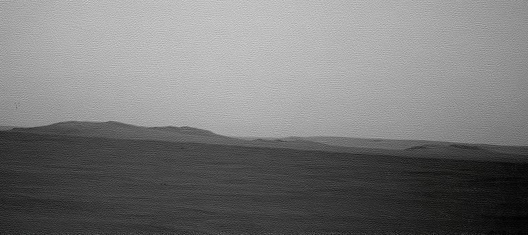 And a coulour version with L2/R1 stacking : 
-------------------- |
 |
 
|
|
May 24 2010, 09:25 PM
Post
#422
|
|
|
Senior Member Group: Members Posts: 3516 Joined: 4-November 05 From: North Wales Member No.: 542 |
Great post by Emily on the long trek's clay-rich destination. There's loads to say about it and though it's been discussed before maybe another thread on this is warranted? For now, here's the link: http://www.planetary.org/blog/article/00002509/
|
|
|
|
|
May 24 2010, 09:57 PM
Post
#423
|
|
|
Merciless Robot Group: Admin Posts: 8783 Joined: 8-December 05 From: Los Angeles Member No.: 602 |
A great article indeed by Emily, as usual!
 Seems as if the phyllosilicates are generally concentrated on the top of Endeavour's rim. If mountaineering al a Spirit proves not possible for any reason, I wonder if they're going to be aggressively looking for landslide deposits at the base of the hills? -------------------- A few will take this knowledge and use this power of a dream realized as a force for change, an impetus for further discovery to make less ancient dreams real.
|
|
|
|
|
May 24 2010, 10:54 PM
Post
#424
|
|
|
Senior Member Group: Members Posts: 3516 Joined: 4-November 05 From: North Wales Member No.: 542 |
I think we're on the same wavelength nprev. Phyllosilicdates of ancient origin would presumably be exposed at the surface in two kinds of places. Places recently cleared of more recent material by a landslide, and places newly surfaced by clay-rich landslide material. The maps in Emily's post suggest both, else why would the top of the ridge resemble patches at the bottom? On a world like Earth where active processes are going on the presence of something on the surface means it's recently exposed. The timescale on Mars may be longer but I think the same general rule applies.
|
|
|
|
|
May 24 2010, 11:18 PM
Post
#425
|
|
|
Senior Member Group: Members Posts: 2998 Joined: 30-October 04 Member No.: 105 |
This is standard practice in field geology. In an ideal world you have access (walking or otherwise) to the entire geological section. In the real world, you don't always. At a hillside, a cliff, a mine highwall or a quarry face you can many times see the rock strata but aren't able to get a sample of the rocks in-place (or in situ). The next best thing is to move along on your traverse and look at samples of float, or rocks that have broken off of the cliff face and tumbled down to your level. Landslides can be used but tend to be a bit chaotic. Using one's best professional eyeball and judgement and plucky sense of intuition you can frequently place a rock in it's proper location in the section, or at least nearest 5-10 meters of rock or show that it came from somewhere thataway.
It isn't perfect but if it's all you have to work with... --Bill -------------------- |
|
|
|
|
May 25 2010, 07:48 AM
Post
#426
|
||
 Senior Member Group: Members Posts: 2228 Joined: 1-December 04 From: Marble Falls, Texas, USA Member No.: 116 |
That was an excellent article by Emily. As nprev noted, she always writes very well.
While we are discussing Endeavor's rim and the smectite deposits discovered there, it might help to start looking at the rim more closely. Here is a HiRise anaglyph of the NW portion of the rim; the part that Oppy is driving toward. I used PSP-010341-1775 and PSP-010486-1775 respectively as the left and right images. Has anyone calculated the slope on this hill to determine if the rover would have a chance of climbing it?
-------------------- ...Tom
I'm not a Space Fan, I'm a Space Exploration Enthusiast. |
|
|
|
|
|
|
May 25 2010, 08:00 AM
Post
#427
|
|
 Member Group: Members Posts: 547 Joined: 1-May 06 From: Scotland (Ecosse, Escocia) Member No.: 759 |
On the topic of sampling phyllosilicates up the hill, landslides (if they exist) would certainly bring the rocks down to accessible levels, but I'd guess ejecta would do a better job of spreading them about, albeit in smaller quantities. The rover has become quite good a spotting ejecta blocks whose composition differs from the local generalty.
|
|
|
|
|
May 25 2010, 08:58 AM
Post
#428
|
|
|
Senior Member Group: Members Posts: 3516 Joined: 4-November 05 From: North Wales Member No.: 542 |
I think it's useful here to link back to this discussion in Nirgal's thread:
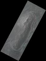
http://www.unmannedspaceflight.com/index.p...st&p=156307 QUOTE (Nirgal @ Mar 2 2010, 09:44 PM)  Upon a request posed over at the "Dust Avalanche" thread I did a small 3D DEM study of an area near Endeavour Crater based on a single image cropped from PSP_010341_1775.
 Click image to see the whole gallery. The first image shows the DEM rendered from above with the same lighting conditions as the original image so as to give an idea of the accuracy of the 3D reconstruction (note, however, that the accuracy decreases somewhat when the DEM is lit from other than the original lighting direction). The generated DEM consists of 8192x4096 = 32 million polygons with true 3D (means no texturing) post spacing at full HiRISE resolution (28.6 cm/pixel ). Here is my usual Disclaimer: the rendered DEMs are intended for visualization only. The absolute heights are not calibrated and there may be distortions due to albedo variations. |
|
|
|
|
May 25 2010, 02:56 PM
Post
#429
|
||
 Senior Member Group: Members Posts: 4246 Joined: 17-January 05 Member No.: 152 |
QUOTE (CosmicRocker @ May 25 2010, 08:48 AM) Has anyone calculated the slope on this hill to determine if the rover would have a chance of climbing it? For any of the hills visible to Oppy, you can measure the slopes transverse to the line of sight directly from the pancams - no need to calculate. I find that the steepest sustained slopes on all the visible bits are consistently around 17 or 18 degrees. There are approaches that are considerably less steep. There are also a few short stretches that approach 30 degrees. But generally that sounds quite doable - Duck Bay was in the 15 to 20 degree range. Of course this also depends on the looseness of the surfaces and the condition of Oppy at the time...
|
|
|
|
|
|
| Guest_Oersted_* |
May 25 2010, 07:04 PM
Post
#430
|
|
Guests |
I just have to second that those renderings you made, cosmicrocker, are really great! - Super-duper-top-notch stuff! - The future trek really comes to life.
|
|
|
|
|
May 25 2010, 08:44 PM
Post
#431
|
|
|
Senior Member Group: Members Posts: 4246 Joined: 17-January 05 Member No.: 152 |
Yikes, it looks like we had some dust blow through on sol 2245. Compare this view of Iazu on 2245:
http://qt.exploratorium.edu/mars/opportuni...7M1.JPG?sol2245 with this view from 2246: http://qt.exploratorium.edu/mars/opportuni...1M1.JPG?sol2246 According to the latest Oppy update, tau on 2245 was 0.421, up a little bit from around 0.32 - 0.35 in recent weeks. This is a good reminder that as spring and summer approach and dust levels rise, we likely won't have such spectacular views of Endeavour/Iazu as we do now until next winter. (Or until we're much closer, whichever comes first!) |
|
|
|
|
May 26 2010, 12:49 AM
Post
#432
|
|
|
Senior Member Group: Members Posts: 1619 Joined: 12-February 06 From: Bergerac - FR Member No.: 678 |
Yes, notice the same thing. This peak of Tau was pretty fast.
The color mosaic showing how fusy the atmosphere was : 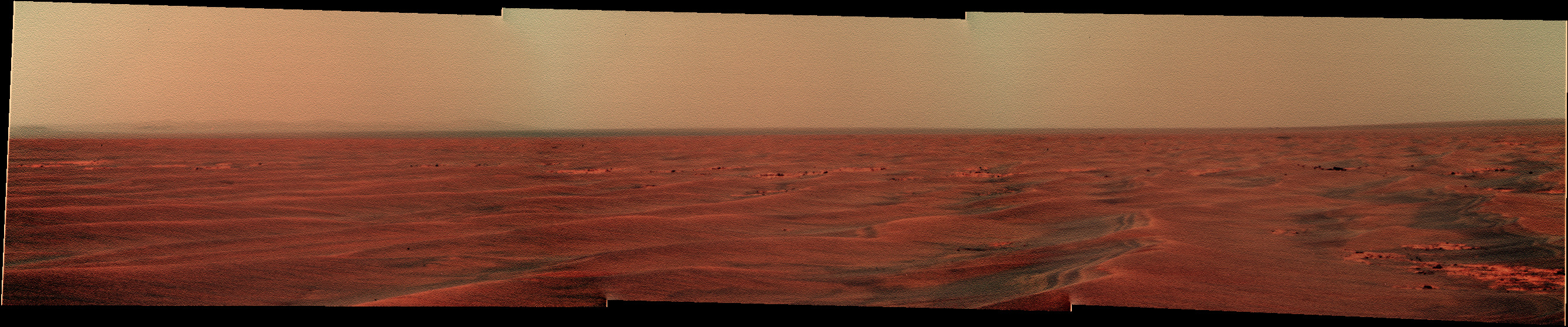
-------------------- |
|
|
|
|
May 26 2010, 04:31 AM
Post
#433
|
|
|
Senior Member Group: Members Posts: 2228 Joined: 1-December 04 From: Marble Falls, Texas, USA Member No.: 116 |
QUOTE (ngunn @ May 25 2010, 03:58 AM) I think it's useful here to link back to this discussion in Nirgal's thread: ... Thanks for reminding me of Nirgal's astounding shape-from-shading work. I see that I had missed some of his best renderings. QUOTE (fredk @ May 25 2010, 09:56 AM) For any of the hills visible to Oppy, you can measure the slopes transverse to the line of sight ... Thanks, fredk. That will work for me as an initial approximation. Sometimes, the most intuitively obvious things escape my attention. QUOTE (Oersted @ May 25 2010, 02:04 PM) I just have to second ... Thank you very much. I had a lot of fun making them. There are some very nice views of Spirit's locale, also. When I get some time to finish it, I'll post something there. -------------------- ...Tom
I'm not a Space Fan, I'm a Space Exploration Enthusiast. |
|
|
|
|
May 26 2010, 08:55 AM
Post
#434
|
|
|
Senior Member Group: Members Posts: 3516 Joined: 4-November 05 From: North Wales Member No.: 542 |
This is about the distance to the near 'horizon' in front of the Endeavour hills. I've measured the change in position of two features relative to the background hills, which I've assumed to be at 12km. I used R1 images from May 14th and today's (26th May) exploratorium updates. What I don't know is the transverse baseline length between the two vantage points. If the baseline's 50 m the distance is 2500m. If the baseline's 100m the distance is 4200m. Those estimates are bigger than I would have guessed but they seem to fit with the change in slope on the contour map.
EDIT: Re dust levels - I see that the Mule Ears are nicely visible in the latest images. I've been watching them clear then fade then clear over recent weeks. |
|
|
|
|
May 26 2010, 09:51 AM
Post
#435
|
|
|
Senior Member Group: Members Posts: 3516 Joined: 4-November 05 From: North Wales Member No.: 542 |
A similar but even more approximate triangulation estimate for the distance to the dark feature I discussed in post 407, on the plain in front of Iazu, comes out at around 10 km. That's about the right order for the CTX feature I suggested as ID but I don't know if the azimuth checks out exactly.
|
|
|
|
|

|
Lo-Fi Version | Time is now: 23rd April 2024 - 07:52 AM |
|
RULES AND GUIDELINES Please read the Forum Rules and Guidelines before posting. IMAGE COPYRIGHT |
OPINIONS AND MODERATION Opinions expressed on UnmannedSpaceflight.com are those of the individual posters and do not necessarily reflect the opinions of UnmannedSpaceflight.com or The Planetary Society. The all-volunteer UnmannedSpaceflight.com moderation team is wholly independent of The Planetary Society. The Planetary Society has no influence over decisions made by the UnmannedSpaceflight.com moderators. |
SUPPORT THE FORUM Unmannedspaceflight.com is funded by the Planetary Society. Please consider supporting our work and many other projects by donating to the Society or becoming a member. |
|