Printable Version of Topic
Click here to view this topic in its original format
Unmanned Spaceflight.com _ Earth Observations _ Whole Earth images
Posted by: elakdawalla Mar 8 2007, 04:17 PM
There are tons of Earth observing satellites producing gorgeous detailed images, but I'm trying to figure out if any of them is capable of producing full-globe images of Earth on some regularly updated basis. Does anyone here know of such a beast? Are there weather monitoring satellites that do this?
--Emily
Posted by: djellison Mar 8 2007, 04:32 PM
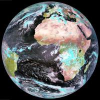
Well - there's Meteosat, the European geostationary effort - but that's just one side of said globe. The latest version of Meteosat is the second generation vehicle ( MSG ) which is producing good imagery at high res, every 6 hours. Of course that means basically one full colour image over 0 degrees per day ( the 0600 and 1800 images are, of course, half dark )
Proper website is www.eumetsat.de ( might have seen signposts for Eumetsat on the way into Darmstadt on the Bus - just opposite ESOC )
I'd recommend here - http://www.sat.dundee.ac.uk - (free reg required for good stuff) for regular full res MSG imagery as well as from other, not quite so high-res or full colour etc sats. (i.e. GOESE, GOESW, IODC, MTSAT). TECHNICALLY...one could take these multiple geostationary views, and fudge some sort of global view from them.
Also - Aqua and Terra each with my favorite polar orbiting instrument MODIS, do technically cover the entire glove at about 500m/pixel, in colour, at about 1200 and 1400 LOCAL time every day - but I don't believe they produce a daily global product, just the swathes in near real time and a lot of near realtime subset that are reprojected - http://rapidfire.sci.gsfc.nasa.gov/
I guess it depends on what you mean by global.
Doug
Posted by: Juramike Mar 8 2007, 04:39 PM
This will get you the "other" side of the globe. (click on the type of view and you'll get the full disk)
http://www.goes.noaa.gov/goesfull.html
And this will get you a full globe snapshot. (The rotating globe movie is waaaaaay cool-o!)
http://www.ssec.wisc.edu/data/composites.html
-Mike
Posted by: stevesliva Mar 8 2007, 04:40 PM
You'd have to be pretty far out there to fit the whole globe in one frame, no?
The NOAA whole-earth water vapor movies are fantastic... neat eddies.
Posted by: Tom Womack Mar 8 2007, 04:44 PM
I think you could get full-globe images by combining pictures from multiple weather satellites, but obviously you get no more than a hemisphere from anything in GEO. Earth is (if I've done my sums right) 20 degrees across from GEO, so you need some sort of scanning platform to take your detector across Earth.
Ah, this is already done: http://www.ghcc.msfc.nasa.gov/GOES/globalwv.html has global images composed from GOES-EAST (over Peru), GOES-WEST (over the Pacific), and the two Meteosats over the Bight of Benin and Sri Lanka. I suspect there's a Japanese satellite filling the gap east of India.
These don't show the poles very well for geometric reasons, and are monochrome (OK, they're trichrome, but those are 10.8u infra-red, 2u infra-red and visible).
The polar Earth-observing satellites (say http://rapidfire.sci.gsfc.nasa.gov/) get any point on Earth every few days, but clouds move fast enough that the pictures will look pretty ugly and not line up.
Posted by: tedstryk Mar 8 2007, 04:46 PM
Modis covers the entire earth every one to two days, depending on how the Aqua and Terra ground tracks fall. This page has some good stuff http://visibleearth.nasa.gov/view_rec.php?id=2429
Seawifs also gets nearly full coverage on a daily basis.
Posted by: djellison Mar 8 2007, 04:47 PM
Thought I would see just how hard it is to merge all the GEO MET IR imagery into one strip.....and the answer...with photoshop..is 'suprisingly hard'
Posted by: tedstryk Mar 8 2007, 04:47 PM
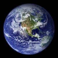
On second thought, Emily, you are breaking the law which states that the only global image of the earth is this one: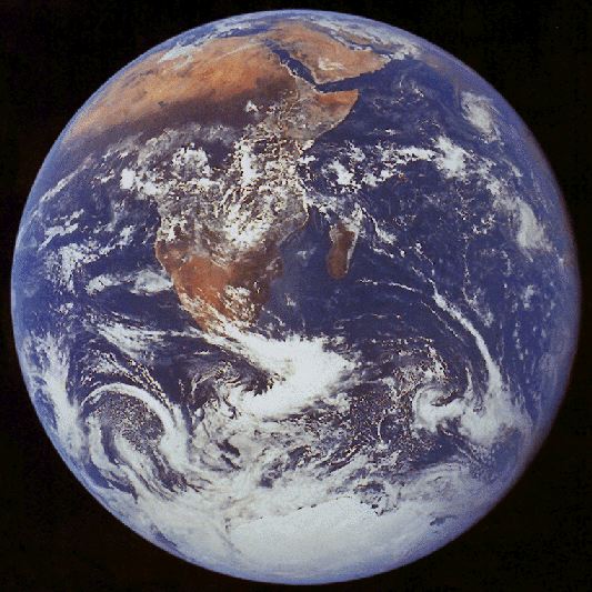
Posted by: elakdawalla Mar 8 2007, 04:49 PM
![]()
I'm asking this question on behalf of Lou, and I think what he really means by "global" is "looks like a globe" -- but then he probably wants to see the whole planet too. I'll have to find out what he really wants.
--Emily
Posted by: djellison Mar 8 2007, 04:53 PM
Again...TEEEeeechnnically - one could take one of those global composites, reproject it as a texture in realtime and render out a globe-like sphere. But that's way beyond my talents (one offs, yeah, automated every few hours...pah)
Alternatively, who's got a few hundred million to launch Triana?
Doug
Posted by: tedstryk Mar 8 2007, 05:16 PM
I want to make a comment here, but I can't without being political, so I won't. But the link I gave in the post before my last one definitely has globe-like images.
Posted by: helvick Mar 8 2007, 05:18 PM
Hey - I can see my old house in that.
Posted by: ngunn Mar 8 2007, 10:25 PM
That is just amazing, Doug. What a thing to think of doing!
Posted by: Pando Mar 9 2007, 01:53 AM
That reminds me, here's another one...

Posted by: climber Mar 9 2007, 09:39 AM
This is one of the more inspiring Earth image to me.
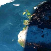
You can see city's lights on the dark side while others are still seeing the sun :
Posted by: remcook Mar 9 2007, 10:22 AM
a shame it's not a real image. Would be nice to see the bottom of the oceans and no clouds at all in the entire world!
Posted by: Juramike Mar 9 2007, 04:25 PM
I wonder if one could see the shadow resulting from the March 19th eclipse in the visible image on the Meteosat or GOES web pages?
Pity they aren't "live" webcams!
Posted by: remcook Mar 9 2007, 04:35 PM
ISS sure had a good look: e.g.
http://www.nasa.gov/vision/universe/solarsystem/sun_earthday2006.html
edit - I'm sure I've seen an animation of the moon's shadow moving across the earth, but can't find it right now.
pretty:
http://sunearthday.nasa.gov/2006/multimedia/gal_011.php
Posted by: Juramike Mar 9 2007, 06:51 PM
Very cool! I hadn't seen that before. Thanks, remcook!
-Mike
Posted by: Hari Mar 13 2007, 02:56 PM
I create global cloud mosaics for the http://xplanet.sourceforge.net project from satellite imagery downloaded from the University of Dundee. They are updated every three hours.
See http://xplanet.sourceforge.net/clouds.php for details.
Posted by: neave Mar 13 2007, 03:08 PM
EUMESAT is a geo-stationary satellite with full disc imagery in lots of spectra: http://www.eumetsat.int/Home/Main/Image_Gallery/Real-time_Images/index.htm
but can also be found via the link djellison mentioned I think.
There are plenty of full disc images in the Apollo Archive http://www.apolloarchive.com/apollo_gallery.html but they're not exactly modern ![]()
Posted by: scalbers Apr 21 2007, 11:40 PM
For clouds this is one of the things I'm working on at NOAA in connection with the Science On a Sphere project. We do have a 30-min global IR animation (interpolated to 15-min) in real-time using a mosaic from the Aviation Weather Center that I am augmenting with Japan's MTSAT data. The actual time resolution does vary over the globe depending on which satellite(s) are covering the area.
My current goal within this effort is to produce an upgraded 15-min global animation by more directly using the various geosynchronous (and polar orbiting) satellites. This will work best with the Meteosat Second Generation data that I believe would have two satellites with the full 15-min resolution over their respective areas of coverage. Other satellites would be used with appropriate temporal interpolation.
The IR mosaics exist in up to 2048x4096 resolution, though for display we sometimes reduce this by half when we wrap the animation around the sphere.
Posted by: edstrick Apr 22 2007, 07:52 AM
The fundamental problem is that there are no spacecraft that can usefully image the "whole" earth beyond geostationary orbit. From 22 thousand miles out, they see to a horizon of something like 82 north and south (and the same east and west of the subspacecraft point) It's easy to imagine the view as a hemisphere, but a matched view to something from at or beyond the moon would show the difference.
Somebody should be able to match up geostationary global data to Messenger or the failed Japanese Mars orbiter or some such mission to get a quasi simultaneous match and maybe fake it using global mosaic data to show the geostationary view you'd have directly below the deep space mission.
Posted by: DDAVIS Apr 22 2007, 09:12 AM
I used to make Earth textures from weather sats using images gathered during equinoxes when the lighting would cover the most of the planet. The availability of the high res European and Asian satellite coverage dried up on the GOES page I used to frequent and I gave up. I did manage to make one nice instantaneous Earth image which I colorised (with night lights added), and a days noon lighting global composite. A good 4K texture was just possible from these sources. Below can be seen a sample rendering from this work. I used 'Morph', a nice Mac package from years ago, to warp the images to fit a simple cylindrical projection, adding the poles from other sources.
I later did the same thing to MGS global swaths to make my own Mars albedo maps.
Don
Posted by: scalbers Apr 22 2007, 02:15 PM
Greetings,
I can show a somewhat dated example of the animation I'm working on at this URL. The current animation has an improved blending and colorizing scheme.
http://sos.noaa.gov/datasets/Atmosphere/grayscaleIR.html
Edstrick - I think the geostationary satellites see up to about 72 degrees latitude. There are an increasing number of polar orbiting satellites that would image the poles with a reasonable frequency if you take them all together.
Posted by: helvick Apr 22 2007, 02:24 PM
Steve that is stunning.
Will the newer version be made public?
Posted by: DDAVIS Apr 22 2007, 03:03 PM
In a recent update to my Earth texture I added gas flares to the night lights, but data on where the flaring takes place seems elusive. National Geographic had some flare locations shown in their recent world map so I used a lot of those, and whatever Middle East, Nigeria, and Canada flare images I could find. Does anyone know of a world map showing current gas flaring?
Don
Posted by: scalbers Apr 22 2007, 03:23 PM
Helvick - glad the animation played OK for you. It is a good question about whether this can be made public. You can see it at the dozen or so museums and such that have the SOS exhibit installed. In terms of having it online in real-time this is a bit different category compared with the single frame planetary maps I work on. There are various proprietary, bandwidth, or simply inertia and political issues that might stand in the way here unfortunately. One example is that EUMETSAT charges a significant amount for their high-resolution data. You're welcome to contact the "powers that be" to add your voice to this question. I suppose that the 5MB compressed animation that is on the SOS website could technically be updated in real-time.
By the way, the upper animation on the page looks to be the current colorization I'm using and the lower one is the older one we're phasing out. Although this is a little frustrating I am hoping to share with everyone what could be possible.
Posted by: edstrick Apr 24 2007, 09:21 AM
"...I think the geostationary satellites see up to about 72 degrees latitude...." Yes, that sounds right.
My favorite full-disc (or nearly) images of Earth are from Apollo 4, where an automated film camera filled a film magazine with images looking out a window at a fattish crescent Earth. Some are partially cut off by camera field of view or the window-frame. It should be quite possible to work those up into a pretty spectacular high-resolution (scanned film) movie like sequence showing a little Earth rotation/spacecraft-motion/illumination shift during the sequence. I have no idea long the sequence took but I'm sure (I'm sure I hope...) the data is online.
My other fav sequence is 2 image sequences from Surveyor 7 on the rim of Tycho. The Earth was low enough in the sky to be visible in the narrow angle camera view. They took 1 image sequence per day, probably through all polarizing filter positions (no color filters on the later Surveyors) showing Earth over a range of phase angles around 180 deg phase (1 day skipped?)
They also took a series of images every ?hour? on one day near the end of the mission showing a decent Earth rotation sequence of a gibbous Earth. A bit of image mapping onto a sphere to make a global map and remapping to the spacecraft view of the Earth could make a decent movie.
Posted by: ElGrifon Apr 27 2007, 12:46 AM
WOW those are just incredable images of the Earth, expecially the first one from djellison. Keep uo the great work. This is a great forum.
Posted by: djellison Apr 27 2007, 07:31 AM
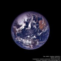
Just to fill up this thread appropriately - from the newly released Hayabusa data ![]()
Posted by: belleraphon1 May 2 2007, 12:00 PM
WOW..
These whole Earth images from departing and returning space craft are particulary evocative to me. I remember Apollo 8 transmissions in 1968. Could actually see the Earth receding.
Hayabusa has had quite a journey and I hope there will be a return image.
Craig
Posted by: elakdawalla May 2 2007, 04:10 PM
I totally forgot to return to this thread after creating some pages on the topic. Thanks, everybody, for your suggestions. Here's the two pages I've put together so far:
http://www.planetary.org/explore/topics/earth/geostationary.html
http://www.planetary.org/explore/topics/earth/spacecraft.html
I still need to add the Hayabusa images, and I know Doug's got a few more pieces of eye candy in production... ![]()
--Emily
Posted by: lyford May 2 2007, 06:10 PM
Nice collection, Emily.
I keep forgetting there's a whole sidebar on the left of the Planetary Society Website to explore.... though I can't even keep up with your blog updates! ![]()
Posted by: scalbers May 5 2007, 02:51 PM
Yes - excellent website Emily. Nice summary of the various geostationary satellites - helps me keep track of them as I contemplate further work on high frequency global animations.
I also like the images with the Earth and moon in the same frame, we live on such a colorful and vibrant planet.
Posted by: djellison May 9 2007, 07:21 AM
The page has been updated with my Galileo efforts ![]()
That Earth 1 flyby I've only ever seen as a tiny .mov or .mpg - so I had a hack at it - every 4th(ish) frame - at full res. Quite pleased with the results.
While doing that, I also found an Earth-Moon conjunction observation from the Earth 2 flyby that is very Cassini-esque ![]()
The Earth 2 flyby data is, on the whole, ruined by dropouts for some reason - truely tragic as it would have been spectacular !!
Posted by: Phil Stooke May 9 2007, 12:43 PM
Don't forget Lunar Orbiter, Surveyor and the Zonds. There are several Earth images to be found among those datasets.
Phil
Posted by: ljk4-1 May 9 2007, 01:10 PM
The Japanese Mars probe Nozomi also took images of Earth and Luna,
which you can see here:
http://www.stp.isas.jaxa.jp/nozomi/MIC/MIC_e.html
Posted by: AlexBlackwell May 9 2007, 09:52 PM
http://nssdc.gsfc.nasa.gov/imgcat/html/mission_page/ER_NEAR_page1.html
Posted by: djellison May 10 2007, 01:36 PM
I plan to do to NEAR what I've done to the Galileo E1 flyby - but I think there might be something a bit broken with NEAR MSI FITS and img2png - and I'm not even going to attempt it if I have to load each frame individually ![]()
As with the Galileo flybys, I've only really seen them put together as a movie at low res. The reason I did the Galileo one was to see it at the full res - and I think the effort was worth it.
Doug
Posted by: tedstryk May 11 2007, 01:40 PM
Great Galileo work, Doug.
By the way, there are several Zond images. The USGS site has quite a few from http://astrogeology.usgs.gov/Projects/LunarConsortium/#Zond8. Zond 7 took a color earthrise sequence. Quite a few of the frames are in my collection and all over the internet, but the color quality is poor (presumably due to poor copying, based on small samples of better copies I have seen. Here is a sequence, showing what I have been able to cobble together from multiple frames, croping out areas I couldn't generate for all images. Click on http://www.strykfoto.org/zondrise.jpg for a larger version.
http://www.strykfoto.org/zondrise.jpg
Posted by: ugordan May 11 2007, 01:54 PM
Wow, awesome, Ted!
Posted by: ugordan May 14 2007, 11:54 AM
I see Doug's Galileo Earth rotation made APOD today, congrats! ![]()
I was browsing through the rotation sequence raws myself and something struck me as interesting. There's a few frames that exhibit a bright glint-like speck somewhere above Argentina. It's visible in several different filter frames and it's not camera-related as it's fixed to Earth in subsequent frames though the glint appears to move slightly along the groundtrack. It's much brighter than the rest of the cloud structure visible so I was wondering if anyone has any theories?
It can be seen as a green-red charge bleed in this composite:
http://m1.freeshare.us/view/?145fs47938.png
The brightness difference between the speck and the rest of the clouds is much lower here due to the processing than it is in the original frames.
Posted by: djellison May 14 2007, 01:31 PM
It's a specular reflection off a lake in Uraguay or Argentina I think - if you run through all the images you can see it very very clearly.(when I say all, I mean every image, i.e. r, ir, g, ir, v..etc etc)
Just guessing - but my initial thoughts were that rough oceans with large amplitude waves dont produce a pin sharp specular reflection from the sun. A small lake - which could be almost totally flat - would produce a sharp specular highlight.
APOD - Sweet - I had no idea ![]()
Doug
Posted by: ugordan May 14 2007, 01:39 PM
I thought about a lake specular, the specular point is in about the right location, but the area seemed to be clouded over to actually see a lake. If it's actually a lake, it's great to see how much brighter speculars on a flat surface are than oceanic specular "point". As the specular point is tighter when the surface is less rough it goes to show what a cool coincidence this turned out to be.
Imagine seeing something of the sort on Titan...
Posted by: tedstryk May 14 2007, 02:08 PM
Emily, you are welcome to add this to the planetary society page, but remember the version I linked to is larger.
Posted by: djellison May 14 2007, 02:18 PM
It's not packed solid cloud though - it's bitty, hazy perhaps -not full on blanket covering. Certainly enough to let the reflection through ![]()
Doug
Posted by: elakdawalla May 14 2007, 03:00 PM
Thanks, Ted! I've been out of town for a few days, so a bit out of the loop, but I'll be back home tonight and will DEFINITELY add your cool Zond images to the site.
And congrats on APOD, Doug!
--Emily
Posted by: Phil Stooke May 14 2007, 03:23 PM
Just to clarify one point, Ted's Earthrise is actually an Earthset. So is the famous Lunar Orbiter 1 view of Earth over the lunar horizon. Only Apollo (among those early missions) saw the Earth rise.
Phil
Posted by: tedstryk May 14 2007, 03:47 PM
Doug: Congratulations!
Phil: I had no idea. The images come from a variety of sources, and I ordered them without even considering that it might be an earthset!
Posted by: tedstryk May 14 2007, 03:58 PM
Here we are then...
http://www.strykfoto.org/earthset.jpg
Posted by: DDAVIS May 27 2007, 01:40 AM
In images 2 and 4 of the Zond sequence the Lunar horizon part of the photos are identical with no perspective change as one would expect from an actual orbital sequence. Only three of the images are thus part of a valid sequence.
I would love to have a full res color version of the 'Earthset' Zond image TASS released in B&W, which I saw and photographed at the Hansen Planetarium when I worked there.
Don
Posted by: tedstryk May 27 2007, 02:00 AM
It is actually image 2 that isn't a valid part of the sequence - I created it using image one and three in order to even up the time intervals.
Posted by: Ant103 Jul 20 2007, 01:26 PM
It's not a whole Earth picture but it's of topicality (dust on Mars... dust on Earth) :
http://www.studiolentigo.net/upload/PoussièreSaharienne-19juill2007-18h.jpg
(taken yesterday à 6 A.M by MSG2)
Posted by: climber Jul 20 2007, 07:27 PM
il marche pas le lien
Posted by: CAP-Team Jul 20 2007, 08:53 PM
http://www.studiolentigo.net/upload/Poussi%e8reSaharienne-19juill2007-18h.jpg link works ![]()
Posted by: LivingNDixie Jul 23 2007, 04:51 PM
This is one of my favorites, it makes a great wallpaper on your computer.
Posted by: djellison Jul 23 2007, 08:37 PM
That's just renered from the Blue Marble data set. Nice - but not real ![]()
Doug
Posted by: MouseOnMars Jul 23 2007, 11:13 PM
The Japanese GMS-5 satellite used to produce full disc images every half an hour. By the time I managed to construct a rather rough animation of full disc cloud movements their camera was failing (as you can see in the following animation).
http://www.divshare.com/img/1351759-98e.gif
(Click for larger)
mouseonmars
Posted by: scalbers Oct 9 2007, 03:16 PM
Hi - there are a few images collected by NASA at this link:
http://eol.jsc.nasa.gov/scripts/sseop/PhotoIdSets/PhotoIdSets.pl?set=EarthDisc
Posted by: ugordan Oct 9 2007, 04:50 PM
Great resource, Steve! Images I hadn't seen before. I only browsed the few images from the Apollo set, but it looks like a gem.
Sadly, the highest resolution versions have too high a compression ratio set and the scans turn weirdly green. I tried to remove the green background.
Two nice Apollo 8 shots, reduced in size:
http://www.fileden.com/files/2007/9/14/1431389/ISD_highres_AS08_AS08-14-2517%20new.jpg http://www.fileden.com/files/2007/9/14/1431389/ISD_highres_AS08_AS08-16-2657%20new.jpg
I'm a sucker for those thru-the-window shots or, in general, views which show objects of recognizable size with which a human can relate.
Apollo 10 Earthrise, always an awesome sight. So they say...
http://www.fileden.com/files/2007/9/14/1431389/ISD_highres_AS10_AS10-27-3893%20new.JPG
Posted by: MouseOnMars Oct 9 2007, 07:59 PM
http://eol.jsc.nasa.gov/scripts/sseop/PhotoIdSets/PhotoIdSets.pl?set=EarthDisc
Cripes. Thanks scalbers. I found that site ages ago. The highest resolution images of this type I've come across before. Complete with views of the Earth taken out of the Apollo mission ports that I did'nt know about. I then lost the address and no one seemed to know what site I was talking about
MouseOnMars
Posted by: ljk4-1 Oct 10 2007, 07:31 PM
Twin Blue Marbles
http://earthobservatory.nasa.gov/Newsroom/NewImages/images.php3?img_id=17794
Posted by: Stu Oct 10 2007, 09:12 PM
Those new Twin Blue Marble images are just spectacularly beautiful, thanks for the link.
Truly an oasis in the dark ocean of space...
Posted by: ustrax Oct 10 2007, 10:01 PM
Truly an oasis in the dark ocean of space...
Yes they are Stu!...Thank you all!
All the provided links are true treasures...don't know why, maybe because I had dinner at an indian restaurant nearby, I became all mystical looking at those images and thinking about all the solid ground I have covered with my own feet in this incredbly small and fragile parcel of the Universe...Man!...How priviliged are we?!...
Posted by: ugordan Oct 22 2007, 08:03 PM
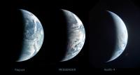
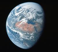
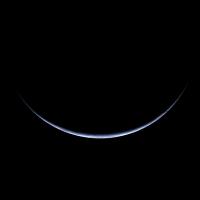
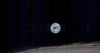
Here's a side-by-side comparison of 3 crescent Earth shots at a similar phase angle. They were all tweaked from what is officially available to make ocean color more similar to each other. From left to right: Kaguya, MESSENGER and Apollo 4. North is up only in Kaguya's image.
Posted by: chuckclark Nov 23 2007, 05:59 PM
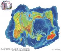
Here is another way to see -- and think about -- the whole globe: with a map, of course. Some of the above posts have been map-like.
This is a constant-scale natural boundary world map of Earth.
Its boundary is a portion, the Atlantic Ocean portion, of the mid-ocean ridge. You might, if you want, follow along with what I learn is called "the Wilson cycle": where the spreading apart of the Atlantic Ocean floor will eventually push closed the Pacific Ocean. That idea, I also hear, is a lot of simplistic, anthropomorphic bunkum. I don't mean to take sides in any argument here, just to point out that with a little ingenuity world maps may be fashioned to illustrate ideas global in scope.
Something meant to address climate change, to reveal large scale patterns in meteorology, a CSNB world map edged by continental divides, for example, would look entirely different.
I'm new around here, and have only recently looked through the "new" rules. It's hard to imagine how this string of posts relates to unmanned space flight. But given the drift of this conversation, I just wanted to add this to the discussion of whole earth views of ther globe.
Posted by: dilo Nov 25 2007, 05:53 PM
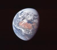
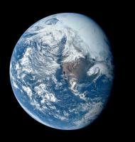
Cool picture, n1ckdrake! Which source/mission? Apollo?
Herebelow an improved crop I made (in particular, color/contrast adjust and sharpening)... I think is a perfect wallpaper! ![]()
Posted by: Paolo Nov 25 2007, 06:50 PM
very cool indeed, and dilo and me we are almost right at the center of it!
Posted by: remcook Nov 25 2007, 08:00 PM
oeee is that a Kelvin wave? Cool!
Posted by: n1ckdrake Nov 26 2007, 03:27 AM
The photo of the Earth is from the Apollo 10 mission, taken at a distance of 100,000 nautical miles. Here is the link to the http://eol.jsc.nasa.gov/scripts/sseop/photo.pl?mission=AS10&roll=34&frame=5026&QueryResultsFile=119604575369802.tsv
Posted by: n1ckdrake Nov 26 2007, 04:10 AM
This image is from the Apollo 16 mission.
http://eol.jsc.nasa.gov/scripts/sseop/photo.pl?mission=AS16&roll=118&frame=18885&QueryResultsFile=119604999458042.tsv
Posted by: dvandorn Nov 26 2007, 05:17 AM
I knew it had to be from one of three missions -- Apollos 10, 11 or 15 -- due to the amount of the North Pole illuminated by the Sun. Since we appeared to be further from solstice than July, my best guess was Apollo 10 (which, of course, flew in May).
Nice to see I was right!
-the other Doug
Posted by: dvandorn Nov 26 2007, 05:20 AM
This view is almost identical to the view televised from Apollo 16 immediately after transposition and docking, which was by far the best image of global Earth ever transmitted via television from an Apollo spacecraft.
-the other Doug
Posted by: peter59 Dec 29 2007, 04:04 PM
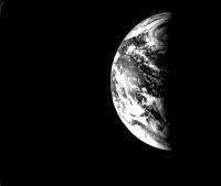
This image is from the Mariner-10 spacecraft.
Image FDS0014553 (November 1973)
Posted by: ugordan Feb 5 2008, 02:59 PM
Here's a montage of Earth and Moon from MESSENGER. I used both the blue and violet filters for Earth because they're fairly narrowband and the violet filter better captures the Rayleigh scattering effect of the atmosphere than the longer wavelength blue. The Moon is a narrow-angle image taken a couple of days earlier and colorized using much lower resolution wide-angle data.
Earth is presented in a gamma-correct version so the contrast is different than in the official release. Earth's color balance is based on recent digital imagery from the Shuttle/ISS missions. I'm always striving to improve Earth's color in my images, this is currently my best guess and I'm fairly pleased with how it turned out.
http://farm3.static.flickr.com/2339/2237142824_6032da8aef_o.png
Posted by: Stu Feb 5 2008, 03:23 PM
Oh my....
"Beautiful" doesn't even begin to do that justice.
Can't help wondering what it will be like for the astronauts of the future, to see that view through their spaceship window as they come home after a mission to Mars, or Europa, or to another star...
Just magical.
Posted by: djellison Feb 5 2008, 03:24 PM
I wonder if, with the Dawn flyby - we might get a similar view of Mars. We have a recent similar shot of Mercury, and Venus - it'd be great to wrap up a nice inner-solar system family portrait
Posted by: ugordan Feb 5 2008, 03:41 PM
Now that you mention it, the Mercury image and this one do have almost completely the same phase angles.
Speaking of Mars, I wonder how much longer it's going to be before any Rosetta data hits the PSA (*cough*Mars flyby*cough*)...
Posted by: rogelio Feb 5 2008, 03:54 PM
Nice picture, ugordan.
Are those smoke plumes from Amazonian forest fires? (I'm referring to the wispy features to the south of the river, not the obvious clouds to the north).
If so, it's quite sobering that they could be seen from 10,000's of km away...
Posted by: charborob Feb 5 2008, 04:12 PM
Very nice image, except the Moon is not in its correct orientation. We can see features invisible from Earth, namely Mare Orientale and part of the farside
Posted by: ugordan Feb 5 2008, 04:19 PM
I said it's a montage, not an exact scene visible from the spacecraft. The Earth-Moon system did not look like this at any single time during the flyby, the phase angle difference makes that pretty obvious. Think of it as "artistic license" - putting the moon "closer" to the source of illumination because it's at a higher phase angle. As to putting the Moon to the left of the planet (at that time it was waaay up and to the left of Earth), I dunno, this looked more aesthetic to me. I didn't want to put the Moon in an inset box either for that reason.
Rogelio, I can't tell if those are forest fires or not. The official image advisory doesn't mention them, but I've found a site concerned with forest fires which claims the 2005 year was particularly bad in terms of fires in the Amazon (something about reduced rainfall that season). It does look like smoke, but then again, it could be low haze due to air humidity in the region. It's widespread all the way to the Andes so I'm inclined to say that's indeed smoke. I can't find any GOES-East satellite archive going back to August 2005 to better see what that was.
Posted by: tedstryk Feb 5 2008, 05:15 PM
Amazing!
Posted by: Ant103 Feb 5 2008, 05:42 PM
Good god ![]()
I've found the desktop wallpaper of the day ![]() .
.
Thanks ![]() .
.
Posted by: centsworth_II Feb 5 2008, 06:23 PM
But the image is not seen from the Earth's perspective.
Posted by: remcook Feb 5 2008, 06:28 PM
amazing work as usual!
Posted by: Juramike Feb 8 2008, 12:07 PM
Thank y'all for this thread!
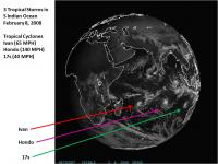
Using these resources I was able to snag an image taken today (February 8, 2008) of three tropical cyclones simultaneously churning in the South Indian Ocean.
(Starting to look like Jupiter down there, isn't it?)
This site was used to access this image: http://www.goes.noaa.gov/goesfull.html
-Mike
Posted by: Stu Feb 9 2008, 08:39 AM
Me too! Thanks for giving me permission to use it, Gordan!
http://journals.aol.com/stuartatk/Cumbrian-Sky/entries/2008/02/05/theres-no-place-like-home.../3382
Posted by: ugordan Feb 9 2008, 05:16 PM
You're welcome, Stu! ![]()
Posted by: Juramike Jul 6 2008, 08:51 PM
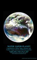
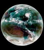
Combination of Water Vapor (primarily), Infrared, and Visible images from the GOES-East geostationary satellite. These images were downloaded from the Dundee Receiving Station http://www.sat.dundee.ac.uk/auth.html today (images for July 6, 20081500 UTC)
Aqua and blue tones indicates higher levels of water vapor, while maroon tones indicate drier air.
In the central Atlantic, Tropical Storm Bertha can be seen leaving a trail of clouds to the east as it pumps water vapor into the atmosphere.
-Mike
Posted by: ugordan Jul 6 2008, 08:58 PM
Ooh... funky stuff!
Posted by: DDAVIS Aug 3 2008, 01:02 AM
Thanks to Robert Beal of the John Hopkins Applied Physics Lab, I now have on my site a copy of the first color image of the Earth as a disk. It was made September 20, 1967 by the Department Of Defense Gravity Experiment satellite (DODGE). He worked on the mission, painting the spherical color target at the end of the boom and photographically assembling the color image. Beal sent me a file based on a print he made, which he had color balanced to resemble the ATS Earth image on my site. Upon my request he reconstructed the color scheme of the poorly imaged target from memory. I was told the colors used, similar in philosophy to Surveyor, were radiation resistant paints which happened to be of low saturation. The idea of a spherical color target is interesting, and strikes me as ingenious. If both target and background are sunlit the target can supply useful information at a wide range of lighting angles. Has this method been used in other camera carrying spacecraft?
In a separate version I have repainted the color target, fixing the motion blur in the boom in the blue channel, and tried to 'fine tune' the Autochrome like image into a kind of 'reconstruction' of how it might have appeared if all imaging steps worked ideally.
http://www.donaldedavis.com/2003NEW/NEWSTUFF/DDEARTH.html
Don
Posted by: Stu Aug 3 2008, 07:13 AM
That's quite a coup you have there, well done. I had no idea images like that were being taken so early on. Thanks for sharing it with us here. ![]()
Posted by: Pertinax Aug 4 2008, 03:50 PM
A bit late but hopefully still helpful....
http://www.ncdc.noaa.gov/gibbs/image/GOE-12/VS/2005-08-02-15
Posted by: Juramike Aug 21 2008, 02:51 AM
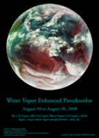
Animated loop of the Atlantic Basin of the Earth from August 10-20, 2008 in Amazing AquaVision (click to launch 1 Mb animated GIF):
Tropical Storm Fay (AKA "The Joker") can be seen pulsing her way into the Florida peninsula.
-Mike
(I gotta figure how to host the big version somewhere...)
Posted by: PhilCo126 Aug 21 2008, 06:19 PM
Nice picture, ugordan, Moon orientation a bit too close to Earth... otherwise no remarks ![]()
Posted by: hendric Aug 21 2008, 07:28 PM
Juramike,
The best places for weather discussion I've found is Weather Underground, www.weatherunderground.com. Check out their blogs.
Posted by: Juramike Aug 21 2008, 10:24 PM
Weather Underground is a great site. I'm a huge fan of the Tropical blog.
The water vapor images of the Earth make our own planet seem so...alien. The overall beltlike appearance in the Water Vapor images of moist zones and dry zones make Earth look much more like Venus (with Earth just having a few more nodes).
The things that really piqued my interest in the (tiny) loop above are the clear zones that seems to be forming around and beyond developing warm core tropical systems like Tropical Storm Fay and Invest 94. These dark, dryish surrounding zones seem to actually "push and clear" into the ITCZ. I've just spent a few hours prowling on the web trying to figure what makes these clear zones in the Water Vapor loop (without much luck). The smaller swirls at the edge of Saturn's South Polar Vortex (multispectral imaging in http://photojournal.jpl.nasa.gov/catalog/PIA08333) look kinda similar, as if the isolated eddies are "pushing and clearing" into surrounding belts. Are they formed by the same mechanism or totally different? Who knows?
It's fascinating how overall similar the structures are. Even the swirling loops around Antarctica look like Earth has it's own South Polar Vortex - just with a more fluid and changing boundary.
-Mike
Posted by: jamescanvin Sep 15 2008, 07:33 AM
Images of storms are rather off topic for this thread, i've moved them to a new one:
http://www.unmannedspaceflight.com/index.php?showtopic=5470
Posted by: Juramike Jul 23 2009, 03:16 PM
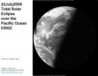
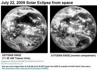
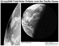
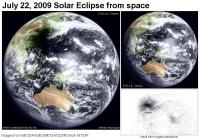
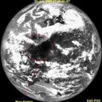
Geostationary satellites caught the 22July2009 Eclipse!
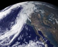
Here's a striking shot over the Pacific Ocean from the GOES-W satellite at 0300 UTC:
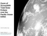
Hi-res zoom of same region:
And here is an image from MTSAT over Asia, comparison with the day before image shows where the shadow is:
NASA's Earth Observatory has color images taken at 8:30 AM and 9:30 AM Tiawan local time. (0300 Z = 11 AM Tiawan time?):
http://earthobservatory.nasa.gov/IOTD/view.php?id=39520
-Mike
Posted by: jmknapp Jul 24 2009, 01:56 PM
This may be 180° off-topic, but are any photographic (or pseudo-photographic) "whole sky" images available? Showing, say, the visible night sky from Earth on a cylindrical projection?
Posted by: Hungry4info Jul 24 2009, 02:59 PM
I don't know much about this... but shouldn't the geostationary satellites catch a solar eclipse every time?
Posted by: djellison Jul 24 2009, 03:04 PM
They do.
Posted by: lyford Jul 24 2009, 05:15 PM
I am confused - a geostationary orbit is fixed over a point of the earth - wouldn't that mean that they would only see an eclipse in the hemisphere they can see?
Would this http://en.wikipedia.org/wiki/Deep_Space_Climate_Observatory (which appears to have http://dsc.discovery.com/news/2009/04/02/gore-sat-satellite.html) have a better view of the only sunlit side and thus all eclipses? Or would a satellite at the Earth-Sun L1 just see the transit of the moon across the earth's sunlit face rather than it's shadow?
Posted by: centsworth_II Jul 24 2009, 05:24 PM
The geostationary satellites (plural) do see every eclipse. Not every individual satellite sees every eclipse though.
Posted by: Juramike Jul 24 2009, 06:16 PM
They do but the timing of the publicly available images has to match up to work. GEOS-W images are available every 3 h period, at 0000, 0300, 0600, etc. So for us in the "cheap seats" you need to have the shadow visible in the illuminated field of view at the right time.
The satellite over the southern Indian Ocean (I forget the name offhand) only has images available every 6 h time point. The timing didn't match, I couldn't find an image of the shadow over India/SW China.
So far I've only found 2 images of the shadow: The GOES W 0300 UTC observation and the METSAT 0300 UTC observation. (+ the NASA processed image of the 0130 observation which is not available to the public as a "raw image"?)
Both of these are thus two images of the shadow at the same time and place but from two different viewpoints high above the Earth.
Posted by: scalbers Jul 25 2009, 02:56 PM
Yes, here's one version (go to FTP link)
http://sos.noaa.gov/datasets/solar_system/all-sky.html
Posted by: dilo Jul 26 2009, 12:14 PM
With some delay, I made a couple of wallpaper compositions with such images, with some denoise in the former and a "difference" image in the latter.
Posted by: jmknapp Jul 26 2009, 12:44 PM
http://sos.noaa.gov/datasets/solar_system/all-sky.html
Excellent... wish I had skies dark enough to see that!
Posted by: NGC3314 Jul 26 2009, 06:01 PM
The good news is that the PC planetarium program Desktop Universe incorporated a color CCD mosaic covering the whole sky. The bad news is that the company producing it seems to have vanished, and secondary vendors may or may not have copies. (I meant to buy a copy, really I did). It's not too hard to make something usable from a star catalog, perhaps augmented with some fisheye Milky Way pictures. Yeah, I meant to do that background production once too...
Edit - I just saw the previous post with an ftp address for Axel Mellinger's wonderful all-sky mosaic. I can't get to it (something about too many redirects). If that's a persistent problem, he has versions on http://home.arcor-online.de/axel.mellinger/.
Posted by: scalbers Jul 26 2009, 06:52 PM
Yes, here's the FTP link to the cylindrical version I was mentioning:
ftp://public.sos.noaa.gov/astronomy/milky_way/all_sky/2048.jpg
Posted by: Hungry4info Jul 26 2009, 09:34 PM
That cylindrical map isn't aligned with the celestial north pole at top v_v. But it is pretty ![]()
Posted by: Phil Stooke Jul 28 2009, 11:16 AM
Chandrayaan saw the eclipse:
http://www.isro.org/pslv-c11/photos/moon_images.htm
Phil
Posted by: dilo Jul 28 2009, 05:07 PM
Cool, a very special viewpoint! I made a rough animation, correcting different zoom of images... slight orientation/aspec ratio differences still visible, however (do someone knows original images without caption?).
Posted by: ugordan Aug 5 2009, 06:38 PM
Check out the time-lapse footage of the eclipse from the Echostar 11 GEO satellite: http://www.youtube.com/watch?v=TV5y0wFA_GM
Posted by: Juramike Sep 2 2009, 12:30 AM
Something I've been working on for a while...combining multichannel IR images of Earth in a meaningful way.
Here is the new and improved pseudocolor Aquavision view of Earth:
IR4 [10.7 um], IR2 [3.9 um], and WV [6.7 um] are all combined using a complex channel mix into the RGB.
Here are what colors the correspond to:
aqua: water-laden air at mid-latitudes
red/brown: dry air
white: cold thick cloudtops (cumulonimbus)
purple/magenta: cold cirrus clouds (outflow)
hazel: warmer suface stratus clouds or fog
(IR2 measures lower level surface cloud temps, while IR4 measures upper level ice cloud temps)
Hi IR2 emission/Lo IR4 emission = DarkIR2/WhiteIR4 = warm surface terrain /cold ice clouds = cirrus
Lo IR2 emission/Hi IR4 emission = White IR2/DarkIR4 = cold surface terrain/ warm high altitudes = stratus or fog.
Note how Hurricane Bill causes downwind (in this case to the NE) flow effects like storms on Jupiter.
At some point I'm gonna apply this technique to another planet....
-Mike
Posted by: ugordan Dec 20 2009, 09:38 PM
This one has been itching me for years. I've animated all but the ending couple of overexposed frames - in total 54 frames, in color.
First, a regular animated GIF (caution, it's over 8 megabytes) can be found http://www.flickr.com/photos/ugordan/4200521241/ on my Flickr page. Second, an experiment with motion interpolation where I "upsampled" the framerate 5x. The resulting AVI (DivX codec) runs at a smooth 25fps and can be found http://www.fileden.com/files/2007/9/14/1431389/gal_ea_mo_compensated.avi. The motion compensator obviously can't cope well with features emerging from the terminator, but overall it doesn't look half bad. If I find a better motion compensator, I might update this.
The sequence ended up more difficult than I expected, partly due to significant data dropouts, partly due to noise level. One set had the IR filter miss the scene completely, and another frame had a bad violet filter dropout so they were real salvage jobs. Significant underexposure, Galileo SSI 8-bit A/D converter combined with the fact this is presented gamma-corrected produced ugly background noise that took considerable effort to clean up.
Here are two higher quality takeouts, using the overexposed infrared/violet frames at observation start and end, one optimized for the Moon, the other for the Earth:
http://www.flickr.com/photos/ugordan/4195211759/
http://www.flickr.com/photos/ugordan/4197705030/
Posted by: elakdawalla Dec 20 2009, 11:16 PM
Oooh awesome awesome awesome, Gordan.
Did I mention AWESOME?
Can you explain what causes the "glow" around Earth's limb?
This is tremendous. I've looked at that data and I know how gungy it is -- it took a lot of work! Thank you!
I enjoy the specular reflection off of the oceans!
Does anybody have any brilliant ideas on how to find out what was happening in terms of weather on December 8, 1992? The animation appears to cover the Pacific Ocean, Australia, and Asia, finishing with eastern Africa on the terminator.
--Emily
Posted by: ugordan Dec 21 2009, 12:05 AM
First I have to ask if it's the same brightness as in the GIF, because it's supposed to be? If it's not it didn't turn out right and it's a funkiness to the AVI codec instead.
It's just the fact that in the end, the SSI is still just a real-world camera with its limitations. The optics are imperfect - diffraction/diffusion internal to the camera cannot be avoided. As I said, this was meant to more accurately convey actual contrast. The usual processing given to images enhances the contrast, suppressing darker areas more and as a result hiding low background noise and such soft diffuse glow around bright objects. Cassini's cameras exhibit this as well (and I'm not talking about that haze problem). My guess is it's the filter as long wavelength infrared filters ehxibit this diffuseness more, on both Cassini and Galileo.
P.S. This sequence was taken between 16 Dec 1992 15:40 UTC and 17 Dec 1992 04:50 UTC. At the beginning you can just see the Americas moving off toward the limb.
I just realized that makes it 17 years almost to the day since that observation. 17 years, wow...
Posted by: scalbers Dec 21 2009, 12:32 AM
Emily - we might be able to correlate with these views for the 16th. I can key on the storm over Australia in both images.
http://www.ncdc.noaa.gov/gibbs/html/GMS-4/IR/1992-12-16-21
http://www.ncdc.noaa.gov/gibbs/html/GMS-4/VS/1992-12-16-21
Other times and satellites can be selected here:
http://www.ncdc.noaa.gov/gibbs/availability/1992-12-16
It's fun though difficult to try and see cloud motions in the Galileo animations.
As a side note I'm considering trying to make simulated real-time global visible satellite images that should give much the appearance of the Galileo animations using Science On A Sphere. These would have the terminator and night-time lights added for some sort of realism.
Posted by: Lightning Dec 21 2009, 01:02 AM
I just wonder which is the first image of the "full" disk of Earth ? Should it be an image taken by Luna 1 or Pioneer 4 ?
It's hard to find full data of those spacecrafts to check that, but maybe you may know... ![]()
Posted by: nprev Dec 21 2009, 01:16 AM
Good question. Definitely not any of the early Lunas, and IIRC none of the Pioneers before P10 even had cameras. I'd actually bet that it was one of the Lunar Orbiters (LO3?)
EDIT: No, wait a minute: Might have been TIROS 1. Will check it out.
Posted by: Lightning Dec 21 2009, 01:20 AM
Apparently, it's before Lunar Orbiter 1:
http://nssdc.gsfc.nasa.gov/imgcat/html/object_page/lo1_h102_123.html
I quote: "This is the first good image of the Earth taken from the vicinity of the Moon, 380,000 km away."
For me, "good" means that there were bad pictures earlier.
Posted by: Lightning Dec 21 2009, 01:27 AM
And this can not be TIROS 1, as its apogee is only 756km. I even think that the first geostationnary satellites may not be the first to take that picture, as very elliptical orbits (reached before GEO) can allow observing the entire earth.
Posted by: DDAVIS Dec 21 2009, 04:53 AM
which is the first image of the "full" disk of Earth ?
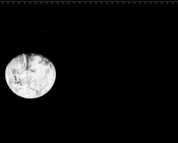
The first crude B&W television image of the Earth as a disk was made by a Soviet weather satellite on May 30, 1966. The first crude color image of Earth as a disk was made by the Department Of Defense Gravity Experiment satellite (DODGE) operating between July and November 1967
http://www.donaldedavis.com/2003NEW/NEWSTUFF/DDEARTH.html
Posted by: Lightning Dec 21 2009, 02:47 PM
Great, thanks for all those information !
But do you have any idea of the identity of that "Soviet weather satellite" ? Because I have controversal sources. According http://www.brainyhistory.com/events/1966/june_25_1966_131631.html, Kosmoss 122 is the first soviet weather satellite and has been launched... the 25th June 1966 (after your image snap date).
But according to the ESA page http://www.esa.int/esaMI/Space_Year_2007/SEMP4FEVL2F_0.html, the first soviet weather satellite is Kosmos 144, launched in Feb. 1967. ![]()
Other sources have more fuzzy descriptions of Kosmos 122, such as http://www.flightglobal.com/pdfarchive/view/1978/1978%20-%202635.html, describing it as the first soviet weather satellite of the Meteor class (as a prototype).
Posted by: ugordan Dec 21 2009, 04:02 PM
Wow, I didn't realize you could go back and look at the weather this far back. Thanks, Steve. Nice to see the weather matching up between the two sources.
A fun fact - Galileo was 6.15 million km from Earth at the start of the sequence and that increased to 6.58 million km at the end. At that distance, the Moon is just 6% closer in so the relative sizes of the two bodies are preserved fairly well. Also, during those 13.5 hours Galileo actually covered more than one lunar distance. Sure doesn't look so in telescopic imagery, does it?
EDIT: Using Steve's link above, these two observations were near-simultaneous (to the minute), they indeed match the clouds right down to the terminator line.
http://www.fileden.com/files/2007/9/14/1431389/australia_19921216_2330.png
Posted by: DFinfrock Dec 22 2009, 02:38 AM
I don't have any "brilliant ideas". But here are a couple of comments and links that might prove useful:
The first link shows winds at 500, 700, and 850 mb, along with the surface analysis for 8 Dec 1992.
http://www.meteo.psu.edu/~gadomski/NARR/1992/us1208.php
Unfortunately, these maps only cover the continental US. But notice the trough on the west coast. That accounts for the clouds visible in western North America. And interestingly, resulted in storms that produced 5 inches of rain in Los Angeles, and over two feet of snow in the Sierras.
This PDF link to the Weekly Weather and Crop Bulletin for the week of 6-12 December 1992 shows the resulting weather (primarily focused on precipitation) in the US and elsewhere around the world. But it is weekly summaries, rather than detailed weather for 8 Dec 1992.
http://usda.mannlib.cornell.edu/usda/waob/weather_weekly//1990s/1992/weather_weekly-12-15-1992.pdf
Probably not of much use. But Emily's question piqued my interest. And yes, Gordan, the animation is fantastic! Thanks again for your great work here.
Posted by: ugordan Jan 2 2010, 03:51 PM
Here's another Earth animation, this one a Deep Impact a.k.a. EPOXI HRI sequence taken March 18/19 2008 from cca. 27 million km. The images are blurry, I deconvolved them but that introduced ringing artifacts. A special thanks to Sean Walker for pointing me to MaxIm DL 5 I used for deconvolution. I used the supplied PSF for the imager on the data volumes. Here's a comparison of a source image and deconvolved one (click):
http://i108.photobucket.com/albums/n15/ugordan/epoxi_comparison.png
The sequence consists of 97 frames taken every 15 minutes and spanning one whole day. For some reason a couple of frames wouldn't converge in deconvolution, these are noticeable as blurred frames. Also, the calibrated data apparently had a line of noisy/hot pixels running near the center of detector, deconvolution made it worse and Earth's terminator is artifacted in some frames, notably at the beginning.
The animated gif (5 megabytes) can be found http://farm5.static.flickr.com/4062/4236608923_1b003276df_o.gif.
The first and last frames are exactly 1 day apart, http://i108.photobucket.com/albums/n15/ugordan/americas_1_day.gif showing cloud evolution in the Pacific. Corresponding satellite imagery (GOES 11): http://www.ncdc.noaa.gov/gibbs/html/GOE-11/VS/2008-03-18-18 and http://www.ncdc.noaa.gov/gibbs/html/GOE-11/VS/2008-03-19-18. Even though there are ringing artifacts due to deconvolution, more of the smaller cloud details than I anticipated are actually real, as illustrated here.
While the Galileo animation was taken near winter solstice, this was taken very close to spring equinox and illustrates a difference in illumination - both sequences have the sun to the right, but Earth spins differently.
EDIT: fixed the few exceedingly blurry frames in the animation.
Posted by: scalbers Jan 2 2010, 04:01 PM
Gordan, pretty impressive results for the deconvolution as I could see some of the cloud features in your comparison. I suppose having the PSF helped, as well as maybe high bit resolution in the dataset. Nice to have the animation span an entire day as I can see all the continents coming into view.
Posted by: djellison Jan 2 2010, 04:06 PM
Make me wonder just what the genius of people like Damian Peach et.al. could do if we all lived on Mars, and Earth was just an astronomical target through 12" telescopes. I think it would be quite a lot like that image sequence. Awesome work!
Posted by: ugordan Jan 2 2010, 04:08 PM
Steve, yes, this observation is at a significantly larger pixel scale than the Moon transit sequence from May 2008. Every bit helps.
Doug, without a doubt, to anyone living on Mars Earth would be competing with Jupiter as the most photogenic object out there!
Posted by: nilstycho Jan 20 2010, 04:52 AM
http://nssdc.gsfc.nasa.gov/imgcat/html/object_page/lo1_h102_123.html
I quote: "This is the first good image of the Earth taken from the vicinity of the Moon, 380,000 km away."
For me, "good" means that there were bad pictures earlier.
This image has been cleaned up by LOIRP, and can be viewed http://www.lpi.usra.edu/resources/lunarorbiter/frame/?1102.
Posted by: tedstryk Jan 20 2010, 11:25 AM
I don't think that is from LOIRP, but it is a nice image.
Posted by: Phil Stooke Jan 20 2010, 12:29 PM
Ted's right. LOIRP has done that image, but the linked version is not theirs.
Phil
Posted by: machi Jan 21 2010, 08:34 PM
One of the first attempts to image Earth from space, was possibly from Able-1 (Pioneer 2?) probe, but failed, because major part of Earth seen from spacecraft was in darkness.
Posted by: nilstycho Jan 24 2010, 01:00 AM
Sorry, I should clarify. You can find the "LOIRP TIFF" linked at the bottom of the page. It apparently weighs 1.2 GB, so I didn't direct-link it.
edit: Aha. You can preview it http://lunarscience.arc.nasa.gov/articles/lunar-orbiter-image-recovery-project.
Posted by: dilo Jan 24 2010, 07:57 AM
So huge... did someone made a lighter med-res version?
Posted by: elakdawalla Jan 25 2010, 04:44 PM
I don't know if it's true for this one, but when I have downloaded LOIRP TIFFs in the past, I found they had two layers, one of which was empty, but both of which were saved without compression, needlessly doubling the file size. All they have to do is toss the extra layer and use LZW compression and it'd save a lot of people a lot of time (and them a lot of bandwidth).
Posted by: Juramike Jan 28 2010, 12:58 AM
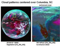
Image of Earth taken today at 1800Z (several hours ago). A zoom shows a weird pattern in the IR4 and Water Vapor channels that is roughly funkiest right over Columbia, South Carolina.
It is not evident in the Visible image and only faintly discernible from white background in the IR2 image. (So...colder high altitude contrails? Why not over the busier airports of Atlanta or Charlotte?)
Any guesses??
Posted by: nprev Jan 28 2010, 01:03 AM
Gotta be contrails. Answer is that those are high-alt corridors. Near the airports planes are ascending or descending, not cruising @ 30K+ ft., therefore much slower speeds & much shorter ground tracks.
Posted by: DFinfrock Jan 28 2010, 01:09 AM
Not only do contrails not show up over the major airport hubs (where aircraft are indeed at lower levels) the contrails will only show up where there is sufficient moisture in the upper atmosphere for the contrails to persist long enough to be imaged from space. There was obviously more moisture available over SC at the time this photo was taken, than in areas farther south, where the contrails do not persist.
David
Posted by: Juramike Jan 28 2010, 01:44 AM
Thanks!
I poked around other time points on the same day, and same time point on different days and didn't see the same phenomenon. Must've just hit the atmospheric conditions just right over the Carolinas. Color us lucky...'till the snowstorm hits this weekend.
Posted by: Juramike May 25 2010, 10:47 AM
The Dundee Satellite Receiving Station home page (DSRS) (http://www.sat.dundee.ac.uk/) has just activated a very neat feature. They have a clickable calendar at the top of the screen, you can now easily click back and forth through the archive.
With a fast enough connection, this can almost be a stepwise animation.
Posted by: Juramike May 28 2010, 02:42 PM
24 hour animated sequence of Earth images in Aquavision from May 27th 0600 UTC to May 28th 0300 UTC:
Available here: http://www.flickr.com/photos/31678681@N07/4646189185/
Posted by: stevesliva Jun 24 2010, 10:19 PM
Great new mosaic from LROC:
http://lroc.sese.asu.edu/news/index.php?/archives/249-The-Earth-from-the-Moon.html
Posted by: scalbers Jun 25 2010, 06:49 PM
Has anyone mentioned this link showing real-time Meteosat images?
http://oiswww.eumetsat.org/IPPS/html/MSG/IMAGERY/
Posted by: ugordan Aug 16 2010, 10:46 AM
This is neat - July 11 solar eclipse seen on the http://www.youtube.com/watch?v=CF9Jckvx_sE.
Posted by: Juramike Aug 29 2010, 02:08 PM
Digging around, I found some really neat high-phase angle shots of Earth taken by the SEVERI Meteosat near the December 21 solstice. This is taken at local midnight, so we are seeing the midnight sun over Antarctica.
At this high phase angle, the Near IR data isn't too bright and can be gently blended into a channel mix with the Vis R-G and Vis G-B to make a pretty RGB composite.
There's a neat specular reflection off Antarctica ice or smooth embayed water.
Check out the REALLY high res image on my flickr site (processing details there, too.): http://www.flickr.com/photos/31678681@N07/4937955948/
Posted by: ugordan Sep 16 2010, 10:39 PM
Here's a colorization of http://lroc.sese.asu.edu/news/?archives/282-Americas-from-the-Moon.html. Below is a preview at 10% resolution, 1/2 res version is available http://www.fileden.com/files/2007/9/14/1431389/lroc_earth_20100809_s.jpg (2.3 MB) and full res version http://www.fileden.com/files/2007/9/14/1431389/lroc_earth_20100809.jpg (8 MB).
Posted by: climber Sep 16 2010, 11:04 PM
The full version is extremely impressive! I can see clearly where I'm at the moment with some details, lake Chungara south East of Lake Titicaca.
Posted by: Josh Stephens Oct 23 2010, 03:24 AM
The earth's image is awesome. Wow! The earth's is beautiful to look at a distant.
Posted by: stevesliva Mar 31 2011, 05:32 AM
Interesting post on gizmodo about data coming from a Russian weather satellite:
http://gizmodo.com/#!5787176/this-is-the-moon-and-the-earth-like-you-have-never-seen-them-before
Posted by: Stu Apr 21 2011, 07:21 PM
Whole Earth images - but from long, long ago..
https://sites.google.com/a/upr.edu/planetary-habitability-laboratory-upra/library/vpe-pr
VERY cool ![]()
Posted by: elakdawalla Apr 21 2011, 07:24 PM
Agreed, those are awesome!
Posted by: Stu Apr 21 2011, 07:33 PM
I am so going to make a gif animation of those three maps, for use in my Outreach talks! ![]()
Posted by: Juramike Apr 21 2011, 09:05 PM
Hey Stu, check out this animation (from Early Precambrian to present):
http://en.wikipedia.org/wiki/File:TectonicReconstructionGlobal2.gif
Posted by: nprev Apr 21 2011, 10:07 PM
Very cool as well, Mike! However, I think that the last image in the animation is probably of the end of the last ice age or so; the Red Sea is much larger, and it looks like the central Asian seas are still merged together.
Posted by: Juramike Apr 22 2011, 12:25 AM
Good catch! It is indeed the Neogene-Miocene period as the last step in the animated gif. The work that Stu originally referred to was done in collaboration by Dr. Ron Blakely of Northern Arizona University. (The animations in the wikipedia entry were done by Dr. Ron Blakely.)
Here is his website that has individual maps of each of the paleo-reconstructions (including Pleistocene and Present) :
http://jan.ucc.nau.edu/~rcb7/mollglobe.html
And a website to other detailed data products:
http://cpgeosystems.com/index.html
I recently got a copy of his (beautifully illustrated) book: "Ancient Landscapes of the Colorado Plateau", mentioned on his site. I highly recommend it.
Posted by: Juramike Jun 14 2011, 02:55 AM
Animation created from simultaneous views of Earth from five geosynchronous weather satellites taken every six hours starting on March 21, 2011:
[animated GIF: click to animate]
Posted by: lacalaca85 Jun 14 2011, 11:20 AM
A few more images of Elektro-L, the Russian geostationary weather satellite can be found here (among others, like Resurs-DK and Meteor-M):
http://eng.ntsomz.ru/news/news_center
Posted by: ugordan Aug 13 2011, 02:26 PM
Chandrayaan-1 view of the Earth during the solar eclipse of July 22nd, 2009 revisited. Very noisy, 4 visible channels of M3 centered at 620, 580, 540 and 500 nm were processed into this approximately natural color view. The 460 nm channel was useless. The way the M3 instrument scanned, the resolution in the vertical axis is much higher than horizontal.
Posted by: elakdawalla Aug 13 2011, 02:43 PM
Wow, really cool. There is a ghost image of Earth about three diameters to the right of the actual image -- do you know what causes that?
Posted by: ugordan Aug 13 2011, 02:53 PM
There's a whole bunch of artifacts visible there. Don't know about that specific ghost, I would assume this is optics related. I noticed imaging spectrometers of this type (pushbroom), VIMS visual channel included have subtantial stray light leakage both in the vertical and especially horizontal direction. You can notice the hot pixel columns get brighter left and right of a bright object. I deliberately left all this crud in to make it clear the other non-removable artifacts, such as vertical discolorations on Earth's disc are in fact artifacts and not real.
I should point out this was done using the raw data, of all the M3 images there are archived this one was not provided in a calibrated form. Perhaps because it was a one-off observation. I had to do manual bias subtraction and rudimentary "I/F" conversion. The whole M3 swath actually included another Earth image higher up, vertically flipped. I presume it was taken when the s/c was slewing back and judging by Earth's rotation it was taken a couple of minutes later. I can post a flickr gif of the two, but it's nothing spectacular.
Posted by: Deimos Aug 13 2011, 03:43 PM
I don't know the instrument--but that sort of thing is frequently due to a double reflection within a window that separates the fore-optics from the outside universe. Depending on the material (silica, sapphire, ...) you get a significant fall-off for a double reflection, and then the same fall-off to quad, etc.
Posted by: centsworth_II Aug 13 2011, 06:56 PM
Posted by: scalbers Aug 14 2011, 12:00 AM
Here is his website that has individual maps of each of the paleo-reconstructions (including Pleistocene and Present) :
http://jan.ucc.nau.edu/~rcb7/mollglobe.html
And a website to other detailed data products:
http://cpgeosystems.com/index.html
I recently got a copy of his (beautifully illustrated) book: "Ancient Landscapes of the Colorado Plateau", mentioned on his site. I highly recommend it.
Yes, this is a good dataset. We've used a smoother version of this animation in Science On A Sphere.
http://sos.noaa.gov/datasets/Land/paleo.html
A frame exists for the future projection of the continents. I've considering making an augmented version of the animation that incorporates this into the future.
Steve
Posted by: Oersted Aug 14 2011, 01:33 PM
Very lovely, except for the Photoshop masking artifacts around the edge (mainly in the 12 o'clock to 2 o'clock positions).
Posted by: Juramike Dec 23 2011, 01:50 AM
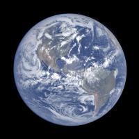
The NPP mission is making a Global Image (not just hemispherical) of the Earth every day. Here is the first image release:
http://earthobservatory.nasa.gov/IOTD/view.php?id=76674
"It's 1:30 PM somewhere..."
Posted by: ugordan Jan 28 2012, 11:10 AM
Rosetta Earth flyby 2 revisited, magnified 1.5x from original scale and rotated so north is up:
http://www.flickr.com/photos/ugordan/6773153381/sizes/o/in/photostream/
This one was hard to work with. The red and especially the green channel suffers from a ghost image which makes the composite look ugly. I tried subtracting them out as best as I could but it still left residual images of the bright clouds in the green channel. As a result, fair portions of the sea and cloud areas use synthetic green while most of the land masses use RGB colorm as synthetic green doesn't produce satisfactory color.
Posted by: dilo Jan 28 2012, 09:21 PM
Great work, Gordan!
Posted by: djellison Jan 28 2012, 09:22 PM
I abandoned the very same data set for the reasons you mention.... GREAT work.
Posted by: scalbers Jan 12 2014, 08:34 PM
http://sos.noaa.gov/datasets/Land/paleo.html
A frame exists for the future projection of the continents. I've considering making an augmented version of the animation that incorporates this into the future.
Steve
Updating this post - the animation for past continental drift has moved to here: http://sos.noaa.gov/Datasets/dataset.php?id=336
And I've been putting together a future projection animation, from some of Ron Blakey's future frames:
http://sos.noaa.gov/Datasets/dataset.php?id=424
Posted by: scalbers Mar 12 2015, 11:04 PM
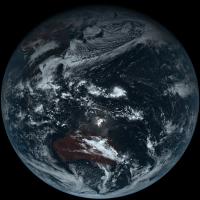
Here is a sample image from the Himawari AHI color imager. Full color and very high resolution. The available one is 11000x11000 pixels (about 1km resolution). This is a sample of a newly launched weather satellite. Will be interesting to see how high of a resolution is publicly available in real-time.
http://www.jma-net.go.jp/sat/data/web89/parts89/himawari8_first_image/trc/trc_LL.jpg
http://www.jma.go.jp/jma/jma-eng/satellite/news/himawari89/20141218_himawari8_first_images.html
Posted by: scalbers Oct 15 2015, 07:35 PM
http://earthobservatory.nasa.gov/IOTD/view.php?id=76674
"It's 1:30 PM somewhere..."
VIIRS composites are also available here: http://www.nnvl.noaa.gov/site-custom/true.php
Posted by: scalbers Apr 29 2017, 08:52 PM
GOES-16 has been up a while. I'm unsure if real-time data are available yet. It's one thing to get images online, though the ABI has 16 channels and judicious use of the "data" can allow construction of more visually realistic imagery. The full disk data is 0.5 to 2km resolution (depending on wavelength) every 15 minutes.
The main idea is that red is at 500m resolution, blue is at 1km, and near-IR data at 2km can be used to help synthesize the green vegetation. Most of the "True-Color" online images are actually somewhat enhanced, though access to the data can help to make more of a natural color image. The thing I would look for is the ABI L1b http://www.goes-r.gov/products/docs/product_file_sizes-20161115.pdf. Maybe https://www.class.ngdc.noaa.gov/saa/products/search?sub_id=0&datatype_family=GRABIPRD&submit.x=21&submit.y=6 will be made public in the near future?
Posted by: peter59 Feb 25 2018, 12:19 PM
LOIRP data are available in PDS.
Lunar Orbiter 5 - Frame_5027_H3
Posted by: elakdawalla Feb 26 2018, 10:29 PM
Here's a link: https://pds-imaging.jpl.nasa.gov/volumes/loirp.html
Posted by: scalbers Jan 16 2022, 06:55 PM
Here are latest full disk images from GOES-West:
https://www.star.nesdis.noaa.gov/goes/fulldisk_band.php?sat=G17&band=GEOCOLOR&length=12
Note that the Level 1b data are available for both GOES and Himawari on AWS.
Powered by Invision Power Board (http://www.invisionboard.com)
© Invision Power Services (http://www.invisionpower.com)
