Sol 90+, Extended mission |

Sol 90+, Extended mission |
 Aug 25 2008, 11:46 AM Aug 25 2008, 11:46 AM
Post
#1
|
|
 Senior Member  Group: Admin Posts: 3108 Joined: 21-December 05 From: Canberra, Australia Member No.: 615 |
|
 |
 
|
 |
|
Aug 31 2008, 05:11 AM
Post
#2
|
|
 Senior Member Group: Members Posts: 2228 Joined: 1-December 04 From: Marble Falls, Texas, USA Member No.: 116 |
QUOTE (CosmicRocker @ Aug 30 2008, 12:21 AM)  What I would really like to see on such maps is an outline of the polygon boundaries in the area. Are there not any within reach of the robotic arm? Duh! I forgot that some of our members had posted several polar pans. James' Phoenix Polar Peter Pan is one of them. Should we call it the P4 pan? If anyone can do it, I think a vertical projection of the imagery would be helpful.As best as I can tell, all of the trenches so far have been within this polygon, and some of the local polygon's boundaries are barely within reach of the robotic arm. Can we dig into a polygon boundary, or not? I'm commenting from my RV in Lufkin, Tx, as we evacuate the gulf coast ahead of hurricane Gustav. I am hoping to avoid the storm and swing back behind it, as it comes ashore. Wish us luck. -------------------- ...Tom
I'm not a Space Fan, I'm a Space Exploration Enthusiast. |
|
|
|
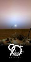
 Astro0 Sol 90+ Aug 25 2008, 11:46 AM
 djellison New mission phase, new UMSF logo ( Thanks Astro0 ... Aug 25 2008, 06:01 PM SpaceListener How long was its recent mission extension? By tha... Aug 25 2008, 08:10 PM
 JTN QUOTE (SpaceListener @ Aug 25 2008, 09:10... Aug 25 2008, 11:02 PM nprev The new banner rules! Well done indeed, Astro0... Aug 26 2008, 02:14 AM CosmicRocker Maybe it is just because I haven't tried to cr... Aug 26 2008, 04:27 AM CosmicRocker It's not entirely obvious to me why the sol 65... Aug 26 2008, 05:14 AM jmknapp QUOTE (CosmicRocker @ Aug 26 2008, 12:14 ... Sep 2 2008, 11:02 AM Stu There is a trio of Sol 90 "low sun" imag... Aug 26 2008, 06:52 AM slinted Here's a view of the bright spots in Snow Whit... Aug 26 2008, 11:03 AM Tman QUOTE (Stu @ Aug 26 2008, 08:52 AM) There... Aug 26 2008, 09:15 PM ElkGroveDan Bye-bye Aug 26 2008, 09:19 PM djellison Mars24 says that Sol 98 is the first day with an a... Aug 26 2008, 09:28 PM climber QUOTE (djellison @ Aug 26 2008, 11:28 PM)... Aug 27 2008, 06:57 AM dot.dk Any official information about how long Phoenix wi... Aug 26 2008, 09:56 PM Reckless At work the new banner is up but here at home same... Aug 26 2008, 10:25 PM ElkGroveDan QUOTE (Reckless @ Aug 26 2008, 02:25 PM) ... Aug 26 2008, 10:27 PM jmjawors Or just force refresh (shift+refresh button). Aug 26 2008, 10:31 PM Reckless Thank you Elkgrovedan and Matt, my cache is now cl... Aug 26 2008, 10:35 PM 1101001 Look who got mentioned in a tweet from Phoenix.
Q... Aug 27 2008, 02:00 AM peter59 Mark Lemmon's Phoenix SSI raw images directory... Aug 27 2008, 10:03 AM 1101001 QUOTE (peter59 @ Aug 27 2008, 03:03 AM) D... Aug 27 2008, 12:51 PM JRehling It sounds like Stone Soup is relatively ice free a... Aug 27 2008, 01:36 PM centsworth_II QUOTE (JRehling @ Aug 27 2008, 09:36 AM) ... Aug 27 2008, 02:08 PM stevesliva Long shadows may actually help them in the quest t... Aug 27 2008, 06:31 PM 3488 AFAIK, the sunlight DID make the regolith clumpine... Aug 27 2008, 07:36 PM 1101001 QUOTE (3488 @ Aug 27 2008, 12:36 PM) Will... Aug 27 2008, 11:38 PM Tman Is there an official Phoenix (horizon) mosaic that... Aug 27 2008, 09:59 PM hortonheardawho RE: Sol 90+ Aug 28 2008, 02:12 AM Stu Couldn't resist animating this sequence...
Aug 28 2008, 05:43 AM Tman Managed to download the 60MB fullres of PeterPan. ... Aug 28 2008, 10:12 AM Tman The azimuth data of the sol 90 sunrise images are ... Aug 28 2008, 02:56 PM Tman Thanks Stu
QUOTE (Tman @ Aug 28 2008, 04... Aug 31 2008, 06:51 PM Phil Stooke ... or the azimuth and elevation in the lander... Aug 28 2008, 03:28 PM Tman If it is the azimuth and elevation in the lander c... Aug 28 2008, 03:42 PM elakdawalla I'm making a new map of the work volume with J... Aug 28 2008, 07:02 PM Aussie Hmmm. I appreciate that the journalistic hype ove... Aug 29 2008, 09:20 AM MahFL My nickname at school was Ichabod, I was skinny an... Aug 29 2008, 11:03 AM ConyHigh QUOTE (Aussie @ Aug 29 2008, 02:20 AM) Hm... Aug 29 2008, 06:16 PM 1101001 JPL Phoenix Mission News: NASA Phoenix Mission Con... Aug 29 2008, 07:50 PM Tman Sometimes you really feel older Aug 29 2008, 12:39 PM climber however data has shown that the gas flow has been ... Aug 29 2008, 08:07 PM CosmicRocker QUOTE (elakdawalla @ Aug 28 2008, 01:02 P... Aug 30 2008, 06:21 AM CosmicRocker QUOTE (Tman @ Aug 29 2008, 06:39 AM) Some... Aug 30 2008, 06:36 AM 1101001 QUOTE (CosmicRocker @ Aug 30 2008, 10:11 ... Aug 31 2008, 05:49 AM Stu Take care, CR, and any other UMSF members or lurke... Aug 31 2008, 06:45 AM peter59 Change of weather ?
Onset wind - sol 94
and stro... Aug 31 2008, 07:10 AM peter59 1B02-3: Ice SHorizon Movie (Sol 94)
sample
htt... Aug 31 2008, 07:53 AM Aussie Is this clouds, or a continuation of the N Polar d... Aug 31 2008, 08:03 AM Stu Here you go... LOVE this sequence...!!
Aug 31 2008, 08:27 AM James Sorenson Sol-94 Telltale animation's .
This is one ... Aug 31 2008, 09:34 AM Oersted QUOTE (James Sorenson @ Aug 31 2008, 11:3... Aug 31 2008, 09:33 PM Stu Another offering for (cue Sky Sports presenter voi... Aug 31 2008, 10:05 AM Tman QUOTE (Stu @ Aug 31 2008, 12:05 PM) Anoth... Aug 31 2008, 05:12 PM jekbradbury QUOTE (CosmicRocker @ Aug 31 2008, 01:11 ... Aug 31 2008, 02:39 PM Doc Cool movies......
From the looks of it these clou... Aug 31 2008, 06:05 PM Stu Great job, Tman. Much cleaner than my 'dirty... Aug 31 2008, 06:07 PM CosmicRocker QUOTE (1101001 @ Aug 30 2008, 11:49 PM) P... Sep 1 2008, 04:49 AM jekbradbury QUOTE (CosmicRocker @ Sep 1 2008, 12:49 A... Sep 1 2008, 10:17 PM 1101001 JPL Phoenix Mission News: Analysis Begins on Deepe... Sep 1 2008, 10:26 PM James Sorenson Nice animation Tman .
http://phoenix.lpl.arizona... Sep 1 2008, 05:24 AM CosmicRocker QUOTE (jekbradbury @ Sep 1 2008, 04:17 PM... Sep 2 2008, 02:43 AM Ant103 Stone soup at Sol 96 :
And TEGA view with oven#1... Sep 2 2008, 03:35 PM hortonheardawho Sol 98 cloud movie
LB ( Uv ) and RB ( green ) fr... Sep 4 2008, 02:58 AM Tman Nice animation Horton!
Hardly to say whether ... Sep 4 2008, 05:03 PM 1101001 TECP: It's dry. Really really dry.
JPL Phoeni... Sep 4 2008, 11:46 PM gallen_53 QUOTE (1101001 @ Sep 5 2008, 12:46 AM) TE... Sep 5 2008, 04:38 PM Stu Phoenix sure is busy up there...
(Sol 99 view o... Sep 5 2008, 11:17 AM marsbug Gallen 53 could you expand on that for me? What I ... Sep 5 2008, 05:48 PM gallen_53 QUOTE (marsbug @ Sep 5 2008, 06:48 PM) Ga... Sep 5 2008, 06:06 PM Gray QUOTE (gallen_53 @ Sep 5 2008, 06:06 PM) ... Sep 8 2008, 02:23 PM slinted Not that there wasn't already confirmation, bu... Sep 6 2008, 02:21 AM Gray I didn't know that olivine was common in the M... Sep 5 2008, 05:49 PM marsbug Thanks! Sep 5 2008, 07:10 PM Stu Animation of the Sun rolling just beneath (I think... Sep 6 2008, 09:05 AM Pertinax QUOTE (Stu @ Sep 6 2008, 04:05 AM) Animat... Sep 6 2008, 11:00 AM TheChemist Regarding the olivine suggestion, I am not convinc... Sep 6 2008, 10:24 AM Aussie QUOTE (TheChemist @ Sep 6 2008, 11:24 AM)... Sep 7 2008, 04:00 AM hortonheardawho sol 100 clouds at sunset movie: Sep 7 2008, 01:09 AM nprev Speaking from ignorance here (my preferred positio... Sep 7 2008, 08:22 AM marsbug My ignorance is at least equal to yours here nprev... Sep 7 2008, 06:43 PM fredk Sorry if this has been discussed (I'm back fro... Sep 8 2008, 04:12 AM slinted QUOTE (fredk @ Sep 7 2008, 08:12 PM) This... Sep 8 2008, 07:39 AM fredk QUOTE (slinted @ Sep 8 2008, 08:39 AM) Co... Sep 8 2008, 03:23 PM Tman Can't remember that this was mentioned anywher... Sep 8 2008, 07:42 AM Tman There's such comparable R6 images where it is ... Sep 8 2008, 08:08 AM slinted Fair enough! I'm convinced Sep 8 2008, 10:54 AM ugordan Wow. I didn't expect that kind of power with M... Sep 8 2008, 10:58 AM climber QUOTE (ugordan @ Sep 8 2008, 12:58 PM) Wo... Sep 8 2008, 09:02 PM Oersted Makes the whole situation up there at the Martian ... Sep 8 2008, 04:43 PM Tman QUOTE (Oersted @ Sep 8 2008, 06:43 PM) Ma... Sep 8 2008, 06:37 PM Ipparchus Why did they aquire another WCL-3 sample(Golden Go... Sep 8 2008, 05:29 PM centsworth_II QUOTE (Ipparchus @ Sep 8 2008, 12:29 PM) ... Sep 8 2008, 05:46 PM 1101001 QUOTE (centsworth_II @ Sep 8 2008, 10:46 ... Sep 8 2008, 06:04 PM centsworth_II QUOTE (1101001 @ Sep 8 2008, 02:04 PM) So... Sep 8 2008, 06:52 PM peter59 Great days for MECA OM team. Many high quality OM ... Sep 8 2008, 07:06 PM Stu QUOTE (peter59 @ Sep 8 2008, 08:06 PM) Gr... Sep 8 2008, 08:37 PM elakdawalla Did anybody else notice this? I didn't see it... Sep 8 2008, 10:00 PM mars loon QUOTE (elakdawalla @ Sep 8 2008, 11:00 PM... Sep 9 2008, 12:30 AM
JTN QUOTE (SpaceListener @ Aug 25 2008, 09:10... Aug 25 2008, 11:02 PM nprev The new banner rules! Well done indeed, Astro0... Aug 26 2008, 02:14 AM CosmicRocker Maybe it is just because I haven't tried to cr... Aug 26 2008, 04:27 AM CosmicRocker It's not entirely obvious to me why the sol 65... Aug 26 2008, 05:14 AM jmknapp QUOTE (CosmicRocker @ Aug 26 2008, 12:14 ... Sep 2 2008, 11:02 AM Stu There is a trio of Sol 90 "low sun" imag... Aug 26 2008, 06:52 AM slinted Here's a view of the bright spots in Snow Whit... Aug 26 2008, 11:03 AM Tman QUOTE (Stu @ Aug 26 2008, 08:52 AM) There... Aug 26 2008, 09:15 PM ElkGroveDan Bye-bye Aug 26 2008, 09:19 PM djellison Mars24 says that Sol 98 is the first day with an a... Aug 26 2008, 09:28 PM climber QUOTE (djellison @ Aug 26 2008, 11:28 PM)... Aug 27 2008, 06:57 AM dot.dk Any official information about how long Phoenix wi... Aug 26 2008, 09:56 PM Reckless At work the new banner is up but here at home same... Aug 26 2008, 10:25 PM ElkGroveDan QUOTE (Reckless @ Aug 26 2008, 02:25 PM) ... Aug 26 2008, 10:27 PM jmjawors Or just force refresh (shift+refresh button). Aug 26 2008, 10:31 PM Reckless Thank you Elkgrovedan and Matt, my cache is now cl... Aug 26 2008, 10:35 PM 1101001 Look who got mentioned in a tweet from Phoenix.
Q... Aug 27 2008, 02:00 AM peter59 Mark Lemmon's Phoenix SSI raw images directory... Aug 27 2008, 10:03 AM 1101001 QUOTE (peter59 @ Aug 27 2008, 03:03 AM) D... Aug 27 2008, 12:51 PM JRehling It sounds like Stone Soup is relatively ice free a... Aug 27 2008, 01:36 PM centsworth_II QUOTE (JRehling @ Aug 27 2008, 09:36 AM) ... Aug 27 2008, 02:08 PM stevesliva Long shadows may actually help them in the quest t... Aug 27 2008, 06:31 PM 3488 AFAIK, the sunlight DID make the regolith clumpine... Aug 27 2008, 07:36 PM 1101001 QUOTE (3488 @ Aug 27 2008, 12:36 PM) Will... Aug 27 2008, 11:38 PM Tman Is there an official Phoenix (horizon) mosaic that... Aug 27 2008, 09:59 PM hortonheardawho RE: Sol 90+ Aug 28 2008, 02:12 AM Stu Couldn't resist animating this sequence...
Aug 28 2008, 05:43 AM Tman Managed to download the 60MB fullres of PeterPan. ... Aug 28 2008, 10:12 AM Tman The azimuth data of the sol 90 sunrise images are ... Aug 28 2008, 02:56 PM Tman Thanks Stu
QUOTE (Tman @ Aug 28 2008, 04... Aug 31 2008, 06:51 PM Phil Stooke ... or the azimuth and elevation in the lander... Aug 28 2008, 03:28 PM Tman If it is the azimuth and elevation in the lander c... Aug 28 2008, 03:42 PM elakdawalla I'm making a new map of the work volume with J... Aug 28 2008, 07:02 PM Aussie Hmmm. I appreciate that the journalistic hype ove... Aug 29 2008, 09:20 AM MahFL My nickname at school was Ichabod, I was skinny an... Aug 29 2008, 11:03 AM ConyHigh QUOTE (Aussie @ Aug 29 2008, 02:20 AM) Hm... Aug 29 2008, 06:16 PM 1101001 JPL Phoenix Mission News: NASA Phoenix Mission Con... Aug 29 2008, 07:50 PM Tman Sometimes you really feel older Aug 29 2008, 12:39 PM climber however data has shown that the gas flow has been ... Aug 29 2008, 08:07 PM CosmicRocker QUOTE (elakdawalla @ Aug 28 2008, 01:02 P... Aug 30 2008, 06:21 AM CosmicRocker QUOTE (Tman @ Aug 29 2008, 06:39 AM) Some... Aug 30 2008, 06:36 AM 1101001 QUOTE (CosmicRocker @ Aug 30 2008, 10:11 ... Aug 31 2008, 05:49 AM Stu Take care, CR, and any other UMSF members or lurke... Aug 31 2008, 06:45 AM peter59 Change of weather ?
Onset wind - sol 94
and stro... Aug 31 2008, 07:10 AM peter59 1B02-3: Ice SHorizon Movie (Sol 94)
sample
htt... Aug 31 2008, 07:53 AM Aussie Is this clouds, or a continuation of the N Polar d... Aug 31 2008, 08:03 AM Stu Here you go... LOVE this sequence...!!
Aug 31 2008, 08:27 AM James Sorenson Sol-94 Telltale animation's .
This is one ... Aug 31 2008, 09:34 AM Oersted QUOTE (James Sorenson @ Aug 31 2008, 11:3... Aug 31 2008, 09:33 PM Stu Another offering for (cue Sky Sports presenter voi... Aug 31 2008, 10:05 AM Tman QUOTE (Stu @ Aug 31 2008, 12:05 PM) Anoth... Aug 31 2008, 05:12 PM jekbradbury QUOTE (CosmicRocker @ Aug 31 2008, 01:11 ... Aug 31 2008, 02:39 PM Doc Cool movies......
From the looks of it these clou... Aug 31 2008, 06:05 PM Stu Great job, Tman. Much cleaner than my 'dirty... Aug 31 2008, 06:07 PM CosmicRocker QUOTE (1101001 @ Aug 30 2008, 11:49 PM) P... Sep 1 2008, 04:49 AM jekbradbury QUOTE (CosmicRocker @ Sep 1 2008, 12:49 A... Sep 1 2008, 10:17 PM 1101001 JPL Phoenix Mission News: Analysis Begins on Deepe... Sep 1 2008, 10:26 PM James Sorenson Nice animation Tman .
http://phoenix.lpl.arizona... Sep 1 2008, 05:24 AM CosmicRocker QUOTE (jekbradbury @ Sep 1 2008, 04:17 PM... Sep 2 2008, 02:43 AM Ant103 Stone soup at Sol 96 :
And TEGA view with oven#1... Sep 2 2008, 03:35 PM hortonheardawho Sol 98 cloud movie
LB ( Uv ) and RB ( green ) fr... Sep 4 2008, 02:58 AM Tman Nice animation Horton!
Hardly to say whether ... Sep 4 2008, 05:03 PM 1101001 TECP: It's dry. Really really dry.
JPL Phoeni... Sep 4 2008, 11:46 PM gallen_53 QUOTE (1101001 @ Sep 5 2008, 12:46 AM) TE... Sep 5 2008, 04:38 PM Stu Phoenix sure is busy up there...
(Sol 99 view o... Sep 5 2008, 11:17 AM marsbug Gallen 53 could you expand on that for me? What I ... Sep 5 2008, 05:48 PM gallen_53 QUOTE (marsbug @ Sep 5 2008, 06:48 PM) Ga... Sep 5 2008, 06:06 PM Gray QUOTE (gallen_53 @ Sep 5 2008, 06:06 PM) ... Sep 8 2008, 02:23 PM slinted Not that there wasn't already confirmation, bu... Sep 6 2008, 02:21 AM Gray I didn't know that olivine was common in the M... Sep 5 2008, 05:49 PM marsbug Thanks! Sep 5 2008, 07:10 PM Stu Animation of the Sun rolling just beneath (I think... Sep 6 2008, 09:05 AM Pertinax QUOTE (Stu @ Sep 6 2008, 04:05 AM) Animat... Sep 6 2008, 11:00 AM TheChemist Regarding the olivine suggestion, I am not convinc... Sep 6 2008, 10:24 AM Aussie QUOTE (TheChemist @ Sep 6 2008, 11:24 AM)... Sep 7 2008, 04:00 AM hortonheardawho sol 100 clouds at sunset movie: Sep 7 2008, 01:09 AM nprev Speaking from ignorance here (my preferred positio... Sep 7 2008, 08:22 AM marsbug My ignorance is at least equal to yours here nprev... Sep 7 2008, 06:43 PM fredk Sorry if this has been discussed (I'm back fro... Sep 8 2008, 04:12 AM slinted QUOTE (fredk @ Sep 7 2008, 08:12 PM) This... Sep 8 2008, 07:39 AM fredk QUOTE (slinted @ Sep 8 2008, 08:39 AM) Co... Sep 8 2008, 03:23 PM Tman Can't remember that this was mentioned anywher... Sep 8 2008, 07:42 AM Tman There's such comparable R6 images where it is ... Sep 8 2008, 08:08 AM slinted Fair enough! I'm convinced Sep 8 2008, 10:54 AM ugordan Wow. I didn't expect that kind of power with M... Sep 8 2008, 10:58 AM climber QUOTE (ugordan @ Sep 8 2008, 12:58 PM) Wo... Sep 8 2008, 09:02 PM Oersted Makes the whole situation up there at the Martian ... Sep 8 2008, 04:43 PM Tman QUOTE (Oersted @ Sep 8 2008, 06:43 PM) Ma... Sep 8 2008, 06:37 PM Ipparchus Why did they aquire another WCL-3 sample(Golden Go... Sep 8 2008, 05:29 PM centsworth_II QUOTE (Ipparchus @ Sep 8 2008, 12:29 PM) ... Sep 8 2008, 05:46 PM 1101001 QUOTE (centsworth_II @ Sep 8 2008, 10:46 ... Sep 8 2008, 06:04 PM centsworth_II QUOTE (1101001 @ Sep 8 2008, 02:04 PM) So... Sep 8 2008, 06:52 PM peter59 Great days for MECA OM team. Many high quality OM ... Sep 8 2008, 07:06 PM Stu QUOTE (peter59 @ Sep 8 2008, 08:06 PM) Gr... Sep 8 2008, 08:37 PM elakdawalla Did anybody else notice this? I didn't see it... Sep 8 2008, 10:00 PM mars loon QUOTE (elakdawalla @ Sep 8 2008, 11:00 PM... Sep 9 2008, 12:30 AM |

|
Lo-Fi Version | Time is now: 26th September 2024 - 12:53 PM |
|
RULES AND GUIDELINES Please read the Forum Rules and Guidelines before posting. IMAGE COPYRIGHT |
OPINIONS AND MODERATION Opinions expressed on UnmannedSpaceflight.com are those of the individual posters and do not necessarily reflect the opinions of UnmannedSpaceflight.com or The Planetary Society. The all-volunteer UnmannedSpaceflight.com moderation team is wholly independent of The Planetary Society. The Planetary Society has no influence over decisions made by the UnmannedSpaceflight.com moderators. |
SUPPORT THE FORUM Unmannedspaceflight.com is funded by the Planetary Society. Please consider supporting our work and many other projects by donating to the Society or becoming a member. |
|