
3D shape, cartography, and geoid of Comet 67P C-G |

3D shape, cartography, and geoid of Comet 67P C-G |
 Aug 6 2014, 02:11 PM Aug 6 2014, 02:11 PM
Post
#1
|
|
|
Solar System Cartographer  Group: Members Posts: 10192 Joined: 5-April 05 From: Canada Member No.: 227 |
Explorer 1 said:
"A 2D map of C-G seems like a tough order; the projection math alone..." Don't worry! If you can put a grid on the surface (as we have seen already), you can warp that grid into any map projection you like. Mapping will be no huge problem - in fact I expect they have a rough one already (I've been playing with one myself). Phil -------------------- ... because the Solar System ain't gonna map itself.
Also to be found posting similar content on https://mastodon.social/@PhilStooke Maps for download (free PD: https://upload.wikimedia.org/wikipedia/comm...Cartography.pdf NOTE: everything created by me which I post on UMSF is considered to be in the public domain (NOT CC, public domain) |
 |
 
|
 |
|
Sep 2 2014, 11:41 PM
Post
#2
|
|
|
Member Group: Members Posts: 890 Joined: 18-November 08 Member No.: 4489 |
QUOTE t would be interesting to see a map of where "down" is in the different surface areas of the comet. down in the -- north up and south down --- a repost from a different forum the bottom two images in the bottom right image been working on mapping the esa jpg images to a updated mesh -- not looking good YET a 10 deg grid test map then warped to the mesh -- this is SCARY ( as in Oct. 31 scary ) then just the updated mesh and esa images from aug. 7 and 15  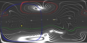  
|
|
|
|
|
Sep 3 2014, 11:49 AM
Post
#3
|
|
 Member Group: Members Posts: 241 Joined: 22-August 05 From: Stockholm Sweden Member No.: 468 |
QUOTE (JohnVV @ Sep 3 2014, 01:41 AM)  down in the -- north up and south down --- a repost from a different forum the bottom two images in the bottom right image been working on mapping the esa jpg images to a updated mesh -- not looking good YET a 10 deg grid test map then warped to the mesh -- this is SCARY ( as in Oct. 31 scary ) then just the updated mesh and esa images from aug. 7 and 15 Is that your own shapemodel or is it something ESA have made that is in the public domain? Im working on building my own. but I would like to have another stereo pair from osiris before i continue in ernest. (i want to make an ultra high density model) I have reverseengineered all the spacecraft positions relative to the comet for all pictures up until now but i have no real coordinate system yet. Is there a consensus northpole and a southpole and a prime meridian that i can use to build that? Just points on the surface would help  edit: oh.. you just posted those pictures... where did you get that information? |
|
|
|
 Phil Stooke 3D shape, cartography, and geoid of Comet 67P C-G Aug 6 2014, 02:11 PM
 acastillo It would appear that the neck is an "erosiona... Aug 6 2014, 02:44 PM
 AndyG QUOTE (acastillo @ Aug 6 2014, 03:44 PM) ... Aug 6 2014, 03:47 PM TheAnt QUOTE (acastillo @ Aug 6 2014, 04:44 PM) ... Aug 6 2014, 04:46 PM
 mcgyver QUOTE (acastillo @ Aug 6 2014, 03:44 PM) ... Aug 8 2014, 07:47 PM Phil Stooke Not a pain, it just means the cartographers have l... Aug 8 2014, 08:04 PM Explorer1 Wouldn't the two lobes just gradually come bac... Aug 8 2014, 08:06 PM Mercure I believe the centrifugal forces at the rotational... Aug 8 2014, 10:05 PM Phil Stooke I think you're right, the lobes would collapse... Aug 8 2014, 10:00 PM djellison Rotation rate is 12.7 hours. The circumference dr... Aug 8 2014, 10:17 PM nprev The key variable between these scenarios is mass, ... Aug 8 2014, 10:20 PM ngunn Every irregular object eroded from the outside mus... Aug 8 2014, 10:22 PM nprev Could acquire more angular momentum from impacts o... Aug 8 2014, 10:28 PM djellison If it were rotating fast enough to displace the tw... Aug 8 2014, 10:37 PM SteveM I'm not convinced by the emerging consensus th... Aug 8 2014, 10:42 PM djellison QUOTE (SteveM @ Aug 8 2014, 03:42 PM) I... Aug 8 2014, 11:10 PM Y Bar Ranch QUOTE (SteveM @ Aug 8 2014, 05:42 PM) I... Aug 11 2014, 02:16 PM djellison QUOTE (Y Bar Ranch @ Aug 11 2014, 07:16 A... Aug 11 2014, 02:47 PM Y Bar Ranch QUOTE (djellison @ Aug 11 2014, 09:47 AM)... Aug 11 2014, 04:02 PM ngunn QUOTE (Y Bar Ranch @ Aug 11 2014, 03:16 P... Aug 11 2014, 02:48 PM Greenish I had been curious about the gravity field so was ... Aug 9 2014, 01:42 AM machi According to my calculations gravity/centripetal r... Aug 9 2014, 01:53 AM Adam Hurcewicz OK, here is visualization from Celestia. I made mo... Aug 10 2014, 05:16 PM Gerald For 67P/C-G, and similarly asymmetric bodies, I... Aug 10 2014, 06:03 PM fredk QUOTE (Gerald @ Aug 10 2014, 06:03 PM) Pr... Aug 10 2014, 06:38 PM Harder thanks, Gerald, for your insights. I noticed you f... Aug 10 2014, 06:36 PM Gerald QUOTE (Harder @ Aug 10 2014, 08:38 PM) ..... Aug 10 2014, 07:11 PM Phil Stooke The up and down can be incorporated into topograph... Aug 10 2014, 09:43 PM JohnVV the problem at this time is we do not have a mesh ... Aug 10 2014, 11:38 PM Gerald If you take a binary of two spherical bodies, the ... Aug 11 2014, 03:37 PM Y Bar Ranch QUOTE (Gerald @ Aug 11 2014, 10:37 AM) If... Aug 11 2014, 04:08 PM Gerald QUOTE (Y Bar Ranch @ Aug 11 2014, 06:08 P... Aug 11 2014, 04:36 PM ngunn QUOTE (Y Bar Ranch @ Aug 11 2014, 05:08 P... Aug 11 2014, 04:42 PM Y Bar Ranch QUOTE (ngunn @ Aug 11 2014, 12:42 PM) I r... Aug 11 2014, 04:50 PM Phil Stooke Ok... I have been taking some time out from what I... Aug 15 2014, 06:18 PM MoreInput Thanks for the map, Phil.
What about the idea to ... Aug 16 2014, 08:46 PM Explorer1 Very impressive! The axis must be tilted quite... Aug 15 2014, 07:13 PM wildespace I have seen members here mention generating synthe... Aug 16 2014, 07:54 AM ngunn That same idea occurred to me: map them separately... Aug 16 2014, 09:42 PM JohnVV this gif animation ( pre orbit data )
http://sci... Aug 17 2014, 04:55 AM mcgyver QUOTE (JohnVV @ Aug 17 2014, 04:55 AM) th... Aug 22 2014, 02:13 PM Phil Stooke Re - mapping the lobes separately - it's an in... Aug 17 2014, 05:33 AM JohnVV still working on this , just an early preview
... Aug 20 2014, 10:26 PM Phil Stooke JohnVV wrote:
I was able to extract a pointcloud ... Aug 22 2014, 03:39 AM JohnVV phil
there is a zip with a obj mesh in it here
ht... Aug 22 2014, 03:50 AM Malmer I'm playing around making a highresolution 3D ... Aug 22 2014, 04:07 PM JohnVV QUOTE (Malmer @ Aug 22 2014, 12:07 PM) I... Aug 23 2014, 01:35 AM Malmer QUOTE (JohnVV @ Aug 23 2014, 03:35 AM) ni... Aug 23 2014, 06:42 AM mcgyver QUOTE (Malmer @ Aug 22 2014, 04:07 PM) I... Aug 23 2014, 10:06 PM Malmer QUOTE (mcgyver @ Aug 24 2014, 12:06 AM) S... Aug 23 2014, 10:42 PM Toma B QUOTE (Malmer @ Aug 24 2014, 12:42 AM) I ... Aug 24 2014, 10:07 AM JohnVV QUOTE Do you explain somewhere the method you used... Aug 22 2014, 05:50 PM Phil Stooke Hi Malmer - cartographers have already discussed t... Aug 23 2014, 02:37 PM Malmer For my own selfish purposes I will probably use so... Aug 23 2014, 05:36 PM machi QUOTE (wildespace @ Aug 16 2014, 09:54 AM... Aug 25 2014, 10:42 AM Gerald QUOTE (machi @ Aug 25 2014, 12:42 PM) ...... Aug 25 2014, 12:08 PM charborob What I would like to see is an image of the comet ... Sep 3 2014, 12:42 AM SteveM QUOTE (charborob @ Sep 2 2014, 07:42 PM) ... Sep 3 2014, 01:20 AM JohnVV with "Down as the direction of the SouthPole ... Sep 3 2014, 01:08 AM JohnVV QUOTE Is that your own shapemodel or is it somethi... Sep 3 2014, 05:14 PM Malmer QUOTE (JohnVV @ Sep 3 2014, 07:14 PM) no ... Sep 3 2014, 08:54 PM Y Bar Ranch I'd be interested in grabbing whatever you guy... Sep 3 2014, 09:09 PM Malmer Will post as soon as it is resonably correct. Sep 3 2014, 09:48 PM Phil Stooke I am very impressed by this, John! Looking fo... Sep 3 2014, 06:05 PM JohnVV QUOTE I'd be interested in grabbing whatever y... Sep 3 2014, 09:50 PM Malmer QUOTE (JohnVV @ Sep 3 2014, 11:50 PM) i j... Sep 3 2014, 10:32 PM CAP-Team QUOTE (JohnVV @ Sep 3 2014, 11:50 PM) i j... Sep 4 2014, 06:50 PM mcgyver QUOTE (CAP-Team @ Sep 4 2014, 06:50 ... Sep 4 2014, 07:08 PM djellison QUOTE (mcgyver @ Sep 4 2014, 12:08 PM) Wh... Sep 4 2014, 09:09 PM Malmer QUOTE (JohnVV @ Sep 3 2014, 11:50 PM) i j... Sep 4 2014, 11:05 PM JohnVV 3ds to cmod is rather easy
now the plugin is for ... Sep 4 2014, 08:11 PM Malmer QUOTE (JohnVV @ Sep 4 2014, 10:11 PM) 3ds... Sep 4 2014, 08:33 PM Gerald Some qualitative sensitivity analysis of trajector... Sep 4 2014, 10:07 PM fredk Nice. So did you chose the rotation axis to be pe... Sep 4 2014, 10:23 PM Gerald Yes. Sep 4 2014, 10:30 PM JohnVV Blender is not a "cad/cam" set-up
so th... Sep 5 2014, 06:47 PM Malmer QUOTE (JohnVV @ Sep 5 2014, 08:47 PM) Ble... Sep 5 2014, 07:04 PM JohnVV well the landing site is near 190 long and just a ... Sep 16 2014, 05:44 AM JohnVV with the few images and the video
"Possible ... Sep 24 2014, 12:43 AM Malmer QUOTE (JohnVV @ Sep 24 2014, 02:43 AM) wi... Sep 24 2014, 01:17 AM JohnVV from the image
"Comet_on_16_August_c.jpg... Sep 24 2014, 02:25 AM
mcgyver QUOTE (acastillo @ Aug 6 2014, 03:44 PM) ... Aug 8 2014, 07:47 PM Phil Stooke Not a pain, it just means the cartographers have l... Aug 8 2014, 08:04 PM Explorer1 Wouldn't the two lobes just gradually come bac... Aug 8 2014, 08:06 PM Mercure I believe the centrifugal forces at the rotational... Aug 8 2014, 10:05 PM Phil Stooke I think you're right, the lobes would collapse... Aug 8 2014, 10:00 PM djellison Rotation rate is 12.7 hours. The circumference dr... Aug 8 2014, 10:17 PM nprev The key variable between these scenarios is mass, ... Aug 8 2014, 10:20 PM ngunn Every irregular object eroded from the outside mus... Aug 8 2014, 10:22 PM nprev Could acquire more angular momentum from impacts o... Aug 8 2014, 10:28 PM djellison If it were rotating fast enough to displace the tw... Aug 8 2014, 10:37 PM SteveM I'm not convinced by the emerging consensus th... Aug 8 2014, 10:42 PM djellison QUOTE (SteveM @ Aug 8 2014, 03:42 PM) I... Aug 8 2014, 11:10 PM Y Bar Ranch QUOTE (SteveM @ Aug 8 2014, 05:42 PM) I... Aug 11 2014, 02:16 PM djellison QUOTE (Y Bar Ranch @ Aug 11 2014, 07:16 A... Aug 11 2014, 02:47 PM Y Bar Ranch QUOTE (djellison @ Aug 11 2014, 09:47 AM)... Aug 11 2014, 04:02 PM ngunn QUOTE (Y Bar Ranch @ Aug 11 2014, 03:16 P... Aug 11 2014, 02:48 PM Greenish I had been curious about the gravity field so was ... Aug 9 2014, 01:42 AM machi According to my calculations gravity/centripetal r... Aug 9 2014, 01:53 AM Adam Hurcewicz OK, here is visualization from Celestia. I made mo... Aug 10 2014, 05:16 PM Gerald For 67P/C-G, and similarly asymmetric bodies, I... Aug 10 2014, 06:03 PM fredk QUOTE (Gerald @ Aug 10 2014, 06:03 PM) Pr... Aug 10 2014, 06:38 PM Harder thanks, Gerald, for your insights. I noticed you f... Aug 10 2014, 06:36 PM Gerald QUOTE (Harder @ Aug 10 2014, 08:38 PM) ..... Aug 10 2014, 07:11 PM Phil Stooke The up and down can be incorporated into topograph... Aug 10 2014, 09:43 PM JohnVV the problem at this time is we do not have a mesh ... Aug 10 2014, 11:38 PM Gerald If you take a binary of two spherical bodies, the ... Aug 11 2014, 03:37 PM Y Bar Ranch QUOTE (Gerald @ Aug 11 2014, 10:37 AM) If... Aug 11 2014, 04:08 PM Gerald QUOTE (Y Bar Ranch @ Aug 11 2014, 06:08 P... Aug 11 2014, 04:36 PM ngunn QUOTE (Y Bar Ranch @ Aug 11 2014, 05:08 P... Aug 11 2014, 04:42 PM Y Bar Ranch QUOTE (ngunn @ Aug 11 2014, 12:42 PM) I r... Aug 11 2014, 04:50 PM Phil Stooke Ok... I have been taking some time out from what I... Aug 15 2014, 06:18 PM MoreInput Thanks for the map, Phil.
What about the idea to ... Aug 16 2014, 08:46 PM Explorer1 Very impressive! The axis must be tilted quite... Aug 15 2014, 07:13 PM wildespace I have seen members here mention generating synthe... Aug 16 2014, 07:54 AM ngunn That same idea occurred to me: map them separately... Aug 16 2014, 09:42 PM JohnVV this gif animation ( pre orbit data )
http://sci... Aug 17 2014, 04:55 AM mcgyver QUOTE (JohnVV @ Aug 17 2014, 04:55 AM) th... Aug 22 2014, 02:13 PM Phil Stooke Re - mapping the lobes separately - it's an in... Aug 17 2014, 05:33 AM JohnVV still working on this , just an early preview
... Aug 20 2014, 10:26 PM Phil Stooke JohnVV wrote:
I was able to extract a pointcloud ... Aug 22 2014, 03:39 AM JohnVV phil
there is a zip with a obj mesh in it here
ht... Aug 22 2014, 03:50 AM Malmer I'm playing around making a highresolution 3D ... Aug 22 2014, 04:07 PM JohnVV QUOTE (Malmer @ Aug 22 2014, 12:07 PM) I... Aug 23 2014, 01:35 AM Malmer QUOTE (JohnVV @ Aug 23 2014, 03:35 AM) ni... Aug 23 2014, 06:42 AM mcgyver QUOTE (Malmer @ Aug 22 2014, 04:07 PM) I... Aug 23 2014, 10:06 PM Malmer QUOTE (mcgyver @ Aug 24 2014, 12:06 AM) S... Aug 23 2014, 10:42 PM Toma B QUOTE (Malmer @ Aug 24 2014, 12:42 AM) I ... Aug 24 2014, 10:07 AM JohnVV QUOTE Do you explain somewhere the method you used... Aug 22 2014, 05:50 PM Phil Stooke Hi Malmer - cartographers have already discussed t... Aug 23 2014, 02:37 PM Malmer For my own selfish purposes I will probably use so... Aug 23 2014, 05:36 PM machi QUOTE (wildespace @ Aug 16 2014, 09:54 AM... Aug 25 2014, 10:42 AM Gerald QUOTE (machi @ Aug 25 2014, 12:42 PM) ...... Aug 25 2014, 12:08 PM charborob What I would like to see is an image of the comet ... Sep 3 2014, 12:42 AM SteveM QUOTE (charborob @ Sep 2 2014, 07:42 PM) ... Sep 3 2014, 01:20 AM JohnVV with "Down as the direction of the SouthPole ... Sep 3 2014, 01:08 AM JohnVV QUOTE Is that your own shapemodel or is it somethi... Sep 3 2014, 05:14 PM Malmer QUOTE (JohnVV @ Sep 3 2014, 07:14 PM) no ... Sep 3 2014, 08:54 PM Y Bar Ranch I'd be interested in grabbing whatever you guy... Sep 3 2014, 09:09 PM Malmer Will post as soon as it is resonably correct. Sep 3 2014, 09:48 PM Phil Stooke I am very impressed by this, John! Looking fo... Sep 3 2014, 06:05 PM JohnVV QUOTE I'd be interested in grabbing whatever y... Sep 3 2014, 09:50 PM Malmer QUOTE (JohnVV @ Sep 3 2014, 11:50 PM) i j... Sep 3 2014, 10:32 PM CAP-Team QUOTE (JohnVV @ Sep 3 2014, 11:50 PM) i j... Sep 4 2014, 06:50 PM mcgyver QUOTE (CAP-Team @ Sep 4 2014, 06:50 ... Sep 4 2014, 07:08 PM djellison QUOTE (mcgyver @ Sep 4 2014, 12:08 PM) Wh... Sep 4 2014, 09:09 PM Malmer QUOTE (JohnVV @ Sep 3 2014, 11:50 PM) i j... Sep 4 2014, 11:05 PM JohnVV 3ds to cmod is rather easy
now the plugin is for ... Sep 4 2014, 08:11 PM Malmer QUOTE (JohnVV @ Sep 4 2014, 10:11 PM) 3ds... Sep 4 2014, 08:33 PM Gerald Some qualitative sensitivity analysis of trajector... Sep 4 2014, 10:07 PM fredk Nice. So did you chose the rotation axis to be pe... Sep 4 2014, 10:23 PM Gerald Yes. Sep 4 2014, 10:30 PM JohnVV Blender is not a "cad/cam" set-up
so th... Sep 5 2014, 06:47 PM Malmer QUOTE (JohnVV @ Sep 5 2014, 08:47 PM) Ble... Sep 5 2014, 07:04 PM JohnVV well the landing site is near 190 long and just a ... Sep 16 2014, 05:44 AM JohnVV with the few images and the video
"Possible ... Sep 24 2014, 12:43 AM Malmer QUOTE (JohnVV @ Sep 24 2014, 02:43 AM) wi... Sep 24 2014, 01:17 AM JohnVV from the image
"Comet_on_16_August_c.jpg... Sep 24 2014, 02:25 AM |

|
Lo-Fi Version | Time is now: 13th June 2024 - 04:35 PM |
|
RULES AND GUIDELINES Please read the Forum Rules and Guidelines before posting. IMAGE COPYRIGHT |
OPINIONS AND MODERATION Opinions expressed on UnmannedSpaceflight.com are those of the individual posters and do not necessarily reflect the opinions of UnmannedSpaceflight.com or The Planetary Society. The all-volunteer UnmannedSpaceflight.com moderation team is wholly independent of The Planetary Society. The Planetary Society has no influence over decisions made by the UnmannedSpaceflight.com moderators. |
SUPPORT THE FORUM Unmannedspaceflight.com is funded by the Planetary Society. Please consider supporting our work and many other projects by donating to the Society or becoming a member. |
|


