
shape from shade, so i do not take over Bjorn's |

shape from shade, so i do not take over Bjorn's |
 Apr 7 2010, 04:03 AM Apr 7 2010, 04:03 AM
Post
#1
|
|
|
Member  Group: Members Posts: 890 Joined: 18-November 08 Member No.: 4489 |
So that i do not take over his nice thread i figured i would start a new one
I am just figuring it out so bear with me Rhea This is a example - very early example http://www.shatters.net/forum/viewtopic.php?f=5&t=15847  one that i am going to redo . the program i am using "Cyclops" has a few bugs Enceladus this is a good example a bit better than the above 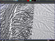 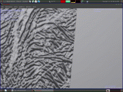 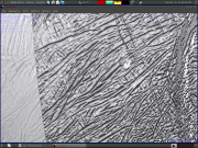 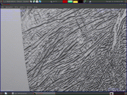 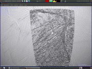 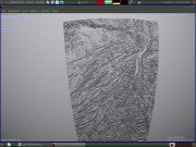 the close ups are a 8k level 3 VT with and without a texture over it then a 4k level2 vt unfortunately i still have to figure out a bug .I need to run a highpass on it ( the 32 bit isis dem ) Cyclops exports to a 3d *.ply this is easy to export to a isis cub and i get this ( this happens when i combine 16 smaller images into one big one ) and this example is at 1/2 size  Just a bit of a bug !!! |
 |
 
|
 |
|
Oct 23 2021, 07:00 PM
Post
#2
|
|
|
Solar System Cartographer Group: Members Posts: 10226 Joined: 5-April 05 From: Canada Member No.: 227 |
Schenk, P., McKinnon, W.B., Moore, J. and Nimmo, F., 2021, March. The Topography of Ganymede (and Callisto): Geology, Global Characteristics, and Future Exploration. In Lunar and Planetary Science Conference (No. 2548, p. 2228).
This is a recent discussion of topography on Ganymede and Callisto which shows how very limited the stereo coverage is. Here's a link: https://www.hou.usra.edu/meetings/lpsc2021/pdf/2228.pdf Nobody knows more about icy satellite topography than these authors. Phil -------------------- ... because the Solar System ain't gonna map itself.
Also to be found posting similar content on https://mastodon.social/@PhilStooke Maps for download (free PDF: https://upload.wikimedia.org/wikipedia/comm...Cartography.pdf NOTE: everything created by me which I post on UMSF is considered to be in the public domain (NOT CC, public domain) |
|
|
|
|
Oct 23 2021, 10:48 PM
Post
#3
|
|
 Member Group: Members Posts: 127 Joined: 15-April 21 Member No.: 9009 |
QUOTE (Phil Stooke @ Oct 23 2021, 07:00 PM)  Schenk, P., McKinnon, W.B., Moore, J. and Nimmo, F., 2021, March. The Topography of Ganymede (and Callisto): Geology, Global Characteristics, and Future Exploration. In Lunar and Planetary Science Conference (No. 2548, p. 2228). This is a recent discussion of topography on Ganymede and Callisto which shows how very limited the stereo coverage is. Here's a link: https://www.hou.usra.edu/meetings/lpsc2021/pdf/2228.pdf Nobody knows more about icy satellite topography than these authors. Phil yeah, i have seen that before, i even tried finding the PC DEM coverage in other papers to make a Ganymede DEM map from the data, but i failed miserably |
|
|
|
|
Oct 23 2021, 11:26 PM
Post
#4
|
|
 Senior Member Group: Members Posts: 2530 Joined: 20-April 05 Member No.: 321 |
QUOTE (TrappistPlanets @ Oct 23 2021, 03:48 PM) I even tried finding the PC DEM coverage in other papers to make a Ganymede DEM map from the data, but i failed miserably The paper itself makes this clear. They state that less than 20% of the surface has usable data. Those oddly-shaped pieces do not overlap, so it is impossible to calibrate their relative altitudes together. The paper is full of interesting comments about Ganymede's and Callisto's global topography around the overarching fact that our knowledge is spotty for now. |
|
|
|
 JohnVV shape from shade Apr 7 2010, 04:03 AM
 JohnVV making progress
started with N1500060254_2.img
r... Apr 8 2010, 12:27 AM 4th rock from the sun Nice bump maps !
I have already suggested som... Apr 8 2010, 02:53 PM JohnVV right now i am working on Dione i have a list of f... Apr 13 2010, 07:26 AM JohnVV just an update
this is a TESTING only 100% auto t... Apr 17 2010, 03:42 AM Bjorn Jonsson This looks very impressive, there is some loss of ... Apr 27 2010, 12:41 AM JohnVV hi Bjorn
at this point i am just using a default ... Apr 27 2010, 03:58 AM JohnVV only 3 show so a link to the photo album
http://w... Apr 27 2010, 04:22 AM
JohnVV making progress
started with N1500060254_2.img
r... Apr 8 2010, 12:27 AM 4th rock from the sun Nice bump maps !
I have already suggested som... Apr 8 2010, 02:53 PM JohnVV right now i am working on Dione i have a list of f... Apr 13 2010, 07:26 AM JohnVV just an update
this is a TESTING only 100% auto t... Apr 17 2010, 03:42 AM Bjorn Jonsson This looks very impressive, there is some loss of ... Apr 27 2010, 12:41 AM JohnVV hi Bjorn
at this point i am just using a default ... Apr 27 2010, 03:58 AM JohnVV only 3 show so a link to the photo album
http://w... Apr 27 2010, 04:22 AM
 Bjorn Jonsson I have now tested Cyclops a bit. The first test ru... Apr 29 2010, 09:26 PM TrappistPlanets QUOTE (Bjorn Jonsson @ Apr 29 2010, 10:26... Oct 18 2021, 08:48 PM JohnVV QUOTE (TrappistPlanets @ Oct 18 2021, 04... Oct 19 2021, 01:22 AM TrappistPlanets QUOTE (JohnVV @ Oct 19 2021, 02:22 AM) i ... Oct 19 2021, 10:48 AM JohnVV i am calling it a "bug" because i am doi... Apr 30 2010, 02:06 AM JohnVV while i am starting to put together an ISIS contro... May 3 2010, 04:33 AM Bjorn Jonsson QUOTE (JohnVV @ May 3 2010, 04:33 AM) if ... May 4 2010, 02:28 PM JohnVV at the end will be a link to the folder
newbump.ta... May 6 2010, 06:16 AM JohnVV five more and most likely the last until i find wh... May 8 2010, 08:42 PM Bjorn Jonsson Thanks - I'll take a look at these files soon.... May 8 2010, 10:27 PM TrappistPlanets i figured out how to dem process in gimp, but how ... Nov 29 2021, 01:41 AM JohnVV QUOTE (TrappistPlanets @ Nov 28 2021, 08... Nov 29 2021, 03:27 PM TrappistPlanets QUOTE (JohnVV @ Nov 29 2021, 04:27 PM) i ... Nov 29 2021, 05:24 PM JohnVV first the gimp Gmic filter( was called Graystratio... May 9 2010, 04:02 AM JohnVV a bit of a change - the below will create a ... May 13 2010, 06:42 PM JohnVV 2)
removing the curvature
yes one or two meshes c... May 13 2010, 08:01 PM Sajid Interesting work you are doing.
Where did you fi... May 13 2010, 08:20 PM JohnVV 3)
convert the hipassed normal to a mesh then to ... May 13 2010, 08:39 PM JohnVV 4)
-- optional --
i like to normalize and convert ... May 13 2010, 11:46 PM JohnVV an update
just a "testing " shot
with... May 28 2010, 12:07 AM Bjorn Jonsson Looks very promising despite the 'terraced... Jun 6 2010, 09:05 PM JohnVV QUOTE Looks very promising despite the 'terrac... Jun 7 2010, 03:02 AM 4th rock from the sun I've programed a simple SFS implementation in ... Sep 2 2010, 01:16 PM AndyG Very nice!
ActionScript, huh? Smarty-pants... Sep 2 2010, 01:52 PM 4th rock from the sun Thanks!
I'm reading the image as a raste... Sep 2 2010, 10:17 PM JohnVV the main problem has been with non optimal images ... Sep 2 2010, 11:24 PM JohnVV just a bit of an update
stereo is by far better ... Feb 1 2012, 05:04 AM volcanopele QUOTE (JohnVV @ Jan 31 2012, 10:04 PM) th... Feb 1 2012, 06:11 AM JohnVV a height map but that spot IS an artifact from Sh... Feb 1 2012, 06:53 AM JohnVV for now i have dropped the hyperionCV sfs in favor... Apr 17 2012, 09:03 AM TrappistPlanets QUOTE (JohnVV @ Apr 17 2012, 10:03 AM) fo... May 10 2021, 12:52 PM JohnVV just a update on a rather old thread
i was asked ... Jan 15 2018, 06:13 AM TrappistPlanets i have a SFS dem of umbriel May 10 2021, 01:05 PM TrappistPlanets sorry that the attachemt was spammed, my computer ... May 10 2021, 01:07 PM JohnVV QUOTE why does the 2 sides of the crater rim SFS d... May 12 2021, 06:47 PM TrappistPlanets QUOTE (JohnVV @ May 12 2021, 06:47 PM) th... May 12 2021, 11:25 PM JRehling QUOTE (JohnVV @ May 12 2021, 11:47 AM) th... May 21 2021, 03:07 AM TrappistPlanets a friend of mine processed this fantastic dem from... Jun 10 2021, 11:37 AM JRehling QUOTE (TrappistPlanets @ Jun 10 2021, 04... Oct 21 2021, 04:32 PM TrappistPlanets QUOTE (JRehling @ Oct 21 2021, 05:32 PM) ... Oct 21 2021, 11:10 PM JRehling QUOTE (TrappistPlanets @ Oct 21 2021, 04... Oct 21 2021, 11:24 PM TrappistPlanets QUOTE (JRehling @ Oct 22 2021, 12:24 AM) ... Oct 22 2021, 11:08 AM JRehling First of all, the standard of citing research is t... Oct 22 2021, 02:31 PM JohnVV QUOTE i don't know how to compile programs vea... Oct 19 2021, 02:29 PM stevesliva Just FYI... There was this other discussion: http:... Oct 22 2021, 04:47 PM TrappistPlanets QUOTE (stevesliva @ Oct 22 2021, 04:47 PM... Oct 23 2021, 11:53 AM JRehling Here's the full text of a paper explaining the... Oct 24 2021, 07:00 PM JohnVV a google search found the MS windows binaries
htt... Nov 29 2021, 05:41 PM TrappistPlanets QUOTE (JohnVV @ Nov 29 2021, 06:41 PM) a ... Nov 29 2021, 05:58 PM
Bjorn Jonsson I have now tested Cyclops a bit. The first test ru... Apr 29 2010, 09:26 PM TrappistPlanets QUOTE (Bjorn Jonsson @ Apr 29 2010, 10:26... Oct 18 2021, 08:48 PM JohnVV QUOTE (TrappistPlanets @ Oct 18 2021, 04... Oct 19 2021, 01:22 AM TrappistPlanets QUOTE (JohnVV @ Oct 19 2021, 02:22 AM) i ... Oct 19 2021, 10:48 AM JohnVV i am calling it a "bug" because i am doi... Apr 30 2010, 02:06 AM JohnVV while i am starting to put together an ISIS contro... May 3 2010, 04:33 AM Bjorn Jonsson QUOTE (JohnVV @ May 3 2010, 04:33 AM) if ... May 4 2010, 02:28 PM JohnVV at the end will be a link to the folder
newbump.ta... May 6 2010, 06:16 AM JohnVV five more and most likely the last until i find wh... May 8 2010, 08:42 PM Bjorn Jonsson Thanks - I'll take a look at these files soon.... May 8 2010, 10:27 PM TrappistPlanets i figured out how to dem process in gimp, but how ... Nov 29 2021, 01:41 AM JohnVV QUOTE (TrappistPlanets @ Nov 28 2021, 08... Nov 29 2021, 03:27 PM TrappistPlanets QUOTE (JohnVV @ Nov 29 2021, 04:27 PM) i ... Nov 29 2021, 05:24 PM JohnVV first the gimp Gmic filter( was called Graystratio... May 9 2010, 04:02 AM JohnVV a bit of a change - the below will create a ... May 13 2010, 06:42 PM JohnVV 2)
removing the curvature
yes one or two meshes c... May 13 2010, 08:01 PM Sajid Interesting work you are doing.
Where did you fi... May 13 2010, 08:20 PM JohnVV 3)
convert the hipassed normal to a mesh then to ... May 13 2010, 08:39 PM JohnVV 4)
-- optional --
i like to normalize and convert ... May 13 2010, 11:46 PM JohnVV an update
just a "testing " shot
with... May 28 2010, 12:07 AM Bjorn Jonsson Looks very promising despite the 'terraced... Jun 6 2010, 09:05 PM JohnVV QUOTE Looks very promising despite the 'terrac... Jun 7 2010, 03:02 AM 4th rock from the sun I've programed a simple SFS implementation in ... Sep 2 2010, 01:16 PM AndyG Very nice!
ActionScript, huh? Smarty-pants... Sep 2 2010, 01:52 PM 4th rock from the sun Thanks!
I'm reading the image as a raste... Sep 2 2010, 10:17 PM JohnVV the main problem has been with non optimal images ... Sep 2 2010, 11:24 PM JohnVV just a bit of an update
stereo is by far better ... Feb 1 2012, 05:04 AM volcanopele QUOTE (JohnVV @ Jan 31 2012, 10:04 PM) th... Feb 1 2012, 06:11 AM JohnVV a height map but that spot IS an artifact from Sh... Feb 1 2012, 06:53 AM JohnVV for now i have dropped the hyperionCV sfs in favor... Apr 17 2012, 09:03 AM TrappistPlanets QUOTE (JohnVV @ Apr 17 2012, 10:03 AM) fo... May 10 2021, 12:52 PM JohnVV just a update on a rather old thread
i was asked ... Jan 15 2018, 06:13 AM TrappistPlanets i have a SFS dem of umbriel May 10 2021, 01:05 PM TrappistPlanets sorry that the attachemt was spammed, my computer ... May 10 2021, 01:07 PM JohnVV QUOTE why does the 2 sides of the crater rim SFS d... May 12 2021, 06:47 PM TrappistPlanets QUOTE (JohnVV @ May 12 2021, 06:47 PM) th... May 12 2021, 11:25 PM JRehling QUOTE (JohnVV @ May 12 2021, 11:47 AM) th... May 21 2021, 03:07 AM TrappistPlanets a friend of mine processed this fantastic dem from... Jun 10 2021, 11:37 AM JRehling QUOTE (TrappistPlanets @ Jun 10 2021, 04... Oct 21 2021, 04:32 PM TrappistPlanets QUOTE (JRehling @ Oct 21 2021, 05:32 PM) ... Oct 21 2021, 11:10 PM JRehling QUOTE (TrappistPlanets @ Oct 21 2021, 04... Oct 21 2021, 11:24 PM TrappistPlanets QUOTE (JRehling @ Oct 22 2021, 12:24 AM) ... Oct 22 2021, 11:08 AM JRehling First of all, the standard of citing research is t... Oct 22 2021, 02:31 PM JohnVV QUOTE i don't know how to compile programs vea... Oct 19 2021, 02:29 PM stevesliva Just FYI... There was this other discussion: http:... Oct 22 2021, 04:47 PM TrappistPlanets QUOTE (stevesliva @ Oct 22 2021, 04:47 PM... Oct 23 2021, 11:53 AM JRehling Here's the full text of a paper explaining the... Oct 24 2021, 07:00 PM JohnVV a google search found the MS windows binaries
htt... Nov 29 2021, 05:41 PM TrappistPlanets QUOTE (JohnVV @ Nov 29 2021, 06:41 PM) a ... Nov 29 2021, 05:58 PM |

|
Lo-Fi Version | Time is now: 22nd September 2024 - 05:43 PM |
|
RULES AND GUIDELINES Please read the Forum Rules and Guidelines before posting. IMAGE COPYRIGHT |
OPINIONS AND MODERATION Opinions expressed on UnmannedSpaceflight.com are those of the individual posters and do not necessarily reflect the opinions of UnmannedSpaceflight.com or The Planetary Society. The all-volunteer UnmannedSpaceflight.com moderation team is wholly independent of The Planetary Society. The Planetary Society has no influence over decisions made by the UnmannedSpaceflight.com moderators. |
SUPPORT THE FORUM Unmannedspaceflight.com is funded by the Planetary Society. Please consider supporting our work and many other projects by donating to the Society or becoming a member. |
|


