Marathon Valley, Sol 4078-4481 (July 15, 2015 - September 1, 2016) |

  |
Marathon Valley, Sol 4078-4481 (July 15, 2015 - September 1, 2016) |
 Jun 21 2016, 12:46 PM Jun 21 2016, 12:46 PM
Post
#256
|
||
|
Senior Member  Group: Members Posts: 2821 Joined: 22-April 05 From: Ridderkerk, Netherlands Member No.: 353 |
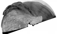
The Navcam L0 Panoramic view on Sol 4409.
Jan van Driel
|
|
 |
 
|
|
|
Jun 21 2016, 08:42 PM
Post
#257
|
||
|
Solar System Cartographer Group: Members Posts: 10153 Joined: 5-April 05 From: Canada Member No.: 227 |
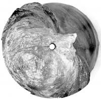
Thanks, Jan - here is a circular version to show the pattern of outcrops here.
Phil
-------------------- ... because the Solar System ain't gonna map itself.
Also to be found posting similar content on https://mastodon.social/@PhilStooke Maps for download (free PD: https://upload.wikimedia.org/wikipedia/comm...Cartography.pdf NOTE: everything created by me which I post on UMSF is considered to be in the public domain (NOT CC, public domain) |
|
|
|
|
|
|
Jun 24 2016, 04:31 AM
Post
#258
|
|
 Member Group: Members Posts: 691 Joined: 21-December 07 From: Clatskanie, Oregon Member No.: 3988 |
Here is my version of the 4409 Navcam 360. I did this one mainly to tryout the new navcam flatfields that it took on Sol-4408.
Polar: 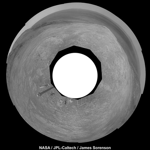 Normal: 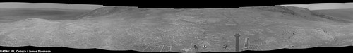
|
|
|
|
|
Jun 24 2016, 03:18 PM
Post
#259
|
|
 Administrator Group: Admin Posts: 5172 Joined: 4-August 05 From: Pasadena, CA, USA, Earth Member No.: 454 |
Holy cow those flat fields are effective

-------------------- My website - My Patreon - @elakdawalla on Twitter - Please support unmannedspaceflight.com by donating here.
|
|
|
|
|
Jun 26 2016, 03:04 PM
Post
#260
|
|
 Senior Member Group: Members Posts: 4246 Joined: 17-January 05 Member No.: 152 |
Looks like a long drive towards the northwest on 4415 - I think these are the 4081 drive tracks:
http://qt.exploratorium.edu/mars/opportuni...0M1.JPG?sol4415 |
|
|
|
|
Jun 27 2016, 09:50 PM
Post
#261
|
||||
|
Member Group: Members Posts: 866 Joined: 15-March 05 From: Santa Cruz, CA Member No.: 196 |
right, it will interesting to see the current state of the tracks if that's part of the plan, and we never did manage to get a snapshot of that cleanly hewn tree trunk on the way down, which is now the subject of a filter sweep. It seems no pics were taken sol4080, actually its hard to spot but at the right of center in this sol4079 shot, almost exactly a year ago..
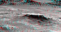
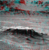
[EDIT 6/29] since the MER team seems to be interested in repeated imaging of this feature, might as well throw in anaglyphs of sol4416 stitch, anag of sol4417 and cross of sol4418 views here, fwiw..
|
|||
|
|
|
|||
|
Jul 2 2016, 04:54 AM
Post
#262
|
|
|
Member Group: Members Posts: 691 Joined: 21-December 07 From: Clatskanie, Oregon Member No.: 3988 |
Have a Happy 4rth of July weekend everyone.
   Full Resolution https://c2.staticflickr.com/8/7599/27416257...ab742f6fd_o.jpg Falsecolor: 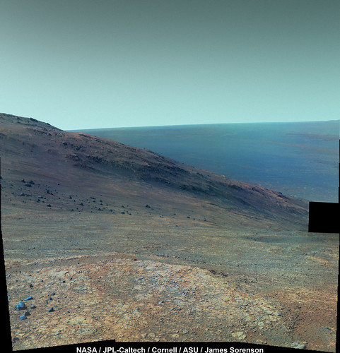 Full Resolution https://c2.staticflickr.com/8/7407/27416259...9d6f56a54_o.jpg |
|
|
|
|
Jul 5 2016, 03:19 PM
Post
#263
|
||
|
Senior Member Group: Members Posts: 2821 Joined: 22-April 05 From: Ridderkerk, Netherlands Member No.: 353 |
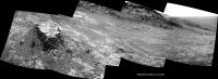
The Navcam L view on Sol 4418-4420.
Jan van Driel
|
|
|
|
|
|
|
Jul 5 2016, 05:13 PM
Post
#264
|
||
|
Solar System Cartographer Group: Members Posts: 10153 Joined: 5-April 05 From: Canada Member No.: 227 |
Thanks, Jan - this is a circular reprojection of it to show the pattern of outcrops.
Phil
-------------------- ... because the Solar System ain't gonna map itself.
Also to be found posting similar content on https://mastodon.social/@PhilStooke Maps for download (free PD: https://upload.wikimedia.org/wikipedia/comm...Cartography.pdf NOTE: everything created by me which I post on UMSF is considered to be in the public domain (NOT CC, public domain) |
|
|
|
|
|
|
Jul 6 2016, 06:40 PM
Post
#265
|
||
|
Senior Member Group: Members Posts: 2821 Joined: 22-April 05 From: Ridderkerk, Netherlands Member No.: 353 |
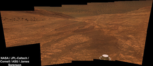
The Navcam L0 panoramic view on Sol 4423-4425.
Jan van Driel.
|
|
|
|
|
|
|
Jul 7 2016, 05:52 AM
Post
#266
|
|
|
Member Group: Members Posts: 691 Joined: 21-December 07 From: Clatskanie, Oregon Member No.: 3988 |
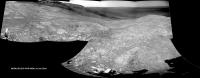
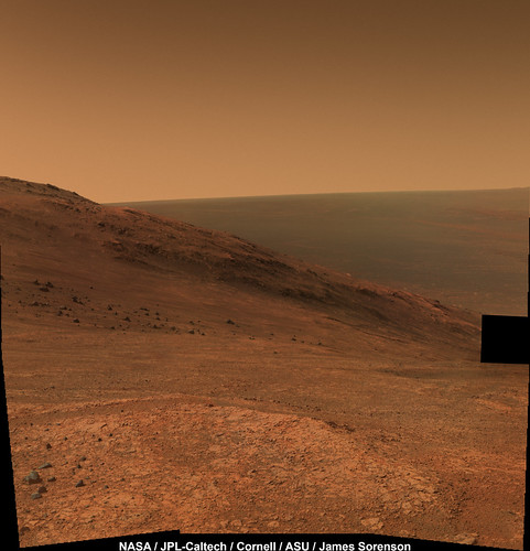
The pancam mosaic that Oppy captured between Sol 4224 and 4225 (July 4rth and 5th 2016)
 False Color: 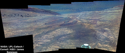
|
|
|
|
|
Jul 7 2016, 07:13 PM
Post
#267
|
||
|
Senior Member Group: Members Posts: 2821 Joined: 22-April 05 From: Ridderkerk, Netherlands Member No.: 353 |
The Navcam L view on Sol 4426.
Jan van Driel
|
|
|
|
|
|
|
Jul 8 2016, 12:05 AM
Post
#268
|
|
|
Member Group: Members Posts: 910 Joined: 4-September 06 From: Boston Member No.: 1102 |
QUOTE (Phil Stooke @ Oct 16 2015, 07:12 PM)  Another update - looks like I will need a new base map soon. Phil [attachment=38222:location_sol_4166.jpg] So are we off to stations 3-6? I don't know why Phil's map doesn't display--but follow link to Phil's post. -------------------- |
|
|
|
|
Jul 9 2016, 02:38 PM
Post
#269
|
|
|
Solar System Cartographer Group: Members Posts: 10153 Joined: 5-April 05 From: Canada Member No.: 227 |
Hi - sorry, Floyd, what is it that is not working?
Phil -------------------- ... because the Solar System ain't gonna map itself.
Also to be found posting similar content on https://mastodon.social/@PhilStooke Maps for download (free PD: https://upload.wikimedia.org/wikipedia/comm...Cartography.pdf NOTE: everything created by me which I post on UMSF is considered to be in the public domain (NOT CC, public domain) |
|
|
|
|
Jul 9 2016, 04:47 PM
Post
#270
|
|
|
Member Group: Members Posts: 910 Joined: 4-September 06 From: Boston Member No.: 1102 |
Hi Phil--your map displays just fine in your post. I quoted it and thought the map would show up in my post, but only get hypertext and no map. Guess I don't quite know how to repost images here.
My real question is if anyone knows if we are off to visit Stations 3-6 (which your map helpfully illustrated) -------------------- |
|
|
|
|

|
Lo-Fi Version | Time is now: 28th April 2024 - 05:33 PM |
|
RULES AND GUIDELINES Please read the Forum Rules and Guidelines before posting. IMAGE COPYRIGHT |
OPINIONS AND MODERATION Opinions expressed on UnmannedSpaceflight.com are those of the individual posters and do not necessarily reflect the opinions of UnmannedSpaceflight.com or The Planetary Society. The all-volunteer UnmannedSpaceflight.com moderation team is wholly independent of The Planetary Society. The Planetary Society has no influence over decisions made by the UnmannedSpaceflight.com moderators. |
SUPPORT THE FORUM Unmannedspaceflight.com is funded by the Planetary Society. Please consider supporting our work and many other projects by donating to the Society or becoming a member. |
|