Landing Site Imagery |

  |
Landing Site Imagery |
 Jan 16 2006, 04:02 PM Jan 16 2006, 04:02 PM
Post
#31
|
|
|
Senior Member  Group: Members Posts: 2454 Joined: 8-July 05 From: NGC 5907 Member No.: 430 |
QUOTE (gndonald @ Jan 15 2006, 11:06 PM) Quite right, the science definitely be worth it, all of the previous surface level weather measurement has been done at the lower latitudes (47 deg N for Viking 1/2, 19 deg N for Pathfinder), thus a look at the high altitude weather patterns should hopefully provide a contrast to them. I just find it a pity that NASA can't get funding to send a second lander to the South Polar region in the same year (even of the Pathfinder variety).  This is why NASA should be working on smaller probes that can be sent in bunches to numerous places all over a target world. With this kind of probe, losing a few would not be the end of the entire mission. -------------------- "After having some business dealings with men, I am occasionally chagrined,
and feel as if I had done some wrong, and it is hard to forget the ugly circumstance. I see that such intercourse long continued would make one thoroughly prosaic, hard, and coarse. But the longest intercourse with Nature, though in her rudest moods, does not thus harden and make coarse. A hard, sensible man whom we liken to a rock is indeed much harder than a rock. From hard, coarse, insensible men with whom I have no sympathy, I go to commune with the rocks, whose hearts are comparatively soft." - Henry David Thoreau, November 15, 1853 |
 |
 
|
|
Jan 17 2006, 01:47 AM
Post
#32
|
|
|
Member Group: Members Posts: 212 Joined: 19-July 05 Member No.: 442 |
QUOTE (ljk4-1 @ Jan 17 2006, 12:02 AM) This is why NASA should be working on smaller probes that can be sent in bunches to numerous places all over a target world. With this kind of probe, losing a few would not be the end of the entire mission. The sad thing, is that this is what NASA had with the basic 'Pathfinder' lander, something that could carry out a fair amount of science, which would have been easier to 'mass produce' than the rovers or the upcoming Phoenix lander. A good strategy would have been to do a 'High/Low' launch with each launch window, say one MRO/Phoenix style 'high complexity' mission and one or more Pathfinder 'low complexity' mission(s). The actual Pathfinder mission lasted for 83 sols, which would nicely complement the 'main missions' reading during the initial phases. The best instrument set would probably be a basic camera, Weather sensor and either a seismonitor or radiation detector. Apologies for going a little off topic, but this is something I feel strongly about. |
|
|
|
|
Jun 8 2006, 10:08 AM
Post
#33
|
|
 Special Cookie Group: Members Posts: 2168 Joined: 6-April 05 From: Sintra | Portugal Member No.: 228 |
I've just received an answer from Doug Lombardi, the Education and Public Outreach Manager for the PML mission regarding the discussion about the landing site choice and he told me that the team is working very hard on the selection. By now the proposed region for is between 65 and 72 deg N and 120 and 140 deg E, making a quick search that would put us on the vicinity of Panchaia Rupes...
By looking into the maps it looks like a quite plain area with some large craters here and there with some possible ice on it... What might be their intention? Landing on one of this or go for a safer touchdown? -------------------- "Ride, boldly ride," The shade replied, "If you seek for Eldorado!"
Edgar Alan Poe |
|
|
|
|
Jun 8 2006, 10:18 AM
Post
#34
|
|
|
Senior Member Group: Members Posts: 2920 Joined: 14-February 06 From: Very close to the Pyrénées Mountains (France) Member No.: 682 |
[quote name='ustrax' date='Jun 8 2006, 12:08 PM' post='57527']
What might be their intention? Landing on one of this or go for a safer touchdown? I have little doubts on this. "If you don't land safely, you've got nothing," said Matt Golombek on a Space.com article I posted yesterday on MSL's topic. -------------------- |
|
|
|
|
Jun 8 2006, 10:33 AM
Post
#35
|
|
|
Special Cookie Group: Members Posts: 2168 Joined: 6-April 05 From: Sintra | Portugal Member No.: 228 |
Maybe it's better to start looking at this place...Maybe it will become familiar in the days to come...:
http://i16.photobucket.com/albums/b14/ustr...chaiaRupes1.jpg 
-------------------- "Ride, boldly ride," The shade replied, "If you seek for Eldorado!"
Edgar Alan Poe |
|
|
|
|
Jun 8 2006, 11:10 AM
Post
#36
|
|
|
Senior Member Group: Members Posts: 2920 Joined: 14-February 06 From: Very close to the Pyrénées Mountains (France) Member No.: 682 |
[quote name='ustrax' date='Jun 8 2006, 12:33 PM' post='57533']
Maybe it's better to start looking at this place...Maybe it will become familiar in the days to come...: Can we already put an elipse ? By the way, I guess that we'll have the same elipse size as Mer's ? MSL's will be a lot smaller refering to the same source as above -------------------- |
|
|
|
|
Jun 8 2006, 11:15 AM
Post
#37
|
|
|
Special Cookie Group: Members Posts: 2168 Joined: 6-April 05 From: Sintra | Portugal Member No.: 228 |
'Can we already put an elipse ?'
I don't think so... It is the current proposed landing site, not the definitive one... -------------------- "Ride, boldly ride," The shade replied, "If you seek for Eldorado!"
Edgar Alan Poe |
|
|
|
|
Jun 9 2006, 02:09 AM
Post
#38
|
|
|
Senior Member Group: Members Posts: 1636 Joined: 9-May 05 From: Lima, Peru Member No.: 385 |
The MSL landing ellipse would be much smaller than MER's one. I think that the longest (major axis) would be around
Rodolfo |
|
|
|
|
Jun 9 2006, 05:37 AM
Post
#39
|
|
|
Senior Member Group: Members Posts: 2920 Joined: 14-February 06 From: Very close to the Pyrénées Mountains (France) Member No.: 682 |
[quote name='RNeuhaus' date='Jun 9 2006, 04:09 AM' post='57679']
The MSL landing ellipse would be much smaller than MER's one. I think that the longest (major axis) would be around 10 km versus 50 km of MERs. Rodolfo Yep, but as Phoenix will use basicaly the same EDL system as MER, it'll about 50 km, right ? -------------------- |
|
|
|
|
Jun 9 2006, 03:20 PM
Post
#40
|
|
|
Senior Member Group: Members Posts: 1636 Joined: 9-May 05 From: Lima, Peru Member No.: 385 |
Climber, good question. I have still not found about the Phoenix EDL details but a brief ones. The best I know is from http://phoenix.lpl.arizona.edu/the_mission/entry.php which does not mention about the elliptical landing. Maybe Bruce or Ustrax can jump into that!
Rodolfo |
|
|
|
|
Jun 9 2006, 03:52 PM
Post
#41
|
|
|
Special Cookie Group: Members Posts: 2168 Joined: 6-April 05 From: Sintra | Portugal Member No.: 228 |
QUOTE (RNeuhaus @ Jun 9 2006, 04:20 PM) Climber, good question. I have still not found about the Phoenix EDL details but a brief ones. The best I know is from http://phoenix.lpl.arizona.edu/the_mission/entry.php which does not mention about the elliptical landing. Maybe Bruce or Ustrax can jump into that! Rodolfo I'm working on it...
-------------------- "Ride, boldly ride," The shade replied, "If you seek for Eldorado!"
Edgar Alan Poe |
|
|
|
|
Jun 10 2006, 06:11 PM
Post
#42
|
|
|
Solar System Cartographer Group: Members Posts: 10153 Joined: 5-April 05 From: Canada Member No.: 227 |
As I understand it, the following three locations (two of them appear to overlap, but they are diagonally oriented) are now being considered for Phoenix.
Area B, box 1 66º to 68º N 225º to 234º. Area B, box 2 66º to 68º N 224º to 227º Area B, box 3 70º to 71º N 220º to 227º MOC images are being collected within each box. Phil -------------------- ... because the Solar System ain't gonna map itself.
Also to be found posting similar content on https://mastodon.social/@PhilStooke Maps for download (free PD: https://upload.wikimedia.org/wikipedia/comm...Cartography.pdf NOTE: everything created by me which I post on UMSF is considered to be in the public domain (NOT CC, public domain) |
|
|
|
|
Jun 11 2006, 02:12 AM
Post
#43
|
||
|
Senior Member Group: Members Posts: 1636 Joined: 9-May 05 From: Lima, Peru Member No.: 385 |
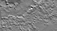
Using the tool: Jmars, I have snapshot the area of 229.90E to 239.30E (approx. 215 km) and 66.83N to 68.88 N (approx. 120 km).
That zone is not so flat like Meridiani Planum and Gusev Crater...then there is some risk during the EDL. Rodolfo |
|
|
|
|
|
|
Jun 13 2006, 04:25 PM
Post
#44
|
|
|
Member Group: Members Posts: 320 Joined: 19-June 04 Member No.: 85 |
Has anybody mentioned this MOC April 2006 imaging update?
http://www.msss.com/mars_images/moc/guest/...17_phoenix.html -------------------- |
|
|
|
|
Jun 13 2006, 04:43 PM
Post
#45
|
|
|
Special Cookie Group: Members Posts: 2168 Joined: 6-April 05 From: Sintra | Portugal Member No.: 228 |
QUOTE (aldo12xu @ Jun 13 2006, 05:25 PM) Has anybody mentioned this MOC April 2006 imaging update? http://www.msss.com/mars_images/moc/guest/...17_phoenix.html Thank you aldo!  Where can we see the coordinates for those captions? -------------------- "Ride, boldly ride," The shade replied, "If you seek for Eldorado!"
Edgar Alan Poe |
|
|
|
|

|
Lo-Fi Version | Time is now: 27th April 2024 - 03:16 AM |
|
RULES AND GUIDELINES Please read the Forum Rules and Guidelines before posting. IMAGE COPYRIGHT |
OPINIONS AND MODERATION Opinions expressed on UnmannedSpaceflight.com are those of the individual posters and do not necessarily reflect the opinions of UnmannedSpaceflight.com or The Planetary Society. The all-volunteer UnmannedSpaceflight.com moderation team is wholly independent of The Planetary Society. The Planetary Society has no influence over decisions made by the UnmannedSpaceflight.com moderators. |
SUPPORT THE FORUM Unmannedspaceflight.com is funded by the Planetary Society. Please consider supporting our work and many other projects by donating to the Society or becoming a member. |
|