Exploring the Greenheugh Pediment, Sols 3387-3871, 16 Feb 2022-1 Jul 2023 |

  |
Exploring the Greenheugh Pediment, Sols 3387-3871, 16 Feb 2022-1 Jul 2023 |
 Jun 11 2023, 02:18 PM Jun 11 2023, 02:18 PM
Post
#946
|
||
 Senior Member  Group: Members Posts: 2428 Joined: 30-January 13 From: Penang, Malaysia. Member No.: 6853 |
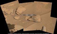
3854 Workspace - Bayer reconstructed L-MastCam (from fredk) roughly assembled in MS-ICE
|
|
 |
 
|
|
|
Jun 11 2023, 09:26 PM
Post
#947
|
||
 Senior Member Group: Members Posts: 1628 Joined: 5-March 05 From: Boulder, CO Member No.: 184 |
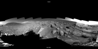
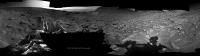
We can see Curiosity traversing toward the ESE during the past two drives, using official mosaics between Sols 3843 and 3853. Will be interesting to see how far this traverse will proceed before being able to top the ridge. It seems eventually to be a much gentler slope about 200 meters eastward. Hopefully the sandy terrain will relax just a short distance ahead.
Longer steppable drive animation with a combination of official and Jan's mosaics from Sol 3435 to the present. -------------------- Steve [ my home page and planetary maps page ]
|
|
|
|
|
|
|
Jun 12 2023, 12:54 PM
Post
#948
|
|
 Member Group: Members Posts: 823 Joined: 9-September 17 From: UK Member No.: 8241 |
-------------------- |
|
|
|
|
Jun 13 2023, 07:58 PM
Post
#949
|
||
|
Senior Member Group: Members Posts: 2820 Joined: 22-April 05 From: Ridderkerk, Netherlands Member No.: 353 |
The Navcam R view on Sol 3857.
Jan van Driel
|
|
|
|
|
|
|
Jun 13 2023, 08:56 PM
Post
#950
|
|
|
Junior Member Group: Members Posts: 27 Joined: 26-August 13 Member No.: 6994 |
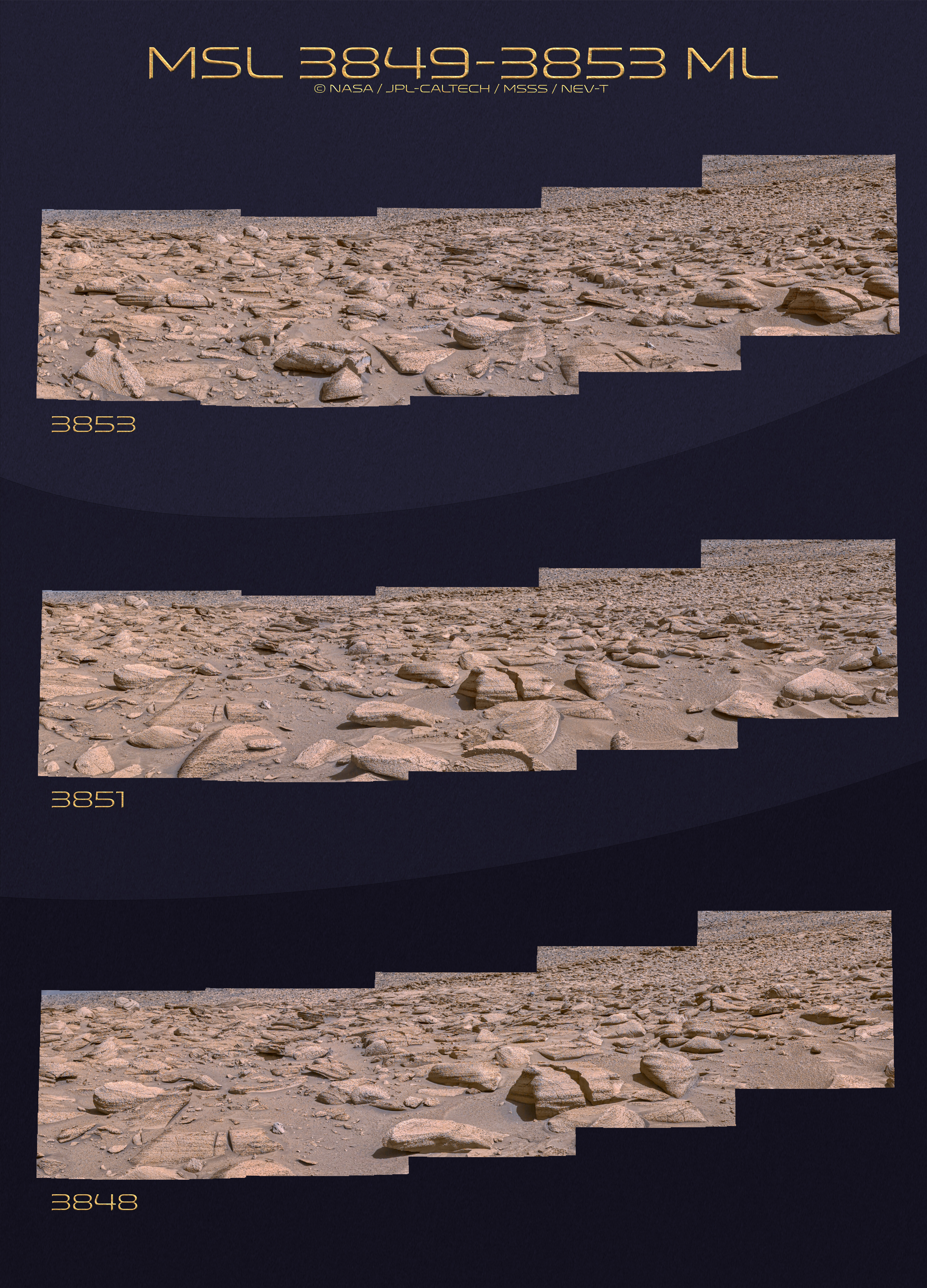
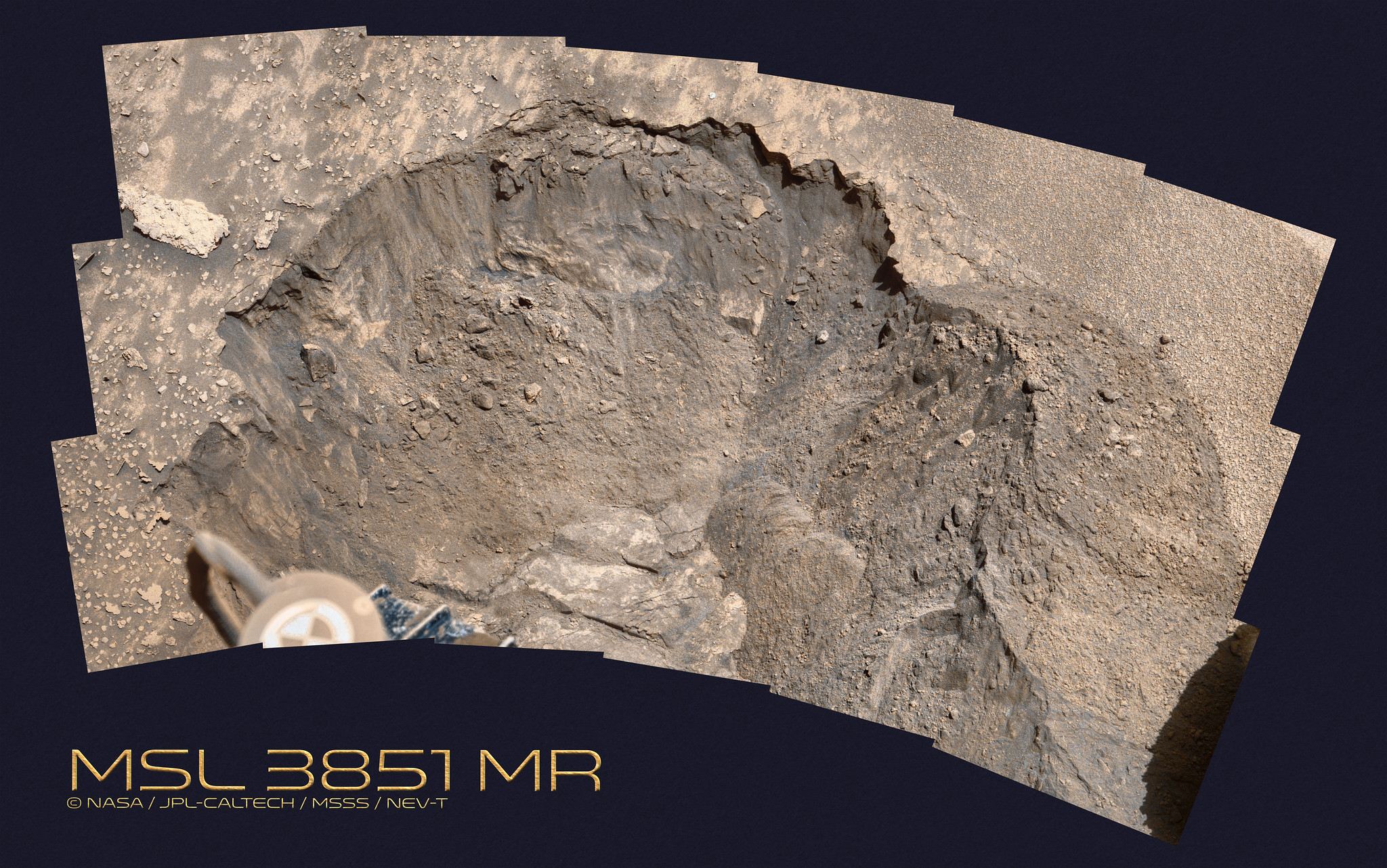
Regarding Neville's image (sol 3851) in post 948, the rock with the big crack in it: What could cause this? The crack looks to have minimal erosion (or at least uniform erosion all along its boundaries), so I'd assume it's relatively fresh, but it can't have fractured from falling off a cliff face--it and all its neighbors must have been emplaced/exposed a loooong time ago, right? I'd naively expect wind erosion to affect the two pieces differently along the crack edges over the years/eons, but it looks like you could fit them together like they were broken apart yesterday.
|
|
|
|
|
Jun 14 2023, 12:27 AM
Post
#951
|
|
|
Member Group: Members Posts: 823 Joined: 9-September 17 From: UK Member No.: 8241 |
could be water (frozen water ) moister gets into a crack or hole in the rock then it freezes and expands - could be over time the water expanded so much the rock cracked under the pressure ..... i don't normally comment I'm just an image man lol
-------------------- |
|
|
|
|
Jun 14 2023, 12:29 AM
Post
#952
|
|
|
Member Group: Members Posts: 823 Joined: 9-September 17 From: UK Member No.: 8241 |
-------------------- |
|
|
|
|
Jun 14 2023, 12:55 AM
Post
#953
|
|
 Member Group: Members Posts: 714 Joined: 3-January 08 Member No.: 3995 |
QUOTE (Xcalibrator @ Jun 13 2023, 02:56 PM)  Regarding Neville's image (sol 3851) in post 948, the rock with the big crack in it: What could cause this? The crack looks to have minimal erosion (or at least uniform erosion all along its boundaries), so I'd assume it's relatively fresh, but it can't have fractured from falling off a cliff face--it and all its neighbors must have been emplaced/exposed a loooong time ago, right? I'd naively expect wind erosion to affect the two pieces differently along the crack edges over the years/eons, but it looks like you could fit them together like they were broken apart yesterday. I imagine the gap widened as the loose material has slowly crept downslope. Additionally, ablation of fine material adjacent to the block could have caused some movement. |
|
|
|
|
Jun 14 2023, 10:40 PM
Post
#954
|
|
|
Member Group: Members Posts: 823 Joined: 9-September 17 From: UK Member No.: 8241 |
-------------------- |
|
|
|
|
Jun 14 2023, 11:10 PM
Post
#955
|
|
|
Senior Member Group: Members Posts: 1043 Joined: 17-February 09 Member No.: 4605 |
Regarding Neville's image (sol 3851) in post 948, the rock with the big crack in it: What could cause this? Just thermal expansion contraction and Mars provides a wide thermal range. Some minerals expand and contract more than others and overall thermal effects weaken the rock. Since we are used to a corrosive (oxygen) atmosphere and plentiful solvent (water) is is difficult to grasp the current sedate pace of erosion on Mars. |
|
|
|
|
Jun 15 2023, 08:45 AM
Post
#956
|
|
|
Member Group: Members Posts: 823 Joined: 9-September 17 From: UK Member No.: 8241 |
-------------------- |
|
|
|
|
Jun 15 2023, 11:23 AM
Post
#957
|
||
|
Senior Member Group: Members Posts: 2820 Joined: 22-April 05 From: Ridderkerk, Netherlands Member No.: 353 |
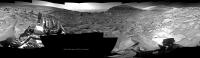
The Navcam R view on Sol 3858.
Jan van Driel
|
|
|
|
|
|
|
Jun 17 2023, 06:21 AM
Post
#958
|
|
|
Member Group: Members Posts: 823 Joined: 9-September 17 From: UK Member No.: 8241 |
-------------------- |
|
|
|
|
Jun 17 2023, 03:50 PM
Post
#959
|
||
|
Senior Member Group: Members Posts: 1628 Joined: 5-March 05 From: Boulder, CO Member No.: 184 |
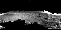
We can see Curiosity traversing toward the east during the past three drives, using official mosaics between Sols 3853 and 3860. Will be interesting to see how far this traverse will proceed before being able to top the ridge. It seems to be a much gentler slope about 150 meters eastward in the little double alcove.
Longer steppable drive animation with a combination of official and Jan's mosaics from Sol 3435 to the present. -------------------- Steve [ my home page and planetary maps page ]
|
|
|
|
|
|
|
Jun 17 2023, 09:51 PM
Post
#960
|
|
|
Member Group: Members Posts: 823 Joined: 9-September 17 From: UK Member No.: 8241 |
-------------------- |
|
|
|
|

|
Lo-Fi Version | Time is now: 27th April 2024 - 06:38 PM |
|
RULES AND GUIDELINES Please read the Forum Rules and Guidelines before posting. IMAGE COPYRIGHT |
OPINIONS AND MODERATION Opinions expressed on UnmannedSpaceflight.com are those of the individual posters and do not necessarily reflect the opinions of UnmannedSpaceflight.com or The Planetary Society. The all-volunteer UnmannedSpaceflight.com moderation team is wholly independent of The Planetary Society. The Planetary Society has no influence over decisions made by the UnmannedSpaceflight.com moderators. |
SUPPORT THE FORUM Unmannedspaceflight.com is funded by the Planetary Society. Please consider supporting our work and many other projects by donating to the Society or becoming a member. |
|